

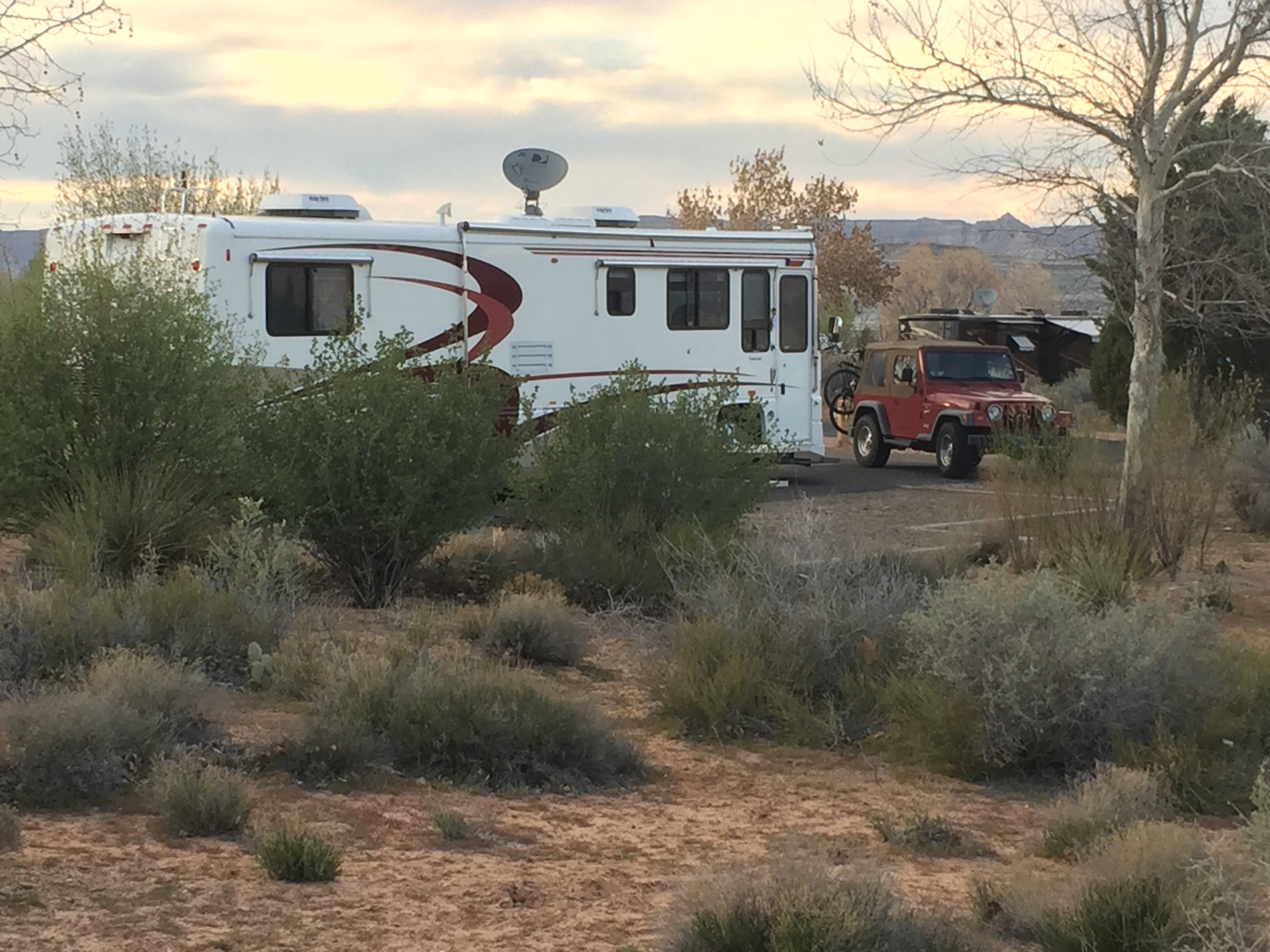
After leaving McDowell Mountain we left a few days to get to Zion National Park. The Wahwaep Campground on Lake Powell near Page looked like an OK place to stop. It is on the lake, near Glen Canyon Dam, near Page for grocery shopping and it had a nice, inexpensive laundry.
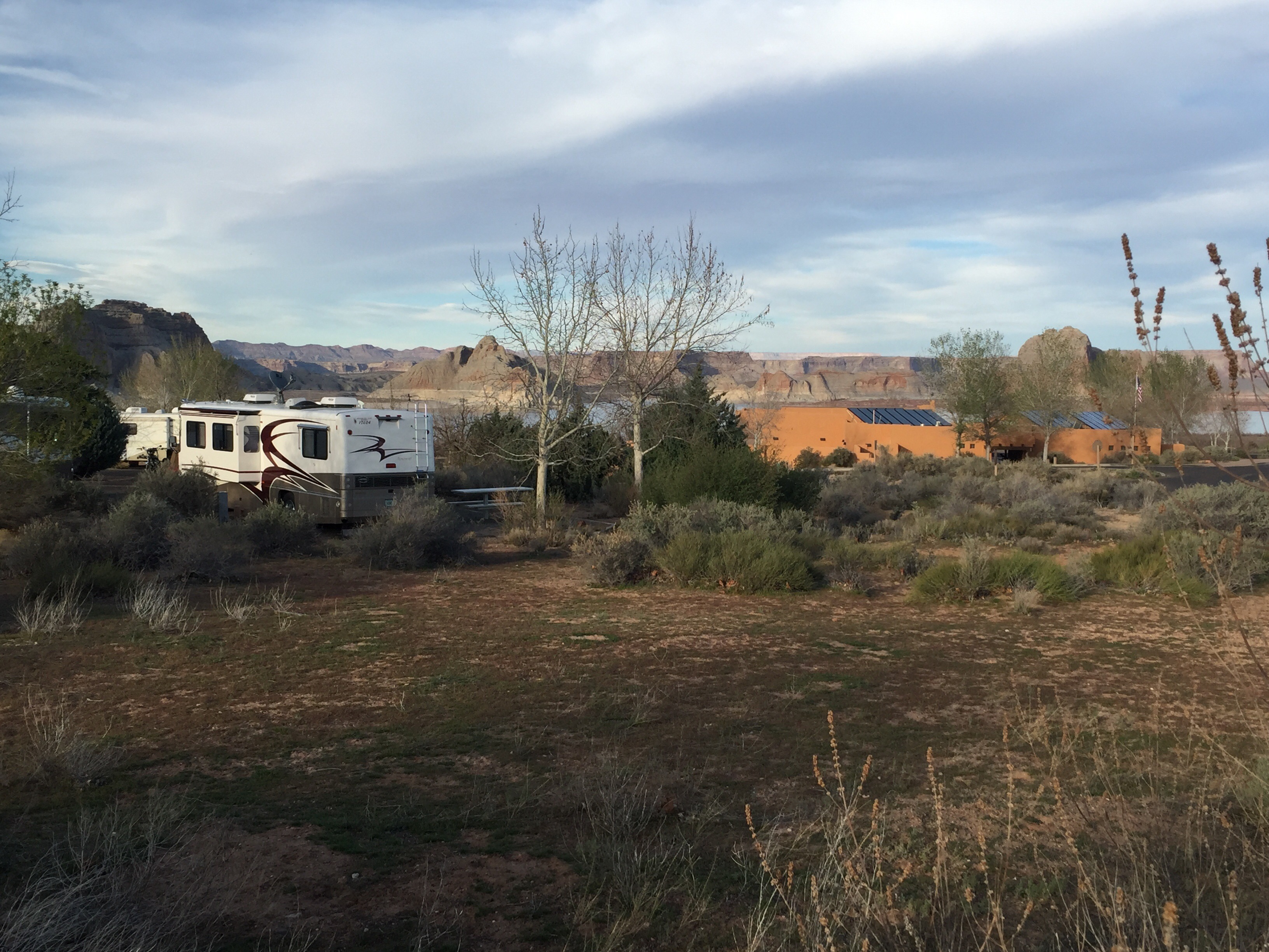
Wahweap is a pretty nice campground but not cheap. Good for a day or two.
The drive north from Phoenix went from about 1,500 ft elevation to about 4,500 ft at Page. The plants and trees change as you go up. The last part as we got closer to Page was very bleak looking, red rocks and dirt, very few trees, just a few shrubs. Lots of long uphill grades. Page is at the east end of the Grand Canyon. Just a hundred miles or so to the west the South Rim is at 7,000 ft and the North Rim is at 9,000 ft and the river is almost 1,000 ft lower. The ground rises and the river keeps cutting through it.
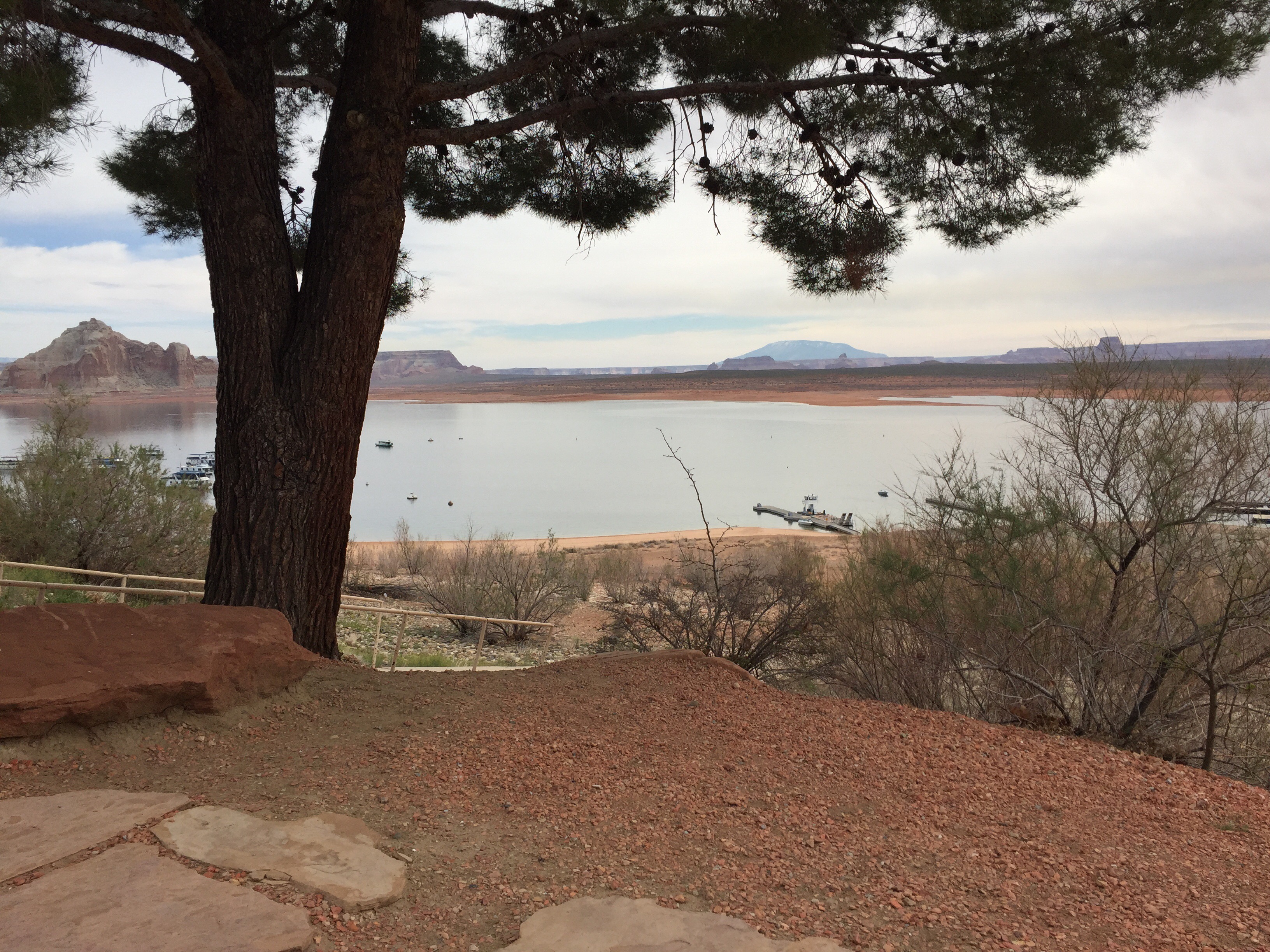
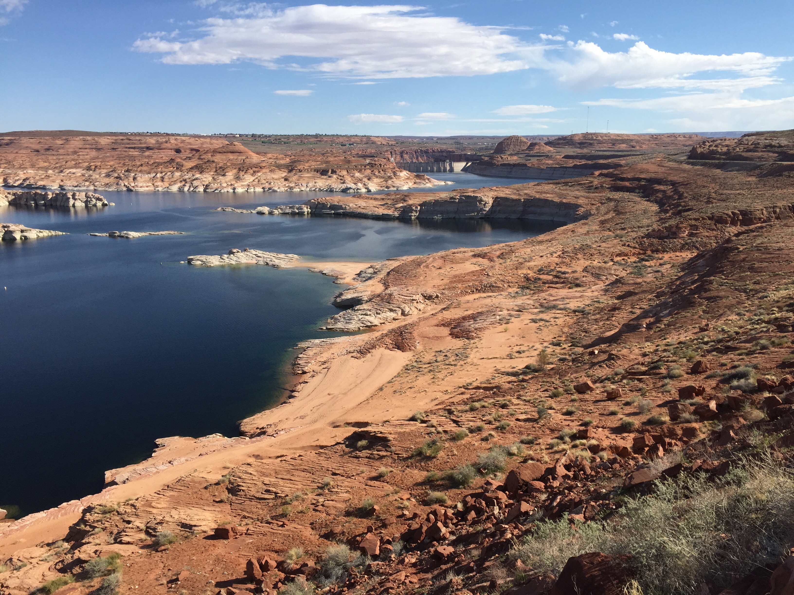
Lake Powell stretches up through canyons almost 150 miles making it a giant water playground. This is the main place to rent houseboats, up to 70 ft long ones. They range from pretty basic to very luxurious. The big fancy ones are a couple thousand dollars a day plus fuel and all the other stuff, five day minimum. The smaller ones are a few hundred a day plus.
The Glen Canyon Dam was built in the 1960’s and is over 700′ high. They built a bridge first and then the dam. Page was built for the workers at the same time.
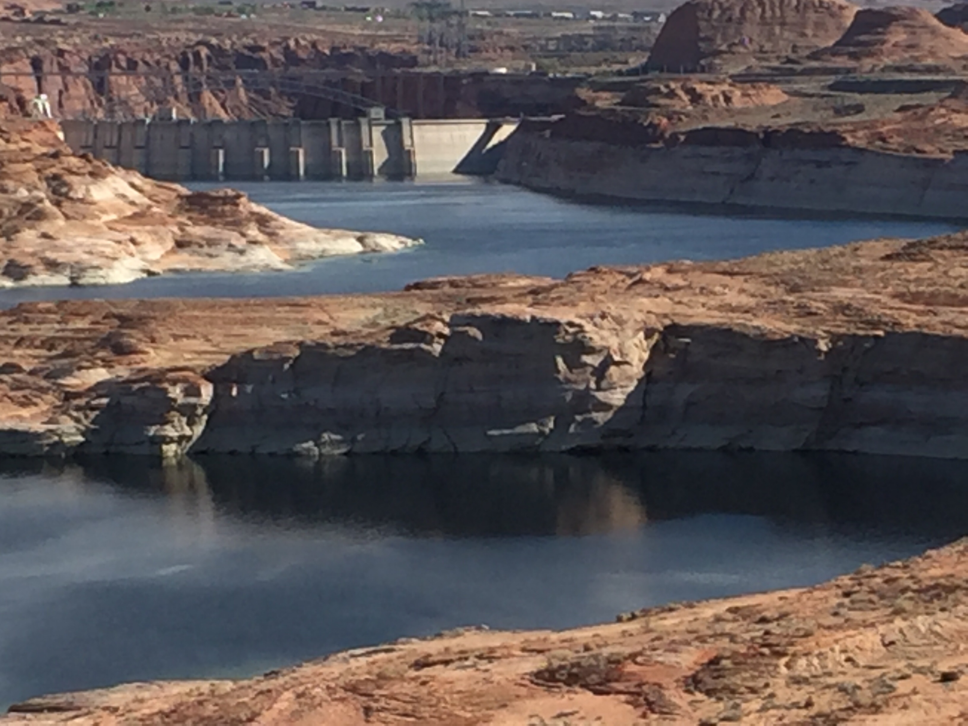
The main reason for the dam is to hold Colorado River water in the reservoir. This manages water flow through the Grand Canyon, provides huge amounts of hydroelectric power and water to much of Arizona and parts of New Mexico.
This dam and Boulder Dam and Parker Dam downstream and several more dams you never hear about manage the Colorado river water for all of the states in the watershed from Wyoming to California. All of them get a share of the water. By the time it gets to Mexico there is just over 1% of all of the water left.
The water level here is down more than 110′ from its high water mark due to 18 years of drought. Just a year ago it was 140′ down. It now has just over 40% of its capacity. You can see the “bathtub” ring that shows how much lower the water level is now.
The bridge is a two lane thing, 25 mph speed limit. If you walk out on it and trucks go by it moves.
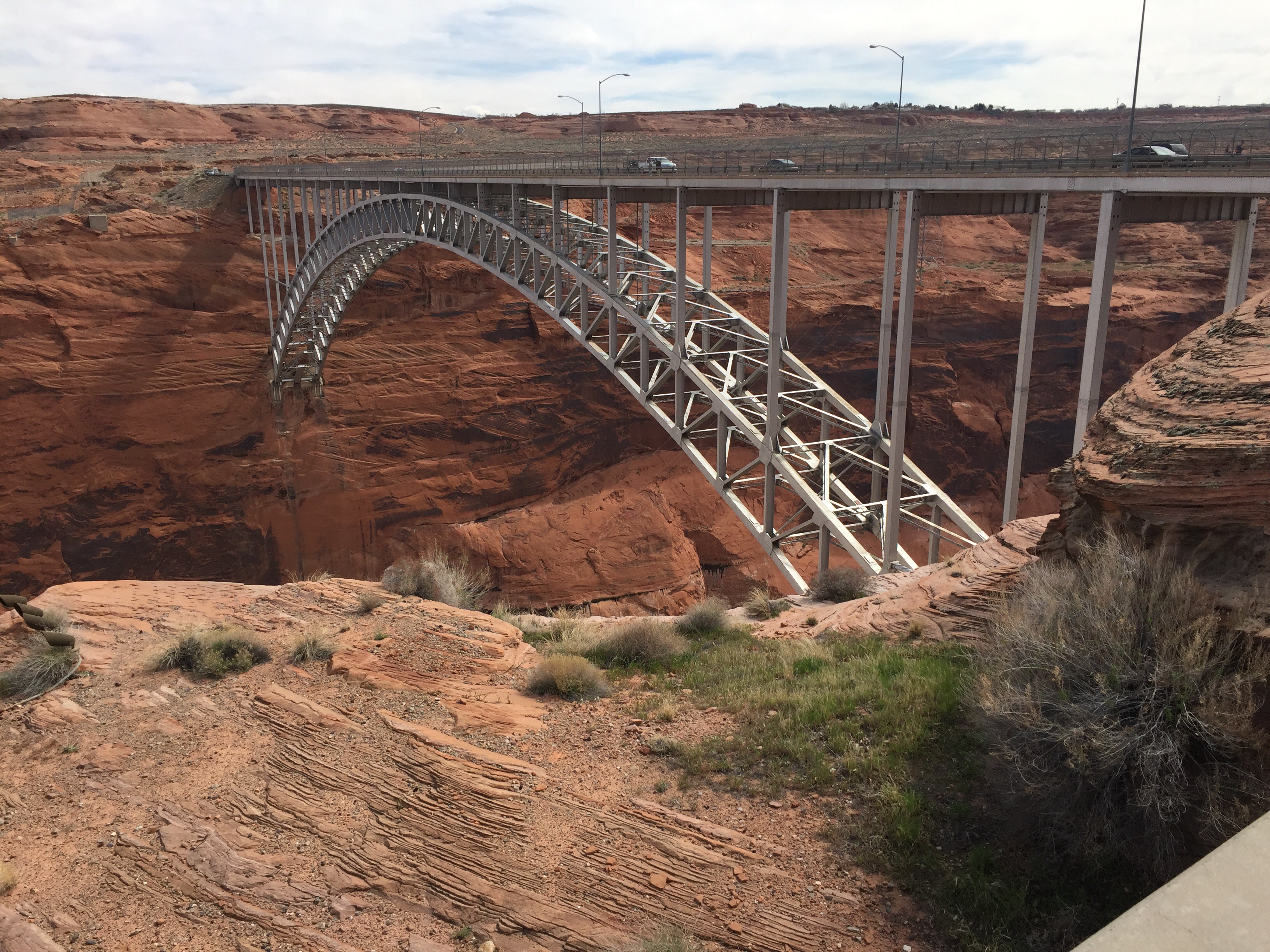
When they built this bridge it was the highest steel arch bridge in the world.
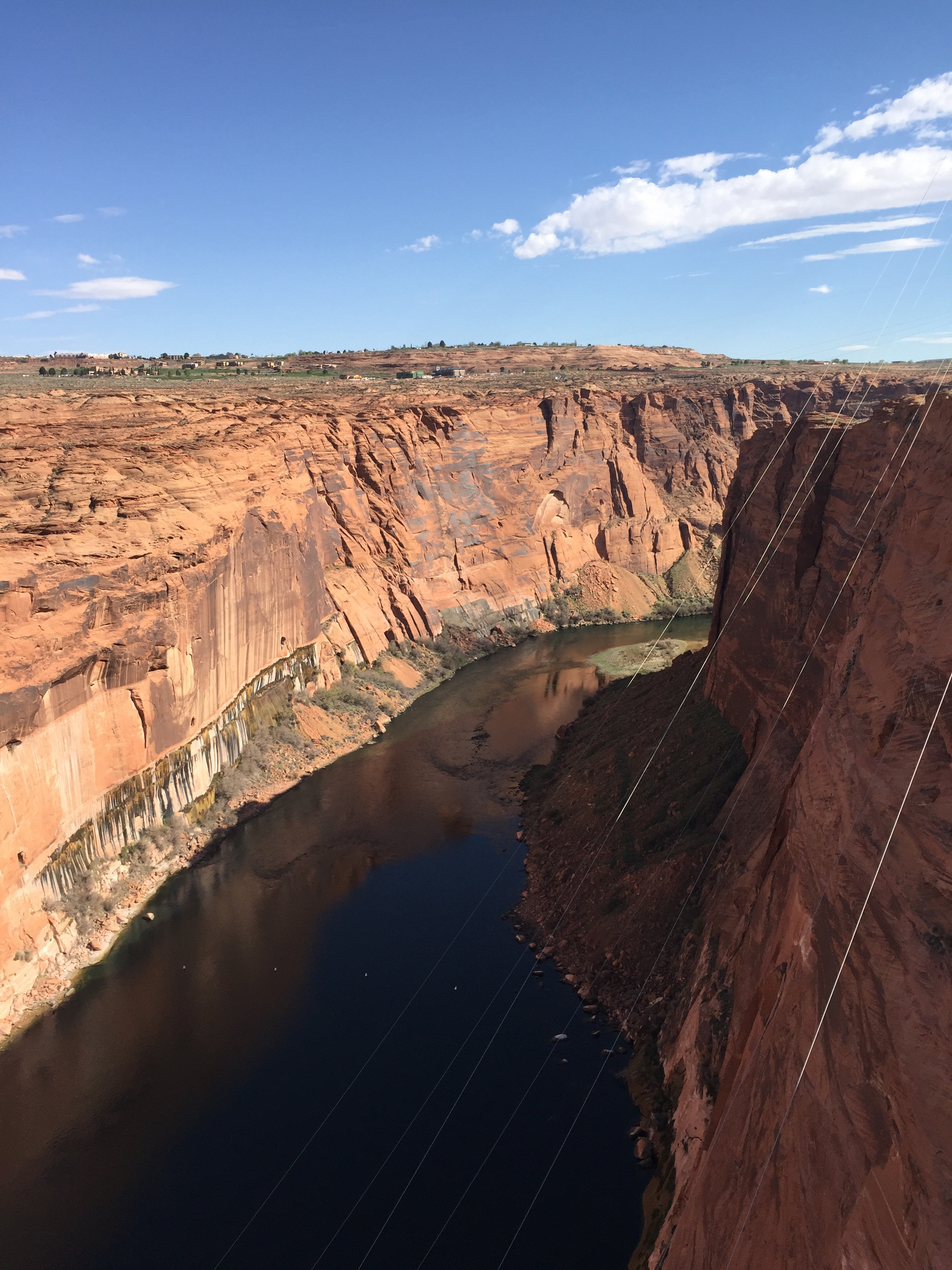
It is a long way down. The canyon walls are very steep.
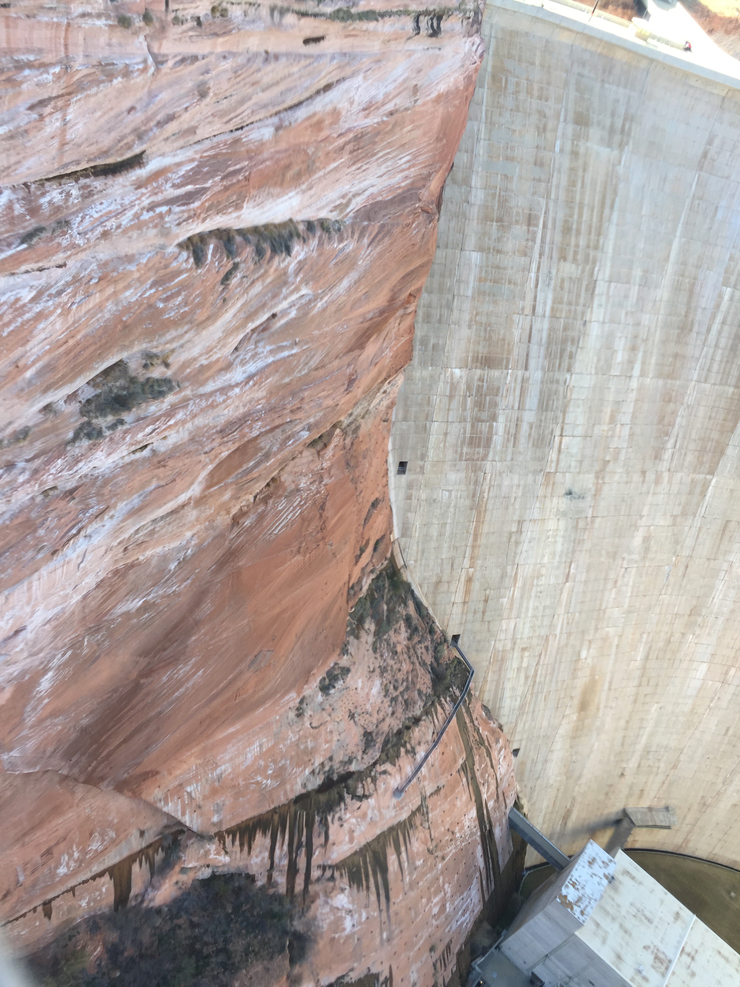
This is the downstream side of the dam on the north end where it meets the canyon wall. The big boxy thing at the bottom is part of the power plant. The gray things coming out of the dam are walkways from the interior of the dam to the power station.
You can see three little rectangular shapes along the dam/canyon junction. Those are doors. The middle one leads to a walkway along the canyon face. Yikes! The inside of the dam has elevators, and passageways though it. These are mostly for inspection and service.
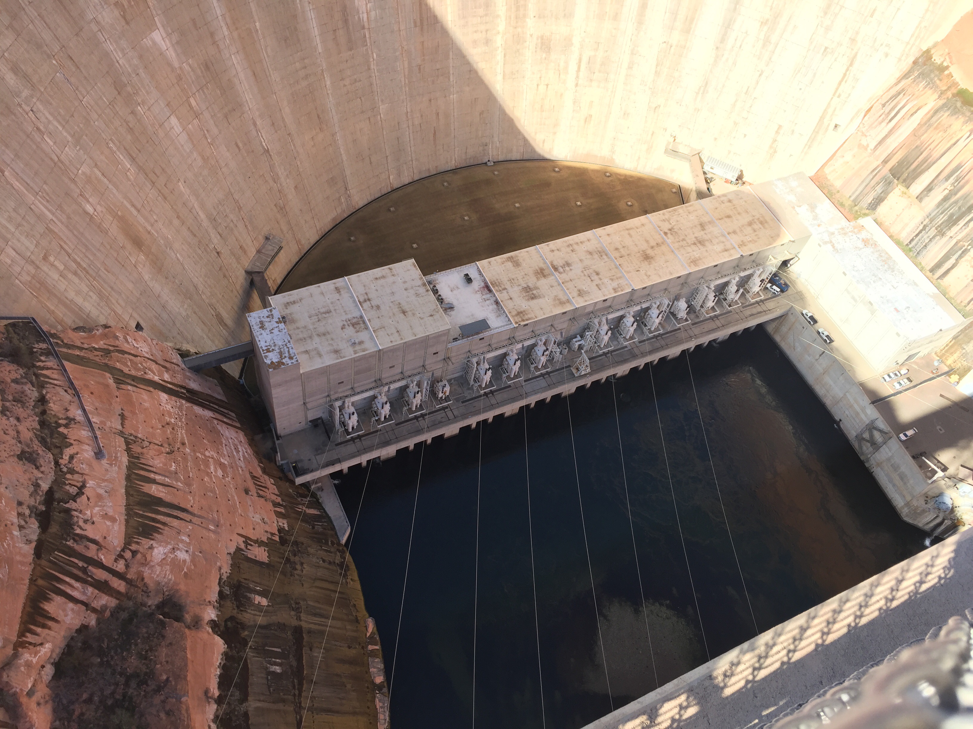
There is the power plant, nine big hydroelectric generators provide power to cities all over the SW and California. There is a road and a huge tunnel on the other side that leads down to the power house level. Big enough to bring in replacement parts for the generators up to 33′ in diameter.
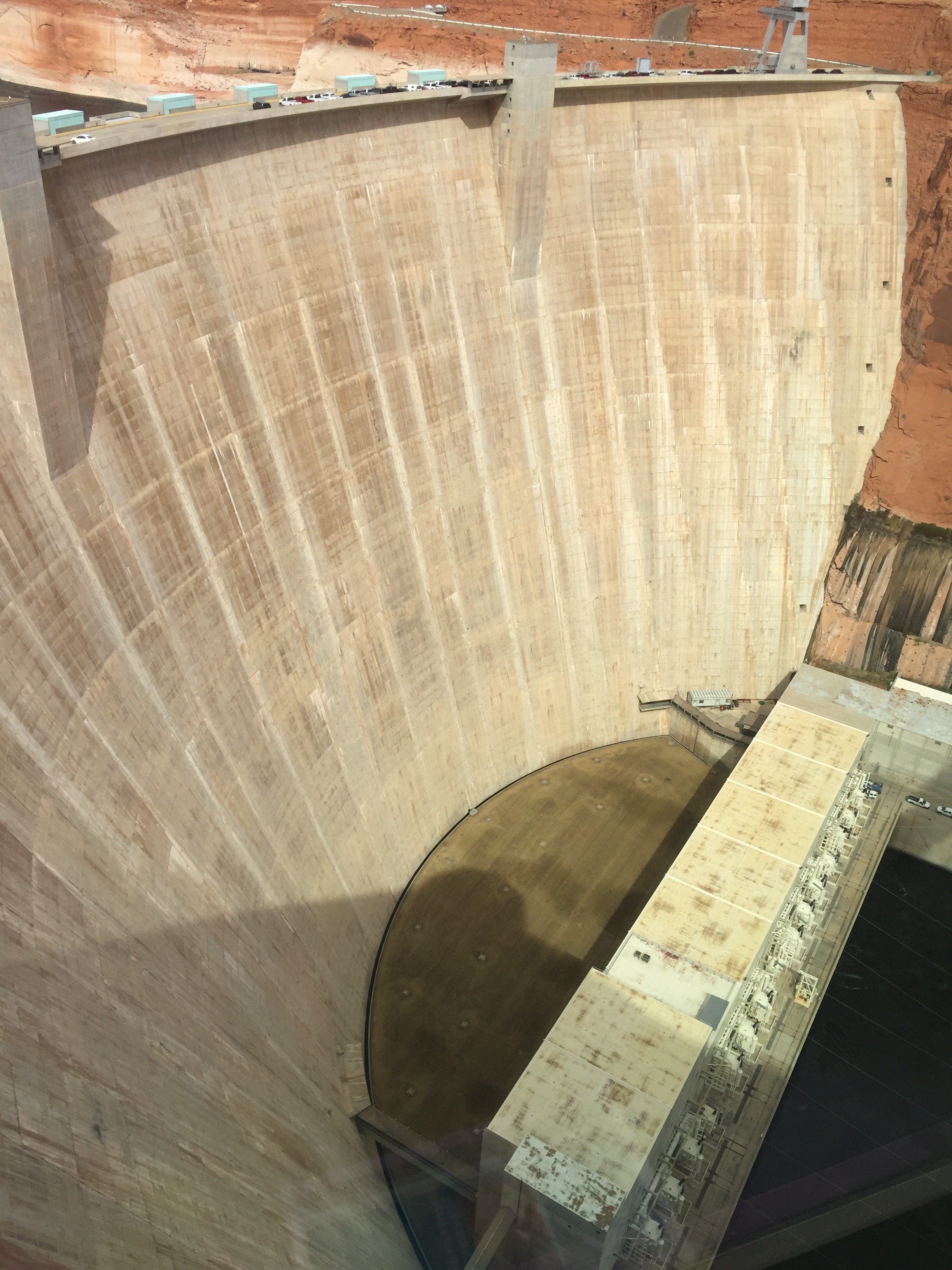
It is a long way down.
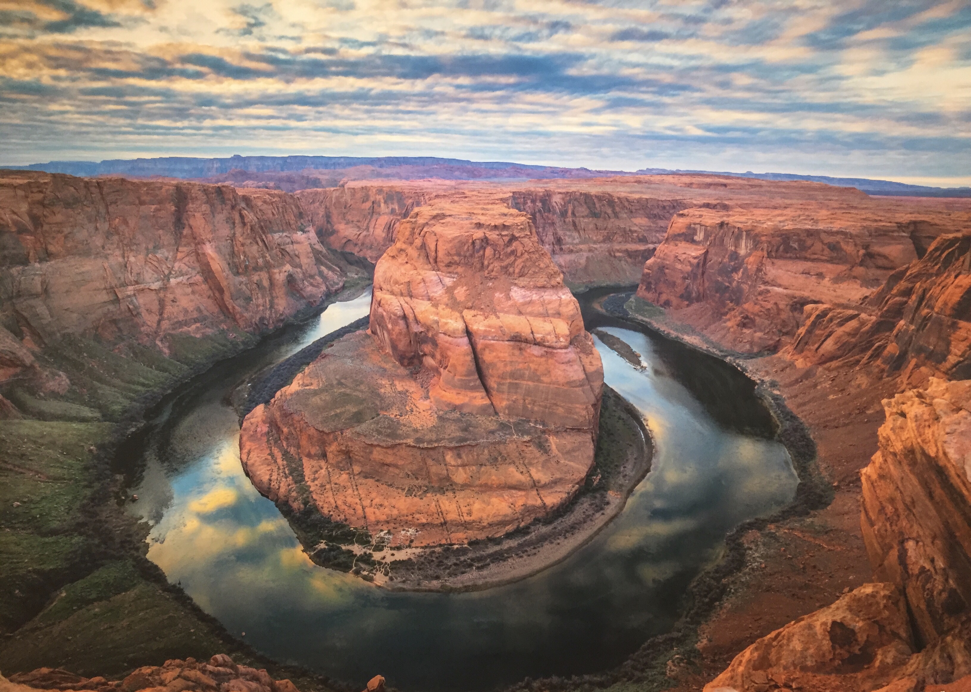
Lots of amazing things to see upstream and down like Horseshoe Bend. We got our laundry done, went grocery shopping, visited the dam and the Powell Museum and were ready to move on.
Zion National Park is next.
More later,
Roger and Susan
