Lake Superior South Shore, 2016. Part 8, The Great Pastie Bakeoff

Pasties.

One cannot go to the Upper Peninsula (UP) of Michigan without being assailed by Pastie shops.  Some spell it pasty or pastys. Not so Yoopers. Pasties (pass tees) are meat pies with origins back to the Cornish Miners who came to this area in the mid 1800’s.  They were particularly skilled folks with copper mining experience from England.  One branch of Susan’s ancestral tree belongs to this bunch. Pasties were a lunch bucket staple of the hard working miners. 

Pasties typically look like a small (6-8″) calzone.  Some look like a half of a softball with a folded up crust around the bottom. Some are like a rustic tart with the crust folded up around the sides towards the center on top. Real pasties have chunks of beef and pork, rutabagas, potatoes and onion, salt and pepper, suet and butter inside a pie crust made with lard. Store bought pasties have ground beef for meat and carrots. The Cornish miners would be rolling over in their graves at this but then they would eat them anyways.  It is not so much what is in them but the care and love that goes into each one for the well being of those they were made for. 
Image result

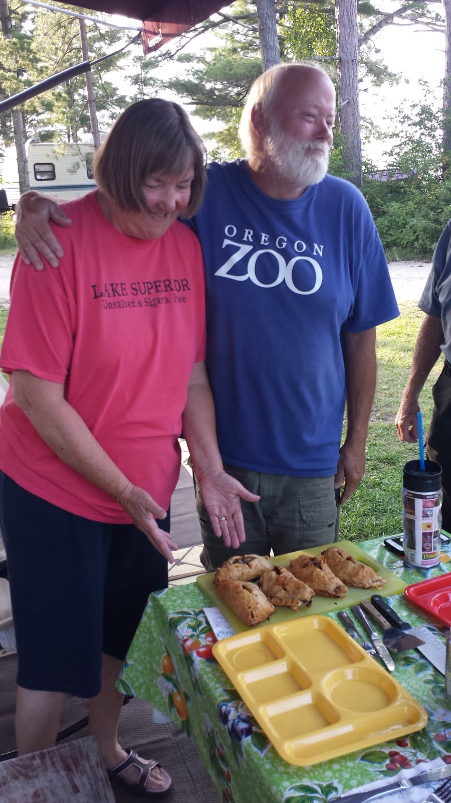
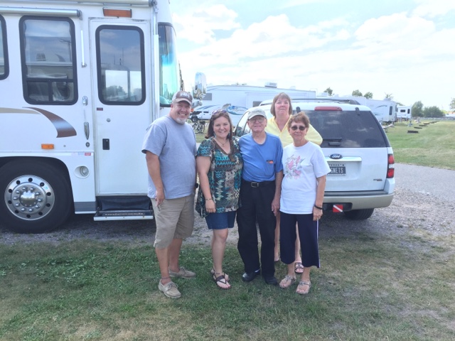
From Susan and Roger

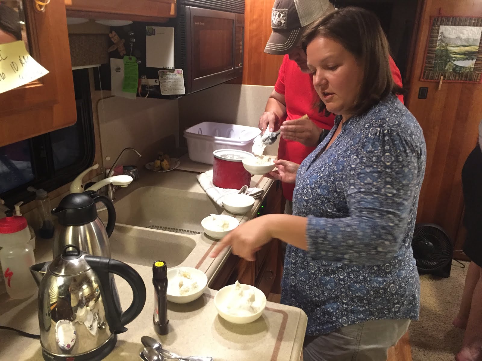
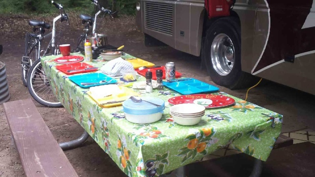
Susan  has her mother’s hand written recipe handed down from one lunch pail to the next over generations.  We follow this, the Gospel of Pie, almost exactly.  We leave out the suet (the birds get it) and to make them a bit more heart healthy, we leave out the lard. We added some of our own decorative embellishments and baked up a batch to share in the convection/microwave oven in the coach. It really smelled good.

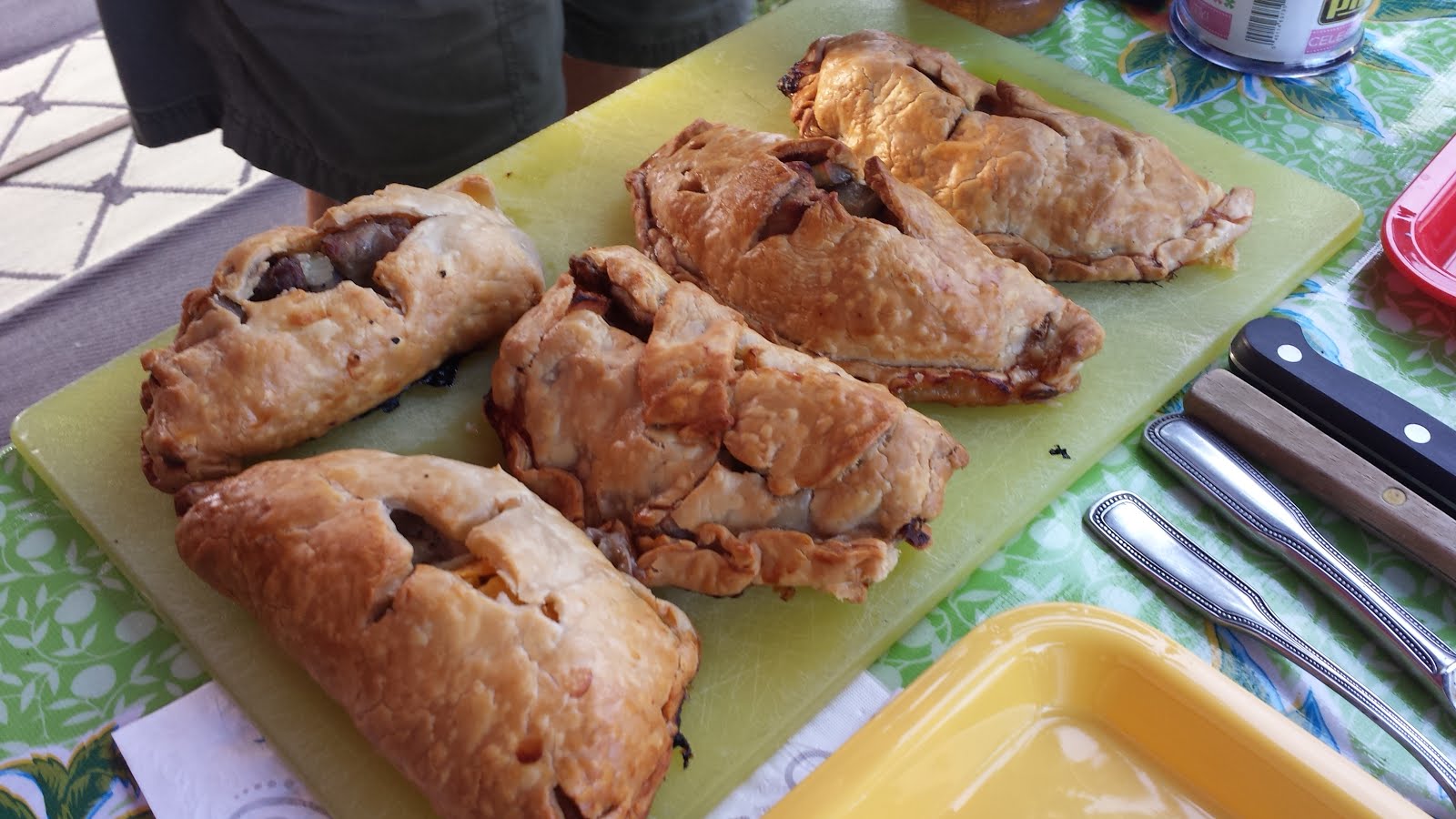
Real Home Made Pasties

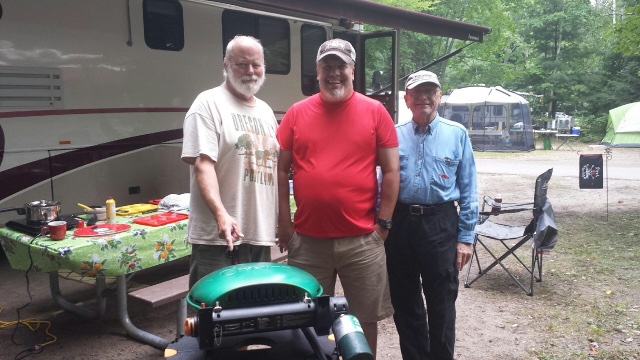
For comparison we bought three beef pasties from Muldoon’s in Munising. They are reportedly the best Yooper Pasties so they were going to be the competition. Amanda and Douglas baked them up in their oven.  The game is afoot!

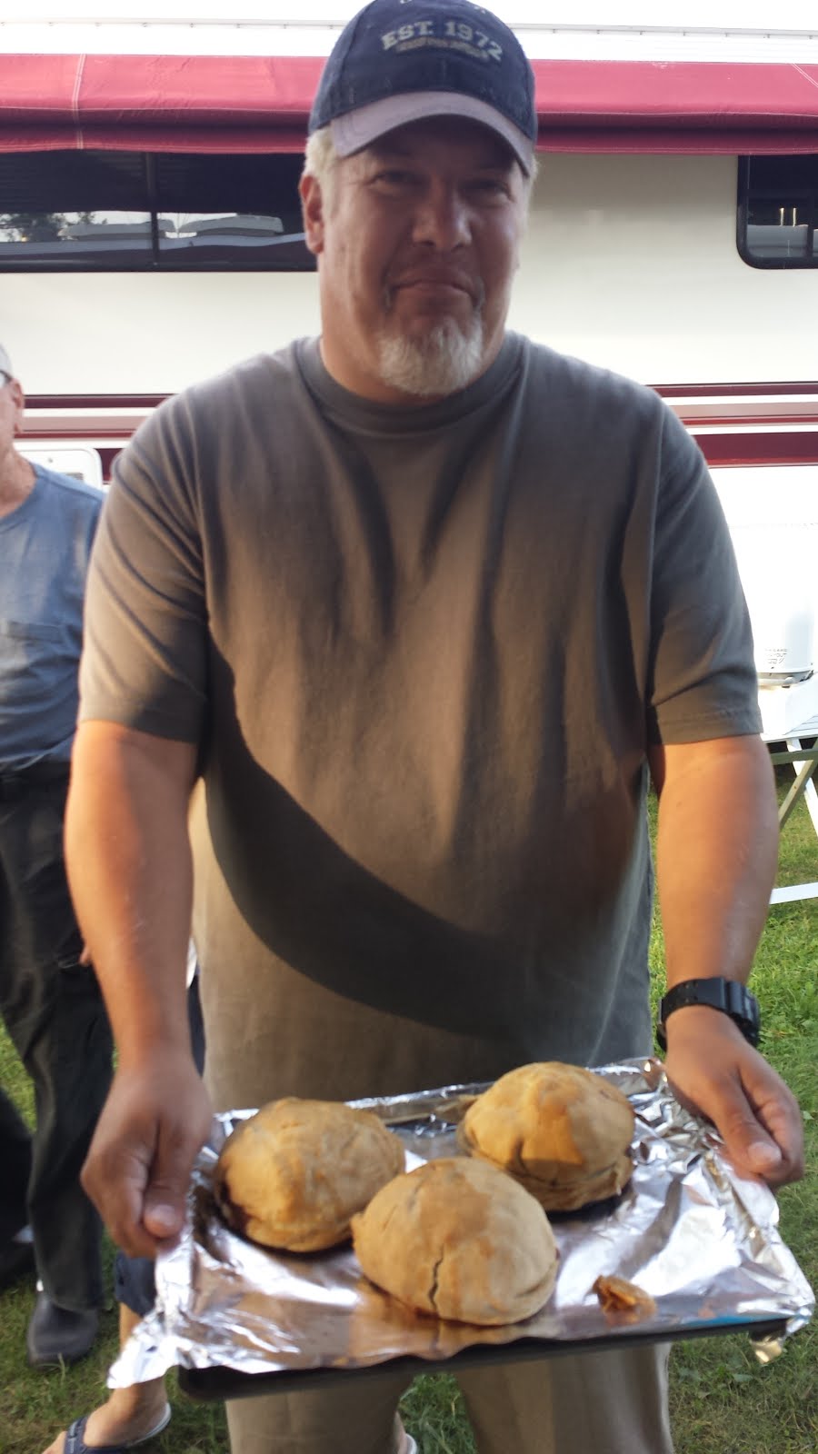
Douglas Presents the Competition

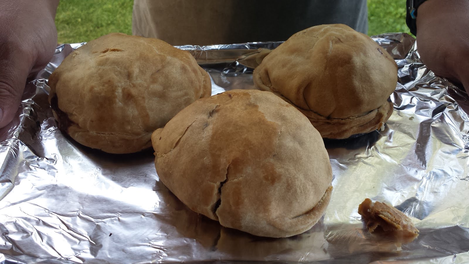
Half Softball Shaped Pasties from Muldoon’s
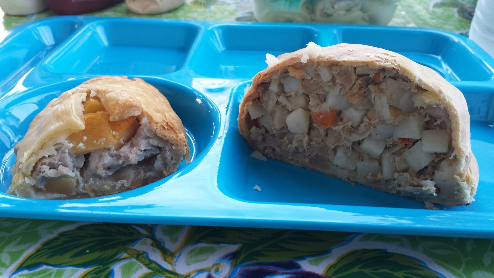
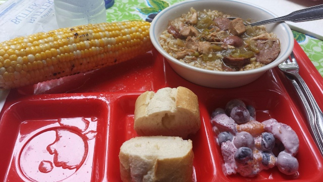
The True Pasty with Flakey Crust, Beef and Pork on the Left
Or Muldoon’s With Ground Meat and Carrots
On the Right (no idea what the red thing is) 

There are no eating pictures. Eight Pasties were woofed down in a flash.  Some salad was eaten too.

The results were unanimous!  Mom’s Rule!  Best Pasties Ever.  

And making them always brings fond memories.

More later,

Roger and Susan

Lake Superior South Shore, 2016. Part 6, Kayaking

August 12-13, 2016

Kayaking!

This is something Susan and I have wanted to do for some time. Last summer when we were in Wyoming there were kayaks for rent and it looked like fun. Then we saw them on the Snake River just for fun and with folks fishing. So now I want to try both.

The park folks delivered the kayaks to our site the evening before. It was a short portage to the river where we found a good launching spot. That was the easy part. Getting ourselves in and out of the kayaks was not pretty. But after a few tries at it we sort of got the hang of it. It still bordered on graceless

Douglas and Susan went first. Up stream and then back down for about 45 minutes.

Amanda and I had a go at it next. I wasn’t sure how my shoulder was going to do. A half hour into it and it was aching so I adjusted paddling procedure a bit and that seemed to help.

Rudy and Carolyn were the safety committee. Ready to whip out that new iPhone and do something.

When we got back it was time for a break after demonstrating our Olympic Exit Style.

It was easy to paddle once we got in. The river was calm with a low current. There was a

light breeze. We were using ten foot kayaks. After talking to other kayakers we think longer paddles for us and maybe 12 foot or 13.5 foot kayaks would track better and give us some more leg room.

Amanda and Douglas went out again for almost an hour and then Susan and I did too. We all tried heading down river first and then upstream.

Susan and I went downstream almost to the lake.


At one point I was paddling through water lily pads that were blooming. They smelled quite nice.

So we all got in about three hours of kayaking practice. All were experiencing some arm and shoulder fatigue. What else were we going to do but have home made ice cream courtesy of Douglas and Amanda.

We liked it. We will do it again.
More later,

Roger and Susan

Lake Superior South Shore, 2016. Part 7, Great Lakes Shipwreck Museum

August 12-13, 2016

This was a good day to head to the Great Lakes Shipwreck Museum at Whitefish Point at the entrance to Whitefish Bay. We left Tahquamenon St Park and headed into a nearby town named Paradise. There is a town in lower Michigan named Hell so there is a lot of jokes going back and forth.


It was about 15 or 30 miles along the lake to get to the museum which is right at the end of the point of land. 


This is another critical lighthouse for ships coming off the main part of Lake Superior into the eastern end of the lake at Whitefish Bay.

The light station is still in operation although it is now automated.  There are several museum segments, the Keeper’s House, the Light Station, the Rescue Station, an Edmund Fitzgerald Theater and of course, a Gift Shop.

We needed pictures of all of us. Where better than with the first mate, the captain and the deep sea diver. There are sand dunes at the end of Whitefish Point. A short trail leads to a lookout.

And the Edmund Fitzgerald in tens of thousands of Legos.

The Keeper’s wife (a replica shown here) had a lot of work to do running the household. The restoration and depiction of everyday life was pretty amazing.

The Edmund Fitzgerald Theater showed a program about how the events unfolded the night the ship was lost.  The facts were not clear, just as the weather had not been. The movie went on to the search for the Edmund Fitzgerald and when found, a long underwater investigation failed to determine a cause. But the bell tower on the Fitzgerald was found to be upright and intact.  So the Great Lakes Shipwreck Museum Foundation cast a new bell with the names of each of the crew. A deep diving crew removed the original bell and replaced it with the new bell.  The original bell is now at the Great Lakes Shipwreck Museum.  Many of the family members of the original crew were on board the ship as the bells were exchanged and a service of remembrance was held to honor the lost crew.  The bell rang out 29 times for each of the crew.

We walked out on the boardwalk to the point.  Susan and I were here once before and the wind was blowing so hard we could hardly stand at the end of the board walk.  This time, not so windy but cloudy and gray.  A “footer” was going by just then. This is what they called the 1000′ long bulk carriers.

It was another nice visit to a familiar place. One that tells the story of so many ships and men lost to the storms, bad navigation and the Lake. More ships were lost in ship to ship collisions than any other cause.  The Light Station Service, the Rescue Stations, the Weather Stations and later the Coast Guard and many technology advances made shipping on the Great Lakes much safer.  The 1975 loss of the Edmund Fitzgerald was the last major shipwreck on the Great Lakes.

Lake Superior South Shore, 2016. Part 5, Tahquamenon Falls

August 11, 2016

Time to leave Sault Ste. Marie. We are heading for Tahquamenon Falls State Park on Whitefish Bay. The camp ground is on the Tahquamenon River about ½ mile from Lake Superior.

On the way there we stopped at the Point Iroquois Lighthouse.

It is pretty rare to see three Foretravels together.

Whitefish Bay is home to many shipwrecks and this station along with many others helped guide the way. There was a Coastguard rescue station here as well. Some of us climbed the narrow circular stairs all the way to the top of the lighthouse. The mechanism is long since gone but the view was good.

There was a young girl up there who decided on the spot that she wanted to be a lighthouse keeper. Other than historical sites they are almost all totally automated now. But you can always work in the gift shops.

We got to the campground and all pulled in to consecutive campsites. We got out the bikes and all of the toys.

Biking was great. Lots of roads and trails to follow. The campground had two sections. There were three loops where we were all next to the river. The other section had a road that followed the river and campsites were next to the river.

We had Texas Gumbo one night. Roasted corn on the grill.

A festive table complete with grade school lunch trays

And a great fruit salad. Pot luck sort of thing. Wonderful.

When we were biking we discovered that you could rent kayaks. $25 for a day. So that evening we rented two figuring everyone who wanted could have a go at it. The park folks delivered them right to our site with paddles and life jackets. It was getting towards dark so we waited until morning.

Sunset was quite spectacular.

Tomorrow kayaking.

Roger and Susan

Lake Superior South Shore, 2016. Part 4

Tuesday, 8/9/2016
Susan and I went up to the Soo Locks this morning to visit the weather station museum. This was one of the first of the US Weather Service stations from the mid 1800’s whose task was to try to watch the weather and give early warning to ships. It was a small but nice museum with what else, a gift shop. We got some ship cards, sort of like trading cards for Great Lakes ships/boats. We got a couple of iron-on patches to add to our collection. These are all stuck to the window trim with velcro. They make a colorful addition to the decor and a reminder of where we have been. Susan got a TShirt, “Lake Superior- salt free, no sharks” and I got a nice Weather Station TShirt.

There is a drive-in restaurant called Clyde’s near the campground. They are supposed to have great food. It looks much like an old drive-in with the slanted windows and neon lights. The Campground manager suggested another called the West Pier. So we went to try that. It was about the size of a two car garage. Somebody came running out to get our order, one cheese burger, one onion rings, one butterscotch shake. Quick service. We took our lunch back to the park next to the locks.

Lunch was great. A massive half hamburger each. We were stuffed. THe Algoma Enterprise was just exiting the lock so we had entertainment as well.  They were repairing a valve in the bigger second lock so thery were using the slightly smaller first lock.  It is about 30 ft from where we were eating our lunch.  This boat was huge!

Our friends Douglas and Amanda arrived today mid afternoon. They were coming up from Indiana and had to cross the Mighty Mac. Good for them, I am not sure Susan could do it.

Douglas, Amanda,Rudy, Carolyn and Susan.

They brought their bikes with them so we rode around the campground checking out all of the other camper and camping things. And then around again. Then up to the the boat launch and next to Clyde’s to check it out. Looks good so we will try that place too. Then we rode down to the Sugar Island Ferry. Cars are lined up there all the time for the ferry ride across the shipping channel to Sugar Island. The ferry ride is less than a quarter mile but it is the only way to the island.

Ships, boats of every size go by all the time. There were passenger ships that went by.

 And the .”footers”, the 1000′ long bulk carriers right out the front door.
A very nice campground right on the river.

August 10, 2016

A footer went by this morning and so Amanda and Douglas and Susan and I piled into cars and hightailed it down river to the Rock Cut.  It was about 15 miles downstream.  The St Mary’s river is a 65 mile run from Lake Superior to Lake Huron and requires these big boats to make more than 20 major changes in course. In the original route there was a single channel only 300′ wide that forced ships to pass very close to one another or wait.  So in the early 1900’s the West Neebish Canal project was started.  It was and still is called the Rock Cut but the West Neebish Canal sounds good too.  It is more than 300 ft wide and about a mile long and 20′ deep.  The depth has been increased over time to now more than thirty feet.  Huge piles of rock are still everywhere. Looking at it now one would think it was dug just a few years ago.
More boats all day.  We went to Clyde’s for diinner and had s’mores for dessert. Stayed up late again with the youngsters.
More later, 
Roger and Susan

Lake Superior South Shore, 2016. Part 3

8/8/2016

Last Friday Susan and I went back to Mackinac Island with our bikes. There are lots of bikes over there already and many folks bring them over or rent them.  Bike rentals are about $9-$12/hr. More expensive than renting a car.  It costs $10 for the ferry ride for your bike.  No matter what, they are going to get your money.
The night before a 1986 Bluebird Wanderlodge pulled in next to us. Nice folks from southern Michigan. This was a 38′ coach that weighed 43,000 lbs. Our 36′ coach weighs about 31,000 lbs.  the Wanderlodges are tanks. It was powered by a 8 cylinder Detroit Diesel 2 stroke engine.  It sounded pretty cool. 
The 10 AM ferry ride over to Mackinac took a detour out to the Mighty Mac Bridge. We didn’t know that, just our luck. The bridge is huge close up.
And a motorhome going across looks tiny.

The speed limit for trucks is 20 mph and cars 45. 

We worked our way from the ferry docks to the west because it was the shortest way out of the town area. The 8.3 mile road around the island is Michigan State Highway 185. It follows the shore and is mostly pretty flat. It is the only state highway in the US where cars are not permitted.  Two lanes, all of the appropriate paint lines, all you have to do is avoid the frequent road apples. 
It seemed like 80% of the bike riders went the other way for some reason. But the horse drawn carriages went both ways.  You can rent a drive-it-yourself horse carriage as these were or you can rent horses to ride on top of.  We didn’t check those prices.

Most of the road is like this, through over-arching trees, partly shady and quite nice.  It was a pretty easy ride with lots of places to stop.  There are some houses along the way side.  About half way there is a rest area with an ice cream shop and bathrooms and lots of bikes.

And the “Waste Management” truck.

A bit further on there was another ferry dock. A service ferry was there with two large dumpsters full of horse manure. Wheew!

We stopped for a break about 3/4 the way around and then continued on to a bed and breakfast we had stayed at several years ago.  There was a small cafe behind the B&B. Good food, no crowds, quiet.

A couple of small tubs out in the back.

Then we went to the Great Turtle Toys shop (eventually found it after going up and down the street few times) looking or kites. I found one that Iiked to add to my collection (of two). Then on to a small park to wait for the next ferry. A young boy asked me about my new kite, where I got it, how do you fly them, do they come with string, 20 questions sort-of-thing. The kite store people were at the other end of the park and I suggested he go see what they were doing. He did and they let him help get a big kite up in the air. He was a pretty excited kid. Mom and Dad and Gramma and Grandpa were there at the next picnic table. They though it was amazing that he came and talked to me (or anyone, they said) and pleased that I took the time to talk to him. It was fun.  
Windy and wavy ride home.  Not too tired or sore.  Bikes did well. Us too. Slept like bricks.
More Later.
Roger and Susan.

Lake Superior South Shore, 2016. Part 2

It is Wednesday 8/3/2016. Today we went by ferry to Mackinac (pronounced Mackinaw) Island.  Once there transportation is by foot, horse, carriage or bicycle.  There are about 800 horses and a bazillion bicycles on the island. There is one motorized vehicle on the island, an ambulance. There is a small airport as well so I guess maybe the few airplanes count.  There are 500 permanent residents and 15-20,000 visitors each day during the peak of the May-September summer season. Visitors are called “fudgies” since they almost all buy some fudge at one of the more than 15 fudge makers, most with several shops.  They are everywhere.  


We got a pretty good view of the Mighty Mac Bridge. We did not drive over the Mighty Mac. We came in from the west. It is famous for how much it moves side to side in a good wind. The Mackinac Bridge Authority has a Drivers Assistance Program that provides drivers (for a fee) for those uncomfortable with driving across the Mackinac Bridge. It is possible that the deck at center span could move as much as 35 feet (east or west) due to high winds. Gulp!  The roadway is about 200′ above the water and the bridge is five miles long


We bought tickets for the carriage tour and waited for just a short while for the appointed time.  The first half of the tour is on a smaller 20 person two horse carriage.  This part wound through town and up a big hill by the Grand Hotel where a night in a basic room will set you back $385.  Imagine a suite.  Lunch was available at the Grand for about $40 which also got you into the Hotel.  If you want to just go in and look around it was $17.  
The first half went by the horse stables and Carriage Barns and ended near the Carriage Museum.  

That’s Rudy.
From there we boarded a bigger 35 passenger carriage pulled by three horses. The segment went through the State Park on the island to the Arch Rock, 

by a couple of cemetaries and the Post Cemetary and finally to Fort Mackinac.  It was originally built by the British about 1780 who occupied It until 1796 long after the American Revolution.  The British retook the fort during the War of 1812. The Americans got it back in 1815 and occupied it until it was decommissioned in 1895.  From 1875 to 1895 the fort was part of America’s second National Park, Mackinac National Park which included most of the island until it was closed in 1895.
We got off at the fort and went into several buildings that showed what everyday life was like at the fort. It is a living history museum so there are lots of folks dressed up in period costume. Soldiers were doing their daily duties.  Flintlock rifles were fired and once a day they shoot a cannon. The fort is up on a bluff and the views were grand.
We walked down the hill towards the town past the garden areas for the fort and had lunch in a small place. Lunch was good.
We walked up and down the street looking for fudge and a kite shop.  Fudge was found, kites not.  We got our 10,000 steps in this day. And it was unseasonably hot (90 ish) and somewhat humid.  We were all pretty pooped so we wandered in the direction of the ferry dock, waited a bit and in spite of the wind and waves that had come up sat on the upper deck to enjoy the breeze on the way back.
A light supper and an early bed time for us.  We are on Eastern time so things seem a bit out of whack.
Tomorrow will be an off day, we need it.  Friday the plan is to go back to Mackinac with our bikes and ride around the island.
More later.
Roger and Susan.

Lake Superior South Shore, 2016

We are off on a Lake Superior South Shore adventure with Rudy and Carolyn from TX in their coach and we in ours.  We will be meeting Douglas and Amanda in a week or so in their coach.

Rudy and Carolyn arrived in Hastings a few days ahead of our departure date (7/31) to work on a couple little projects. Neither were too tough.
 
We fixed his big awning arm support and made some storage improvements.

We left Sunday morning for Shawano, WI just east of Wausau.  We stayed in a nice county park that had hookups. Our friends Ed and Barb were there in an RV they had rented for the week to go to the airshow at Oshkosh. This was a good spot to cross paths so we did.
Nice beach on a lake.
And the normal de-bugging process at the end of a driving day.

Big green and yellow ones this day.

We got some beach time in, some wading, a bunch of walking and a good night’s sleep. 
The next day we had a grueling two hour drive up the north shore of Lake Michigan to OB Fuller County Park near Escanaba, MI.  Another nice spot.
Can’t get much closer to the beach than this.
More Later.  
Roger and Susan