Home to Hastings

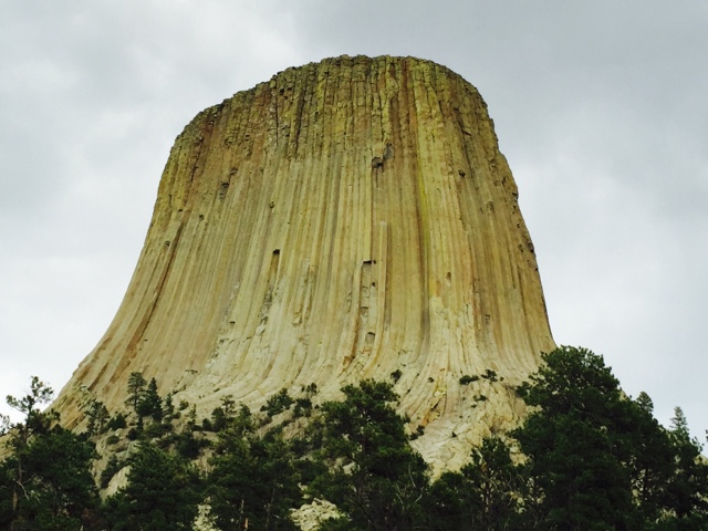
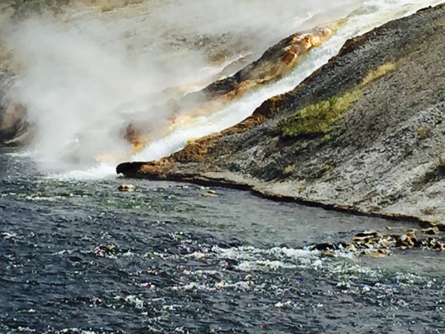
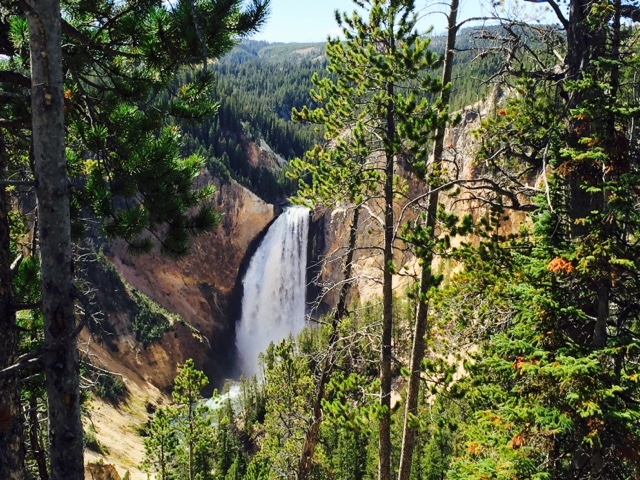
It was pretty close to 4-1/2 hrs from Adrian to Hastings. Maybe a bit more, there was some construction.  It is hard to say but after almost 5,000 miles through North Dakota, Montana, Idaho, Oregon, Wyoming and South Dakota some of the worst roads we have seen are right here.  I 90 and US 52 are in pretty poor shape. It was a stark contrast between I 90 in South Dakota and Minnesota. So why is this? What is it about Minnesota? I 94 heading NW towards Fargo when we left was the same way.  

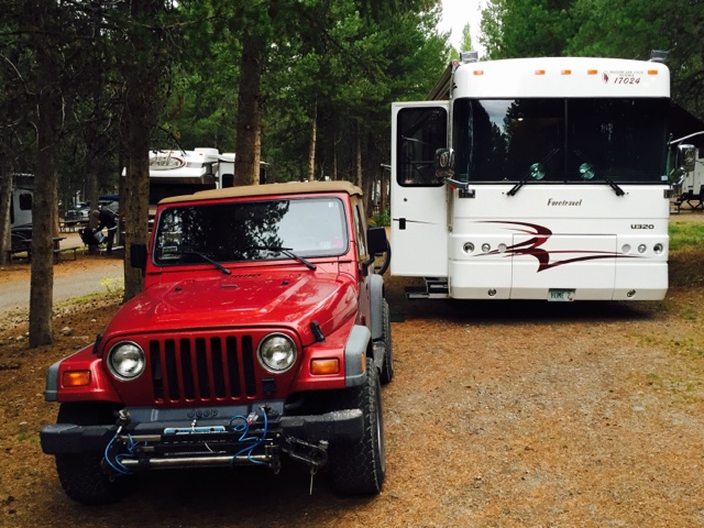
We stopped on a level spot just before home and disconnected the Jeep.  Susan drove on ahead and I followed, stopped just past the driveway and backed in.  The driveway seemed to be gone.  Grass and plants and leaves almost completely covered it. But in I went.  Susan had the barn doors open.  The tractor was in the barn, it started right up and it got moved and the coach was backed into the barn. It took about an hour and a half to unload the refrigerator and freezer, bring in all of the extra food, bring in all of our clothes and toys and be back. Move from one house to another.
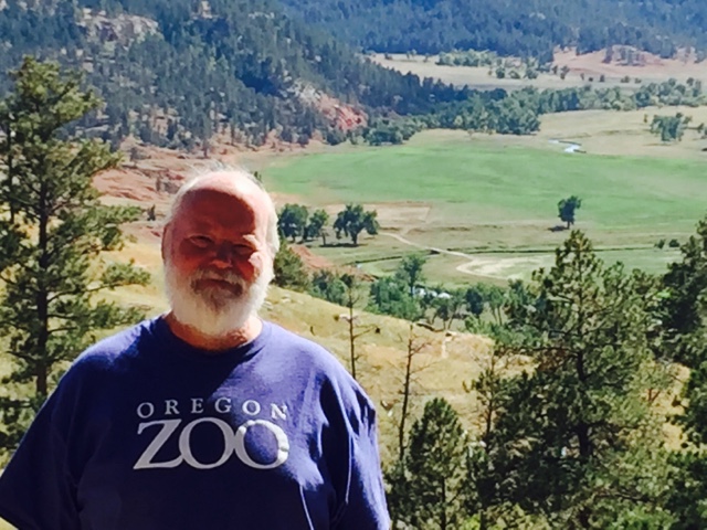
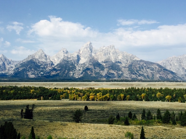
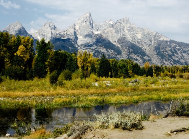
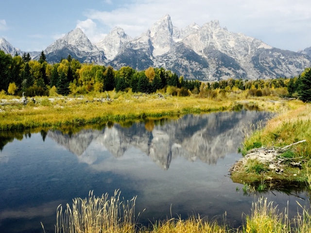
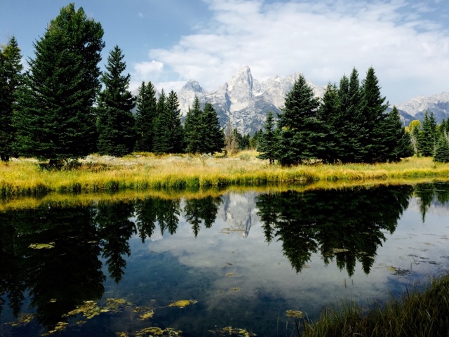
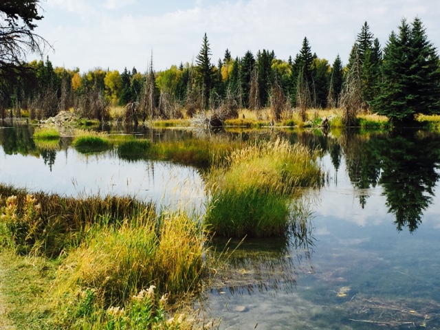
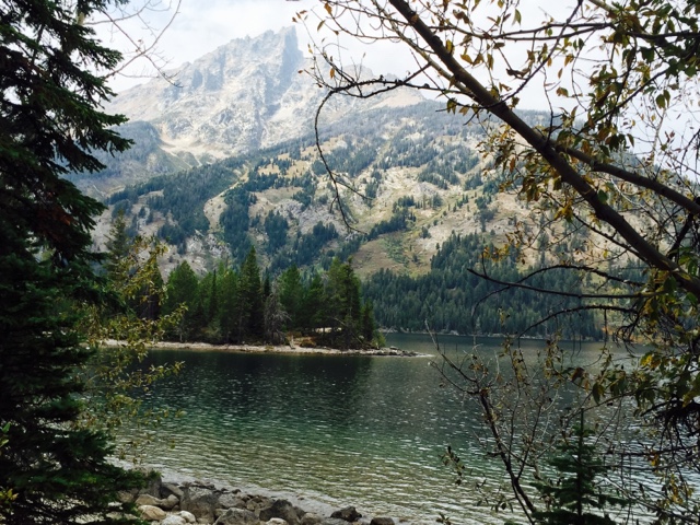
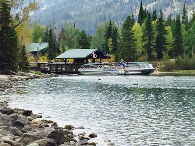
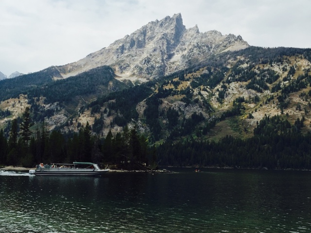
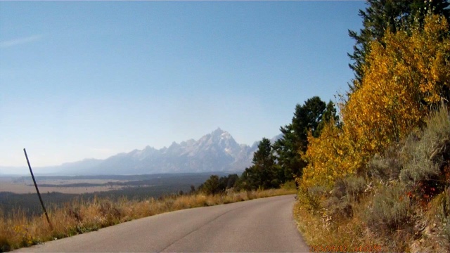
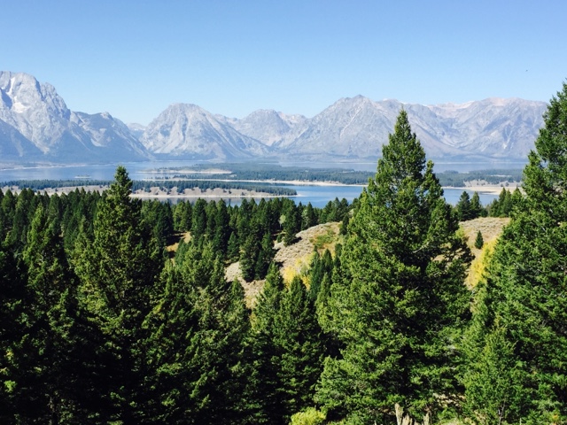
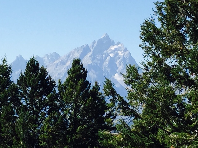
We both are glad to be home but wish we had stayed longer especially in Oregon and the Tetons. Some of our reservations were made almost a year ago and others last March. These high demand places take some planning.  We usually try to keep things as flexible as we can.
Where to next?  Indiana.  We leave on 10/11 for Columbus where more that 100 Foretravel coaches will gather at CERAland campground right next to the Cummins engine factory. It will be fun to meet many of those we have come to know on the Foretravel Forum and many that we already know, attend technical seminars, get a tour of the Cummins factory and hear from Foretravel executives about plans for the future. And there will be lots of show and tell as well.  
More later.
Roger and Susan.

Adrian, MN

Our last stop before home.  

We were thinking about Blue Mound State Park just north of Luverne. This is a very nice park that we have been to several times. There was some severe flooding that damaged one of the two dams in the park in June, 2014.  These dams were built by the CCC in the 30s. So it would have been interesting to see what happened.  And Blue Mound is home to one of the biggest bison herds in the state, over 100 on one of the largest native prairie ranges left in the state. But we didn’t have a current park sticker for either the coach ot the Jeep and there is a water alert (something wrong with the water supply) in the park so there is no water.  A bit of searching using our Allstays RV and Camp app and we quickly located a city park in Adrian only 10 miles or so past Luverne.
Adrian is a small town, about 1200 people.  But they have a big city campground in a park area with softball diamonds, soccer fields, a swimming pool, a frisbee golf course and a big play ground.  There are over 100 camp sites.  Full hookups were about $26.  We just wanted 30 amp connection over night for $22.  A very nice campground, grass sites, showers, lots of shade.  Great for overnight. They also had weekly, monthly and seasonal rates.
I forgot to take a picture.
So our last leg will east on 90 to Rochester and then north on 52 to Hastings.  The routing things on the computers say 3 hours and 45 min.  We add 20% to get 4-1/2 hours.  Much more likely time for us.
We don’t think too much about getting home until we are on our last leg.  We get were we get to. But now we are ready to get home, do what needs to be done.  Apples need picking, yard probably needs to be mowed after two months and there are the mail piles, 80% goes straight to recycling.
But we have to get there first.  Task at hand sort-of-thing.
More later.
Roger and Susan.

Big Bend Dam Corp of Engineers Campground

We left the Devils Tower National Monument after two nights. It rained a bit overnight. We went up over the top of the Black Hills into South Dakota and then down towards Rapid City and then east. It started raining again, the wind was blowing from the north at 20-30 mph.  We had to stop at one point because one of the awnings was trying to unwind in the wind.  We pulled into a gas station parking lot where there was another coach there with the same problem. We added a couple of ropes to hold the awning in place.  It was fine. So it just poured and blew all the way across the wasteland. This has to be the most boring drive we have ever done.

We got all the way to the Missouri River just up stream from Chamberlain where the Big Bend Dam holds back the river making Lake Sharp and makes electricity. There is a nice Army Corps of Engineers campground there.  Water and electric, $9 with the geezer pass.  These are great places to stay. This is clearly a fishing campground.  It is on the tailrace of the power plant.  This is where the water comes out of the turbines.  Lots of swirling water, lots of boats, apparently lots of fish.

It was still raining when we got there and slowly stopped while we got set up so we got a walk in.

In the morning the sun was out and we headed for Adrain, Minnesota.  Another four or five hours across exciting South Dakota except the wind was coming from the south.
More later.
Roger and Susan

Will There Be Mashed Potatoes?

The drive across Wyoming was interesting, diverse and engaging.  Things to look at, wonder about, ask questions and postulate answers. From Caspar we headed north east towards Gillette and then a bit east to the first National Monument in America, Devils Tower.  Yes, there is no apostrophe.  Whether left out on purpose or accident it is as the act of Congress declared it to be.

Just as Richard Dreyfus imagined it, it looks like a giant pile of mashed potatoes formed with a fork.  More than 1,500 ft high. In fact, it is a highly regarded sacred place by many Native American people.

We stayed at the campground in the park, $9 a night with our geezer pass, nice.

Very quiet, lots of RVs and tent campers.  

The Tower is an old volcano core which filled with molten lava and then cooled.  As it cooled the lava cracked and formed hexagonal columns which are the vertical columns you can see.  Most of these are 10 feet across on each side or more. In the middle of this picture there are two climbers decending this side of the tower, the more difficult to climb. Permits are required and nothing can be left behind. When we first saw them they were standing on the top of column to their right about 80 ft above where they are now.

When the core filled with lava and cooled it was more than a mile and a half under ground.  All of this happened before the Tetons were formed. Ancient rivers, several ice ages and weather wore away at the landscape until after millions of years this is what is left.

The base of the tower is surrounded by the rubble field.

Many of these fallen rocks are sections of columns much bigger than a city bus.

Here is another climber.  I took this with my iPhone at maximum zoom through a binocular device visitors were using to look up at the Tower.  It took a bit of adjusting until everything was aligned and then I took the picture.  Pretty amazing.

Same thing with the iPhone with no zoom just the binoculars.

We baked one last loaf of bread.  Amazing how it came out.

Ponderosa pines and oak trees were all around.
Just to the right of the green fields below is where the landing site in “Close Encounters of the Third Kind” was filmed.  At that time there was nothing there. The land owner rented the land to the movie company and with the money he opened a KOA and gift stores right near where the entrance to the Monument is today.  Lots of alien references. Only eleven minutes of actual local scenes were in the movie.  Everything else was on built up sets.
We had thought about going to the Buffalo Roundup at Custer State Park but it is a week away and we just don’t think there is enough draw in the Black Hills for a week.  So we will get to the buffalo roundup another day.

A few more days to get home.  There is the vast wasteland of South Dakota to cross.  A Corp of Enginners Campground at Big Bend Dam looks like our next stop.

A bit more later.
Roger and Susan

Colter Bay, 9/3-9/15/2015 #8, Time to Head East

We have really enjoyed our time here in Colter Bay, Grand Teton National Park, The National Elk Refuge and Yellowstone National Park.  There is so much to do and see that two weeks is hardly enough.

In 1980 when we were here we arrived in the Tetons just before July 4th.  Our friend, Roger Henry, flew to Billings, MT, rented a car and came down and stayed with us for week. That was a very busy week. We stayed at Jenny Lake in our small Class B (big van camper). Today the Jenny Lake Campground is tents only. We went on a horseback ride around one end of the lake, up Cascade Canyon towards Lake Solitude. This was an epic horseback ride. Not just an hour sissy trail ride but an all day up really steep, rugged mountain trails kind of ride. And it was raining. It was raining when we got to the stables in the morning. Ponchos on. And it rained every step of the way up the mountain until we couldn’t go further because there was several feet of snow covering the trail and the guide didn’t want the horses to go through the snow.
We stopped there for lunch in the rain and several folks including Roger Henry walked some distance through the snow only to find Lake Solitude still covered in ice.
It gets worse. It was still raining, drizzling perhaps but by this time we were wet and cold. The ponchos had long ago given up on their job.  Rain ran down the back of the poncho, down our backs, down on the saddles down our pants. Everything was wet. And we had maybe 10 miles to go, straight down.
The back end of the saddle has a raised rim to keep you from sliding back.  Going downhill you lean back to stay vertical.  Wet everything, constant back and forth, constant contact.  Maybe you get the idea.  We were sore, tired, cold, hungry and rubbed raw from wet jeans rubbing on a wet saddle of several hours.  Imagine a cheese grater.
What a memorable trip. We have scars to prove it.
There is no longer horse back riding at Jenny Lake.
And then the three of of went us to Yellowstone to finish out the week.  Roger went out on some long solo hike to prove that he was not a tempting grizzley bear snack. We nursed our wounds.
By the time we left Yellowstone six weeks had past. We changed campgrounds several times and had a really good time.  We had our dog, Xenia, with us.  She was a 65 lb Malamute. Best dog ever.  We think back on that time and while we were glad she was with us we realize now that there were things we didn’t do because she was. We could leave her in the camper for quite a while but not all day.  Today as then you can’t take your dog on any trails. And today it is even more restricted, you cannot leave your dog unattended in your car or RV. 
So finally it was time to leave the Tetons.

It was supposed to rain so we packed everything up the night before.  And it did rain pretty much all night.  Just a  steady gentle rain.  It got down into the 40s.  We were heading east through Togwotee Pass at 9,700 feet. I was concerned about snow or freezing rain.  The next night was supposed to be in the 30s so we were going to go.
The highway was almost deserted going east from the Tetons.  It was a good road, two lanes most of the time, plenty of passing lanes.  Most of the grades were 6% or so so we had no trouble just climbing up over the pass.  The rain had stopped about half way up the pass and once over the pass the clouds broke up and we had a very pleasant drive east towards Camp WalMart in Caspar.
This part of Wyoming is very scenic, lots to look at, big rolling hills, trees.  The Medicine Bow mountains are off to the south.  This would be a good route coming back.
More later,
Roger and Susan

Colter Bay, 9/3-9/15/2015 #7, Snake River Access, Jenny Lake

Schwabacher Road gets you down to a side channel of the Snake River.  Another one of these dirt roads on which most people don’t want to get their cars dirty. But when you get to the end of the dirt road there is a small parking area near where Schwabacher’s homestead was. There was river access through the channels out to the Snake.  Not something used by anyone other than fishing folk now.  No boats.

It is down there near the trees.  Don’t you just want to sit there and marvel at what is right in front of you?  What a spectacular place to be. Two weeks was barely long enought to begin to discover all of the treasures.
The primary user of this bit of Snake River side channel are beavers and ducks. We walked up the river and saw a series of dams each bigger than the downstream one holding back bigger and bigger ponds. 
Perfect time of day, good light, almost no breeze.

We didn’t see the beavers but there were three beaver lodges.  This was an amazing place. Quiet and peaceful, water running throught little openings in the dams, huge effort by the beavers to create this ecosystem and then the reflections in the ponds of the Tetons just in front of you.
On the other side of the Snake River closer to the Grand Teton is Jenny Lake.  This is the closest destination in the park to Jackson and therefore the busiest part as well.  Jenny Lake is another lake in the fault line between the valley and the Tetons filled by melting glaciers.  It is not very big, maybe a mile across and two long.  On the far side of Jenny Lake the Grand Teton just emerges from the lake. There are no foot hills, just mountain.

A small harbor to the right in the picture above has canoes, kayaks and small motor boats for rent.  There is also a boat shuttle to the far side of the lake which cuts off about four and a half miles from the hike up Cascade Canyon to the Hidden Falls.  They have four forty passenger boats. One leaves this side every fifteen minutes.  One leaves the other side every fifteen minutes.  It takes about seven minutes to cross and eight minutes to load.  The boats are pretty much full all the time.  320 people an hour all going up a steep narrow trail to Hidden Falls and the other 320 people coming down.  Some walk around the lake instead of riding the boat.
Just a bit too crowded for our liking.  There are other places to “get back to nature” without a tour bus full of people with selfie sticks.

But across Jenny Lake the Grand Teton looms large.

And of course there is a Gift Store.

Where we found another patch to add to our collection.  We now have about 40 from places we have been stuck to the fabric window valances in the coach.
We do OK without a selfie stick.
Another great day in the Tetons.
More later.
Roger and Susan

Colter Bay, 9/3-9/15/2015 #6, Signal Mountain, Chapel of the Sacred Heart

There are many side roads and trails in the Tetons.  Some have names, some do not.  Some are easy to follow, many are not.  It is up to each visitor to look for these places and to go or not go.

Signal Mountain is an area along the side of Jackson Lake just south of the dam.  Everybody is looking towards the lake, towards the lodge but off to the right is a small road that leads to Signal Mountain, up about 1500 ft above the valley floor.
Fairly steep winding road but it was paved.

They were doing brush and tree trimming along the side of the road.  All of the trimmings and logs were neatly piled up.  We wondered if someone was coming back to pick them up.  We had not seen this anywhere else.
Near the top the views were amazing.

There was a parking area and some trails towards the west.
Jackson Lake is pretty big, 7 miles wide and 15 miles long.  About 460 ft maximum depth.  The natural lake was expanded when an agricultural group from Idaho proposed building a dam.  They would build it and maintain it in exchange for water rights to any additional water it added to the lake.  Three dams later the latest one is “earthquake proof” beyond anything ever recorded here.  The new maximum water level is 39 ft above the original level. Lots of water for Idaho farms.  They rarely use it all or even half of it. Colter Bay exisits because of the higher water.  If the farmers used all they could Colter Bay would be empty.

Every angle looks different and I just never got tired of looking up at the mountains.  Up on Signal Mountain I didn’t have to look up as much.

The valley (Jackson Hole) goes a long way to the north and east all the way to Yellowstone.

Why is it called Signal Mountain? Well this big mast with microwave, radio, cell and who knows what else tells the story. Probably why the road is paved and they were mitigating fire risk.  5 Bars up here.  This is the highest point in the valley.
No buses, no trailers, no RVs.  Actually not too many up here at all.
Heading back to Colter Bay we had driven by the Chapel of the Sacred Heart a few times but not this time.  It is a small log church built in the early 1900s to serve the Dude Ranch visitors.  It was rebuilt in the 1940s and again in the 1960s and then a major rebuild in the early 2000s funded by a New York family and Wyoming family in memory of the 9/11 victims.

It had log flying buttresses.  Neat!  It was on a sturdy concrete foundation.  The latest rebuild should last a long time.

Very quiet inside except for the door that creaked loudly making sneaking in after the service started next to impossible for the late rising dudes.  I can just see His Dudeness trying to slip in in his bathrobe with a quart of milk.
There was a lovely stained glass window.

And a nice wood carving.

Another nice place to see.  So many of them.  You just have to stop.
More next time.
Roger and Susan.

Colter Bay, 9/3-9/15/2015 #5

Another stunning day in the Tetons.  Mornings are usually bright and clear.  Some clouds push over the mountains from the west in the afternoon.

Haven’t caught the mountains yet in the morning when the lake is calm.  I got up pretty early one morning and it is interestimg how the mountains light up as the sun comes up.  
We were headed down to Jackson on an errand so we wanted to try the Snake River Road on the west side of the Snake River marked on the map as something more than a trail but not a real road.  It said 4WD only. Perfect. These are the 5% places or 1% places that we look for.  (5% of park visitors go there). After driving this 20 mile long road that ranged from deep ruts to mud to gravel to softball sized boulders my guess is far less the 1%.
The road isn’t marked on the highway. No sign, no gate, no turn lane, just ruts.  So turn we did.
From the top of Signal Mountain you can see (sort of) the road coming in from the right along the tree line and then heading more southeast. (The little squiggly line). It is mostly sage brush out here.  The road follows the Snake River along the bluff. Down below the bluff there are trees, mostly cottonwoods.

It is a couple hundred feet down to the next level.  The river is in another level below that.

Our old Jeep and the older driver did well. Susan got nervous a couple times when we got close to the edge.

Dead Man’s Bar on the Snake River from above.  We could see the road from the other side to this access point.  Lots of raft trips begin here.  

And tall tales of fishing.  There were many fishing people.  Many on shore, some wading in. Many in these boats that look like New England dories.

The orange rust colored ground cover is actually blueberry and huckleberry bushes.  Everyday we were here colors changed more and more.

We made it all the way through the road.  From the high bank the road dropped down to a lower level, still two steps above the river.  There were signs of animals all over and animal trails too.  We did see a small herd of antelope. And then there was a steep rugged climb back up to the upper level. And then finally  a long downhill run and back towards the highway.  We saw maybe 5 or 6 other 4WDs on this drive, no cars.  We did see one Ford van all set up with 4WD and lots of bolt on stuff.
We did our errand in Jackson and headed back towards Colter Bay on the east side of the Snake looking for the Dead Man’s Bar access.  It is on the map. It had signs and a turn lane.  So off we went.

Remember I said it was at least a couple hundred feet down to the next level?  Three or four hundred feet on this side.  This sign probably turned many around.  A steep winding road leading down.  We got down there and soon after a 40 passenger school bus did to.  So much for bravado.

This is the fishing boat experience.  One or two fishing, one rowing.  The rower and the boat are usually rented for a half day or all day.  Some folks have their own boat but you can’t fish and row at the same time. We talked to an older fellow who was all decked out in his fishing regalia for walking in the water.  He was from the local area and said fishing had been very good.  They catch and release cutthroat trout.  You can keep one a day if we understood the rules.
Another great day in the Tetons.
More later. 
Roger and Susan

Colter Bay, 9/3-9/15/2015 #4, Two One Day Trips to Yellowstone

Our original idea was to stay in Yellowstone for two weeks with a day trip or two to Grand Teton National Park.  

We started in March looking for places in Yellowstone. We were looking for places with room for our 36′ RV where we could make reservations. Electrical connections were not required but would be nice. There is an RV Park at Fishing Bridge, the only place with electric. During the time frames we were checking on plus or minus a week there was nothing available for two weeks, nothing for seven consecutive days even if we changed sites. There were a few openings but nothing more than four days in a row.  
Campgrounds with bigger spaces and no hookups were next. Pretty much the same story.  The best second choice was Madison on the west side.  It had nothing.  I was surprised by this and asked a reservation person why space was so tight and they said that September was prime fishing season and was as busy as the peak summer times.  
Many of the campgrounds close by September 15. Some campgrounds take reservations for some of their sites but not all.  The RV campgrounds are all reservation and usually full 6-9 months in advance.
Another option would have been West Yellowstone but spots there are $60-80 per night or more.  And you are outside of the park.  Not a good choice for us.

So we started checking at Grand Teton and found the space and time we wanted right away.  Lock it in. That turned our plan upside down.  Two weeks in the Tetons with day trips up to Yellowstone.  By sheer luck it was the best turn of events.
We have been to both parks before.  We remember getting up in the morning, packing up and driving to a different campground early to get in line for a first come first served spot.  For many that works fine.  It did for us then with our smaller camper.
So, I am going to combine our day trips up to Yellowstone into one blog. Two trips, about 160 miles each day, 9-10 hours each day. Plenty of time to stop and see, some short walks and picnic lunches.  We both did over 10,000 steps both days even with the drive time.
West Side Story
From Colter Bay it was only 17 miles to the south entrance to Yellowstone. And  up around the west side towards Old Faithful and all that is there and beyond that up to Madison. We drove all the way up to Madison first. You go past Lewis Lake and the Lewis River flowing south and then climb and cross two continental divides before you get to the Old Faithful area.
If you remember Yellowstone NP sits on one of the biggest volcanic hotspots in the world. Only a couple miles beneath the surface lies molten rock, magma which heats the ground water to make the geysers spout, the mud pots to bubble, and the vents to fume. Most of this is pretty stinky, smells like rotten eggs. The entire volcano has erupted at least three times in recent geological time.  The last was 640,000 years ago which created the caldera, 35 miles x 40 miles, that now forms the heart of Yellowstone. That eruption was more than 2,500 times the size of Mount St Helens which erupted in 1980, based on the amount of material blown out during the eruption. This ash and dirt and rocks and molten lava spread over more than half of North America. Smaller eruptions continue, the last only 3,400 years ago. Yellowstone is considered to be an inactive but not dormant super volcano. 
After we crossed the continental divides we headed for Madison.
There are active geyser basins in most of the park. (British folk pronounce these as geezers) There were a lot of both in the park.
This type is called a cone geyser. The stuff blows up through a hole in a cone made by the minerals in the hot water. Eventually the hole gets smaller, the pressure higher and the hole cone will blow apart.
Very hot water full of minerals flows out of super hot springs and pools right into the cold fresh water of the Firehole River which flows north.
The minerals deposit some of the color but most of the colors come from bacteria and other micro-organisms that live in the hot organic soup.
The Firehole River flows out of the caldera over the Firehole Falls.

And through the Firehole Canyon where it merges with the Gibbon river coming from the east to make th Madison River which flows west and then north through Montana.

We stopped at Madison for a picnic, visited the Visitor’s Center and drove throgh the campground to see what it looked like. It was a nice campground with some shade and roomy sites. I can see why it is a popular campground, one we would like to stay at.  It is one of the first to open and one of the last to close.  Great fishing nearby.

And then back towards Old Faithful. It is almost like a theme park. Massive parking areas and many thousands of visitors. We went in to have a look at the Old Faithful Inn. We thought about staying overnight there but for the cost of a couple meals and a room we could stay for another week and a half in Colter Bay.

It was as big and as impressive as we remembered. Some one was asking at the main dining room about dinner reservations.  The next available were two days out at 9:30 PM.  Not only do you need to make room reservations you need dinner reservations as well. And then a tour bus disgorged 40 tourists who walked right in, got in line and went into the main dining room. Probably why nothing is available for a couple days.

There is also the Old Faithful Lodge. A 1970s looking hotel sort of thing right in front of Old Faithful.  I wonder how many people make reservations at the Lodge thinking it is the Inn?
Old Faithful spews forth from its basin (this is basin geyser) about every 90 minutes or so.  There are big signs everywhere telling visitors when the next spewing will take place.  About 15 minutes before crowds form on the semi-circular walkway in front of Old Faithful. A ranger said that there is usually about 3,500 standing there waiting holding their cameras up waiting for the inevitable which is that their arms get tired.  Once the geyser begins to spout the photographic clicking (mechanical or electronic) nearly drowns out the sound of the the geyser.  The eruption lasts about 3-1/2 minutes on average so there is plenty of time to get those arms up and click away. Before the event is even half over the crowd is dispersing heading back to tour buses or to the parking lots.
Pretty neat actually.
Lake Side and Canyon
Our other day started out the same heading north past the Lewis River and Lake Lewis and then east around Yellowstone Lake.

The lake is large, beautiful and has minimal access.

At the top of the lake are three major areas. 
Bridge Bay has a very nice campground, a marina, lake access and a store. We have stayed here before and it is a nice place.  The campgound was already closed for the season.
Lake Village has accomodations, stores and lake access.
Fishing Bridge has a large campground as well as an RV campground.  We drove through the RV campground to check it out.  It is in the middle of a very busy area off the main road into the park from the east.  The RV park was disappointing when compared to Colter Bay.  The sites were closer together, not as many trees and it didn’t have the same feel as Colter Bay. But if we hadn’t seen other RV parks in other National Parks it would have been OK.  We have been in private RV parks that were worse.
Up at the Canyon Area lies the Grand Canyon of the Yellowstone River.
The Yellowstone River flows out of Yellowstone Lake heading north towards the Canyon Area.  As it flows it starts to cut into the rock. There are rapids before the upper falls and the lower falls.
The lower falls drop 308 ft. There are trails along the south rim and lots of ways to have a look.
We started down Uncle Tom’s Trail. This at some long distant life in the past was a rope and ladder trip down into the lower canyon to near the bottom of the lower falls where dinner was served. This was in 1898 – 1905. Imagine climbing down in your suit and tie or dress using ropes and ladders.
Today there is a system of steel stairways, bridges, ramps and paths that lead down 350 steps and more than 500 feet to look out at the falls from a prespective few see. Susan got down about half way before the sharp drop offs and open stairs were enough. I went on to the bottom. Caught my breath and then the cardio workout of the year began. 350 steps. On stairs just hanging out in space.
And then back up the canyon to the upper falls. Beautiful.
We need to get a selfie stick. Maybe not.

We stopped for an ice cream on the way back to Colter Bay. A raven kept us company at the table.  What a big, bold bird.  Absolutely confident around people.

That is a short summary of two full days, lots of hiking, lots of driving and almost three hundred pictures and about 10 hours of dash cam video.
Yellowstone is a beautiful place. We would like to come back, find those back trails where the rest of the visitors don’t go, fishing spots where you might be alone with the fish and a campground that was more than a parking lot. Yellowstone is the fourth most visited park in the nation. The Smokies and Yosemite have nearby population to feed them. The Grand Canyon is a once in a lifetime sort of thing for many. 
We got back to Colter Bay. Calm, space, shade, quiet. The Grand Tetons are the second most revisited park in the nation.  If you drew a fifty mile radius circle around Colter Bay there would be only 15,000 people near by.  The first most revisited park is the Smokies.  In the same sized area there would be millions of people.  Something about the Tetons grabs and holds your attention and makes you want to come back.  We want to. We will.
More to come.
Roger and Susan

Colter Bay, 9/3-9/15/2015 #3

Saturday, September 4th.  

A cold front and possible rain and snow in the higher elevations was supposed to be here Saturday night.  You know how the weather forcasters are, usually wrong.  It was getting pretty windy on Friday evening so we battened down the hatches.  By nine or ten it was raining and as far as we know it rained all night.  Saturday morning was in the low 30’s and it was windy.  The rain continued on and off all morning.  
A good day for reading.  And baking a cake.  We did an 8×8 German Chocolate cake and six cup cakes.  We are getting pretty good at baking in the microwave/convection oven.  We have to watch time a bit, things get done quicker in the convection oven.  So first the cupcakes.  There were no time/temperture instructions for cup cakes especially at high altitude.  We guessed.  They came out fine.  Then the 8×8 cake.  The time the instructions gave was for an 8″ round.  So we added some time, tested the cake and added some more until it looked done.
We did get out for a walk in between rain spells.  I felt sorry for folks who had to leave in the rain if they weren’t packed up the night before.  The weather report said we got almost 1/2″ over night.  We walked over to the Visitor’s Center, down to the marina, back up to the gift shop for another look.  There were a couple of t-shirts that I liked and a fleece jacket.  It was cold so I got the fleece jacket.  Susan is holding out. Back for some more reading.  We baked two buttermilk biscuits and had them with chicken pot pie soup for supper.  Good on a cold night.  We walked down to the lake to catch the end of the day.  Another colorful sky.

Sunday looked promising.

Sunday, September 5th.
Sunday came and the sun was out but it was cold.  A short morning walk down to the beach in our winter gear. It warms up quickly here.
We were driving down to Jackson to meet some Foretravel Folks.  Dave Katsuki and Nancy Elkins are full timers, about our age who are working this summer as volunteers at the National Elk Refuge.  They each work 2-1/2 days each week.  They have had a full hook up site on the Refuge all summer looking out towards the Teton Range.  This work is with the National Forest Service which manages the Elk Refuge.  Dave does maintenance work on equipment.  Nancy is an interpretive guide at the Miller House.  Their schedules don’t often match so one or two days a week when neither is working is about the best they can do.
We ate at a place we saw on “Diners, Drive-Ins and Dives”, on the Food Channel called Cafe Genevieve.  Great breakfasts.  Susan had a salmon eggs bennedict.  I had a green chili huevos rancheros.  Very good.
Dave and Nancy enjoyed their summer here.  They come here almost every summer and have worked or volunteered in a variety of jobs.  This year was their longest, 4-/12 months and while they enjoyed the work and being here they were ready to move on. Sometimes work of any sort gets in the way of fun.

Nice spot for their summer stay.

We stopped by the Miller House out on the Elk Refuge.  It was built in the late 1800s by some guy named Robert Miller who had homesteaded 160 acres about 3 miles from where Jackson is today.  It had water.  He went back to Chicago to marry his wife and brought her to Wyoming.  They built a big 6 bedroom house here but never had any children.  

Farming here is next to impossible.  Only a few inches of soil sit on top of gravel and rocks.  They did well at ranching and kept buying more land.  They became realtively wealthy. MIller started a bank and a land title business. Both prospered.  Many of his neighbors and clients did not so their land holdings increased.  They moved into Jackson into a fancy home which is still there.  Mrs. Miller was elected Mayor of Jackson.  Miller worked for the Snake River Land Company (owned by John D Rockefeller, Jr) buying up as much land as possible.  The Rockefellers later donated more than 30,000 acres to the original Grand Teton National Monument.  Miller was the first Park Superintendent of the Grand Teton National Monument. 
The National Elk Refuge was created in the early 1900s.  The natural elk migration route led right through Jackson.  In the 1800s the elk just move through town.  By the beginning of the 1900s the town was big enough that the migration was blocked.  The area north and east of Jackson didn’t have enough winter food for the thousands of elk coming out of the mountains and many elk were dying.  Another rancher named Steven Leek took photographs of the dead and dying elk.  Many ranchers in Jackson Hole petitioned the Federal Government for assistance and in 1912 the National Elk Refuge was established and many but not all homesteads and ranched were purchased for the refuge.  
To keep the elk from starving the National Forest Service began feeding the elk in the winter.  This practice continues today but instead of hay they feed the elk alfalfa pellets about 3/4″ in diameter and 2″ long. Apparently it is more cost effective and nutritionally better than hay.  
They wait until the elk have eaten as much natural grasses as they can.  When the grass runs out or the snow gets too deep then the feeding begins. They are experimenting with many efforts to increase the natural food supply.  Many hundreds of acres are being irrigated to significantly increase the growth of native grasses to decrease the dependence on feeding.  The herd size is being managed as well with an annual hunting season. In the 2014-2015 winter there were 7,500 elk in the Refuge. A recent newcomer to the refuge are bison.  Last winter 500 showed up. They seem to be able to forage better than the elk.
No elk pictures, they are not here in the summer but in the winter …
Obviously someone elses photo.
Tomorrow we are driving up into Yellowstone.
More later,
Roger and Susan