Port Aransas, TX Jan 2017

Port Aransas is a smaller town at the north end of Mustang Island.  Several expensive RV parks with what looked like small spaces, a big marina or two, several hotels, lots of condo-like places, homes, lots of places to eat and a ferry to the mainland.  It is actually a fleet of ferry boats with 6 or 8 loading docks.  They run continuously and even in this off-season time the waits were 30 minutes.

There was a kite store there as well which was the main reason for going there.  We got a kite for a young fellow we know in Oregon and a whirling thing and a spool of 90 pound test line for a big kite I got last summer at Mackinaw Island.  So back to the beach.  I am sure Port A is wonderful for some folks but not our kind of place for lang.

img_7800

It was interesting that almost every kite and wind sort of thing there was made in China except for this whirling thing  which was made in Oregon.

The new kite is colorful, topical and flew well.

My big kite is over six feet wide and in the strong wind pulled out a couple hundred feet of line in a flash. I was out there pulling on the line doing my shoulder exercises.  There were several kite boarders off-shore too.  The wind would catch their big kites and they would fly through the air.  They were all in wet suits with elaborate harnesses and big curved kites riding on something that looked like a cross between a surfboard and a snowboard.

kiteboard

And there was always somebody fishing out on the jetty.  Maybe not so much catching though.

We found some banana pudding and vanilla cookies to use up our old bananas.  Yum.

img_7534

And then it was time to leave.  Three weeks on the Texas Gulf Coast.  Windy and humid and fun.

We are off towards San Antonio on a not so direct and not very quick route to Tucson.

More later,

Roger and Susan


Padre Island National Seashore

Just across the channel near the end of the causeway from Corpus Christi and to the south is North Padre Island.  The town there is actually part of Corpus Christi. It probably has a name but we never figured out what it was.  Drive through that part of town past the condos about five miles to the Visitor’s Center of the Padre Island National Seashore.

We stopped to pick up some information and an iron on patch.  We try to get one at most places we visit.  With some Velcro added to the back side they stick to the fabric part of the window valence above the windows in the coach.  They add a colorful accent as well as a reminder of all of the places we have been.  We have 58 of them now and are starting to run out of room.

img_7757img_7758img_7759

This is a fun way to keeps places fresh.

img_7494

I always thought being a Park Ranger would be fun.

The Visitor’s Center is on the Gulf side of the island.  On the bay side there is a basic campground (parking lot) and picnic areas.  This is a very popular kite boarding, kayaking and stand up paddle board area.  You can go half way across the bay (1/2 mile or so) and it is only about 4 feet deep.  There are some deeper areas where there are channels for boats and a much deeper dredged section that is part of the InterCoastal Waterway.

The InterCoastal Waterway is a protected way for ships to travel from Brownsville, TX to Boston, MA.  The 3,000 miles began in pieces as far back as the early 1800’s.  The War of 1812 provided more incentive to complete sections.  The Houston Ship Channel is part of the ICW and was originally built in 1872. The demands for efficient bulk transportation demonstrated in WWII and the risk of German UBoats got things moving to finish even more.  Today a deep wide protected channel gets you all the way along the gulf and somewhere through Florida to Boston.  Pretty amazing.

img_7498

A pretty boring campground but it was almost full.

There is another Gulf side campground, still pretty much a parking lot but many of the spaces are much wider and make for some reasonable off-grid camping.  And if you really want to rough it the paved highway ends about 1/2 mile past the Visitor’s Center on the beach.  And then it is 68 miles to where the paved highway starts again.  And in Texas the beach is considered a state highway so off you go.  And anything does.

img_7554

A 4×4 pickup had no problem.  There were lots of just regular cars out there as well  and the home of the brave too.

img_7497

We stopped for a while to sit in the sun.  It was warm and windy.

img_7495

Lot of fun.  The Jeep does well.

That’s it from here.

More later,

Roger and Susan


USS Lexington Slide Show Pictures

Well my slide show experiment worked for some, not for others so I am going to repost the slide show sections.  There may be some duplicates.

Hanger Deck

img_7500
It is huge, there is a 16 person Flight Simulator Ride as well as a movie theater.
img_7504
First step in Naval Aviation, a trainer
img_7503
Hanger Bay Sliding Doors

img_7502

img_7501
A Douglass Dauntless fighter-bomber
img_7505
Heavy torpedo bomber of the type George HW Bush flew

Lower Decks

dscn8782
Knobs, Handles, Dials … OH MY!
img_7532
Steam Turbines, One High Pressure, One Low Pressure  Both Feed Giant Gear Reduction Transmissions to the Propeller Shafts
img_7531
Boilers Make High Pressure Steam
img_7530
Yum, Plastic Food.  Breakfast in the other line looked worse.  The sign at the head of the line said “Take All You Want but Eat All You Take”  When the Lexington was decommissioned in the early 90’s they were spending more than $1 million a week on food.
img_7529
This was the Officer’s Barber.  There were three for everyone else. 
img_7507
Nuts for Knots
img_7506
Anchor Chain

Flight Deck

img_7525
View from the Bridge
img_7526
Blue Angel
img_7527
F-14 Tomcat
img_7521
5″ Deck Guns, 15 rounds a minute!
img_7517
Bird on a Wire (antenna)
img_7516
Lots of Anti-Aircraft guns on both sides
img_7514
Catapult Line

img_7513

img_7510
Tomcat
img_7509
Cloudy Day but Hot

More later,

Roger and Susan

USS Lexington, Corpus Christi, TX February 2017

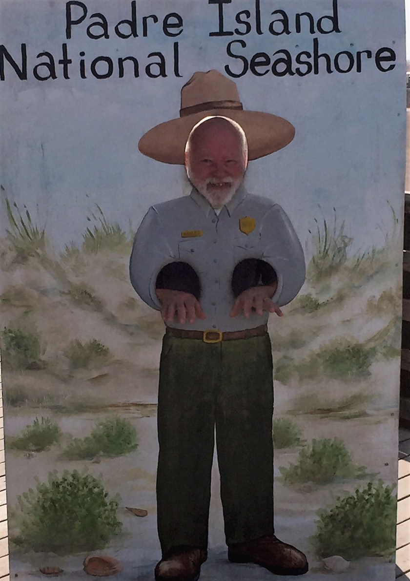
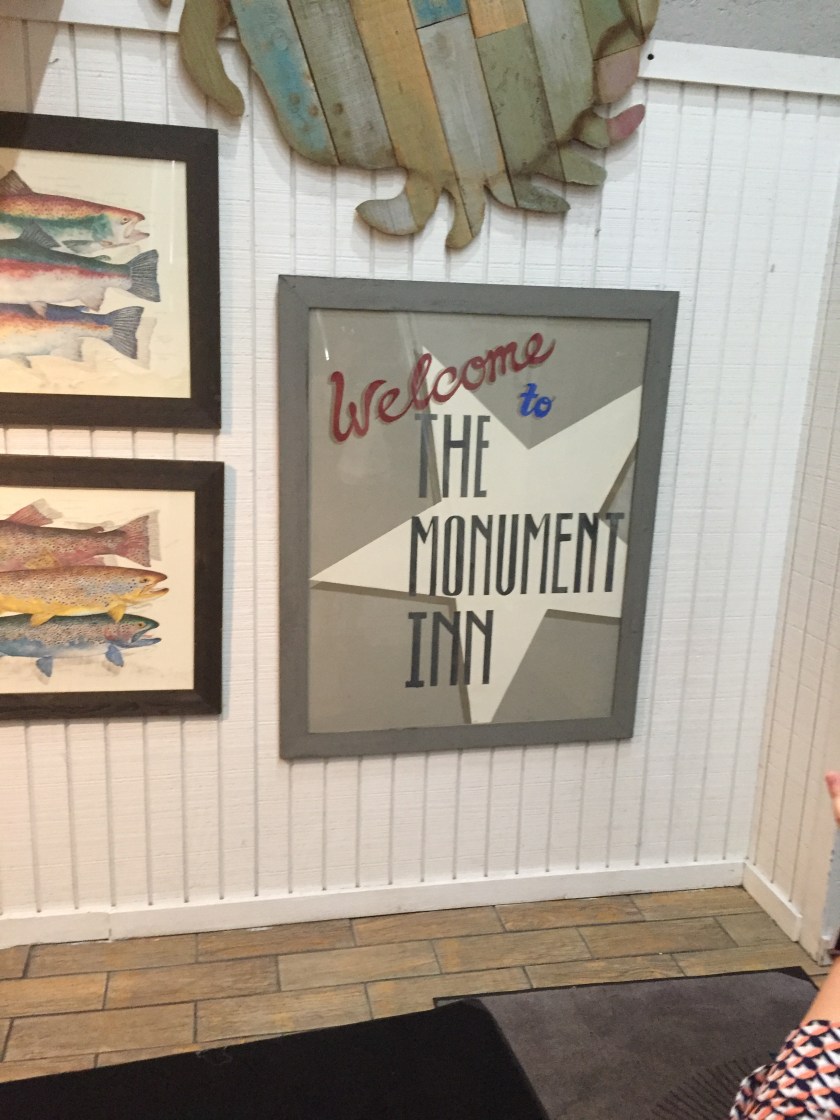
Some of you see these as email updates.  I tried a slide-show feature here and am not sure how it will do in the email.  you can always visit the blog itself at

https://rogerengdahl.wordpress.com/

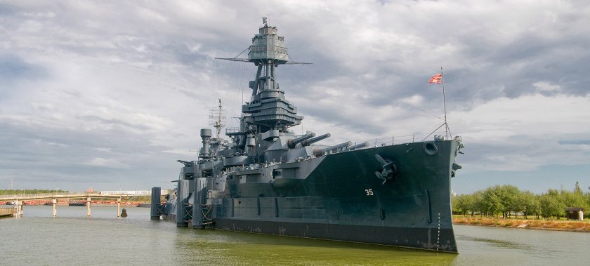
If you look at the maps of the Corpus Christi harbor area on your electronic devices there is an odd-shaped long rectangular island just east of the even more oddly curved T shaped islands.  The row of T shaped islands are marinas.  But the other island when you zoom in a bit is the USS Lexington, CV-16.  A WWII aircraft carrier waiting for us to come and visit.

The USS Lexington, nicknamed “The Blue Ghost”, is an Essex-class aircraft carrier built during the early part of WWII.  It was originally going to be the Cabot  but when the USS Lexington (CV-2) was lost in the Battle of the Coral Sea she was renamed to commemorate the earlier ship and was the fifth US Navy Ship to be named for the Revolutionary War Battle of Lexington.

She was commissioned in 1943 and saw extensive duty in the Pacific earning 11 Battle Stars.  After the War she wa decommissioned for a short while but called back into service and modernized in 1950, well modernized to 1950’s standards. She spent most of her remaining time in the Atlantic finally being decommissioned in 1991 with the longest service life of any aircraft carrier.  She was then donated for use as a museum in Corpus Christi.  In 2003 she was designated as a National Historic Landmark and is the oldest surviving fleet aircraft carrier in the world.

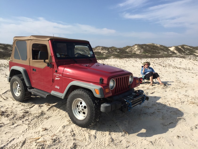
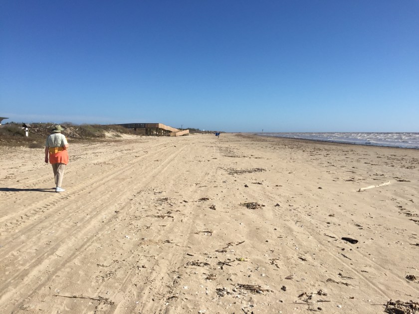
It was a cloudy day when we visited, good thing because it was going to be about 90 degrees that day.

img_7499

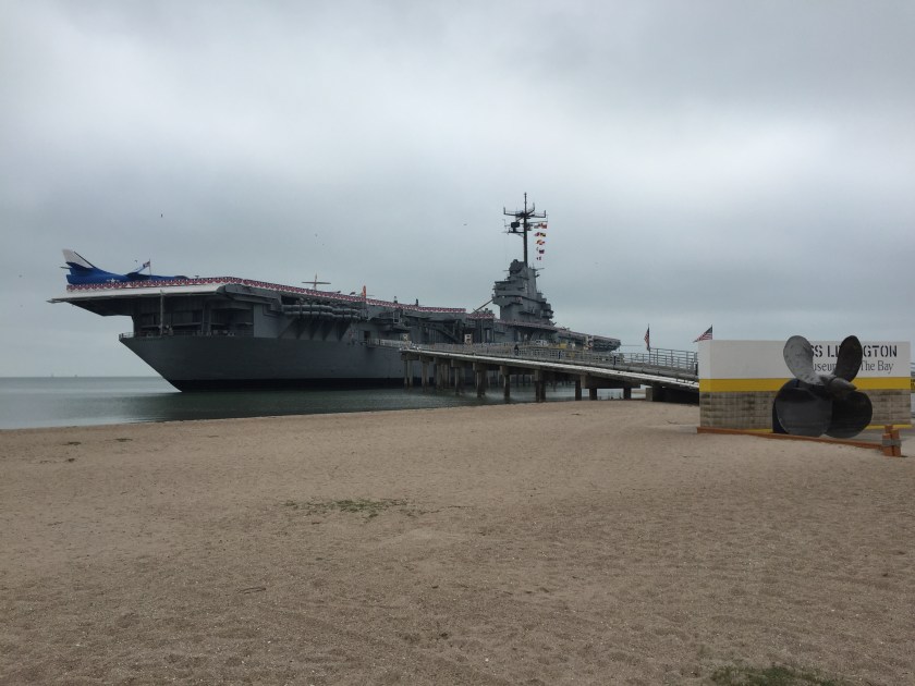
The Lexington is 873 ft long, a very large ship but almost 300 feet shorter than today’s aircraft carriers.  There is a bridge that goes out to the entrance which is one of the aircraft elevators that went from the hanger bay to the flight deck.  A tram takes you up to the entrance.  The place where the ship rests was way too shallow even for the nearly empty ship so a channel was dredge deep enough to move the ship into place.  And then they added water for ballast and it settled onto the bottom of the channel which then over time filled in with mud.  So now the Lexington sits in 18 feet of mud, very solid.  But I have to wonder how long before rust wins the final battle.

This slideshow requires JavaScript.

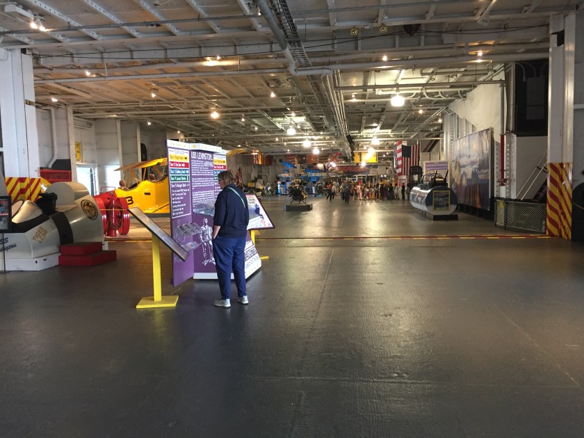
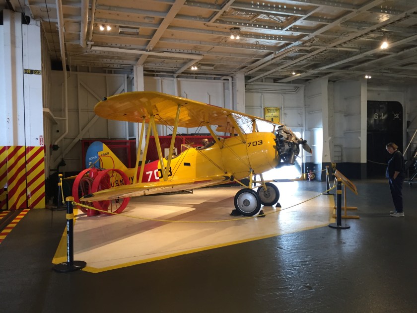
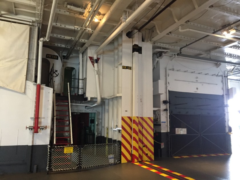
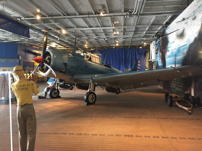
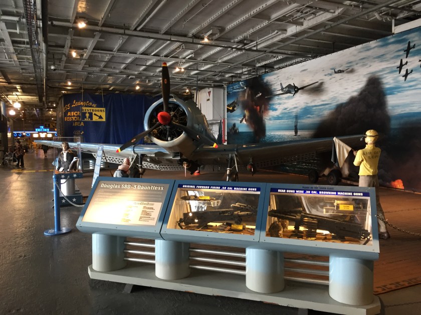
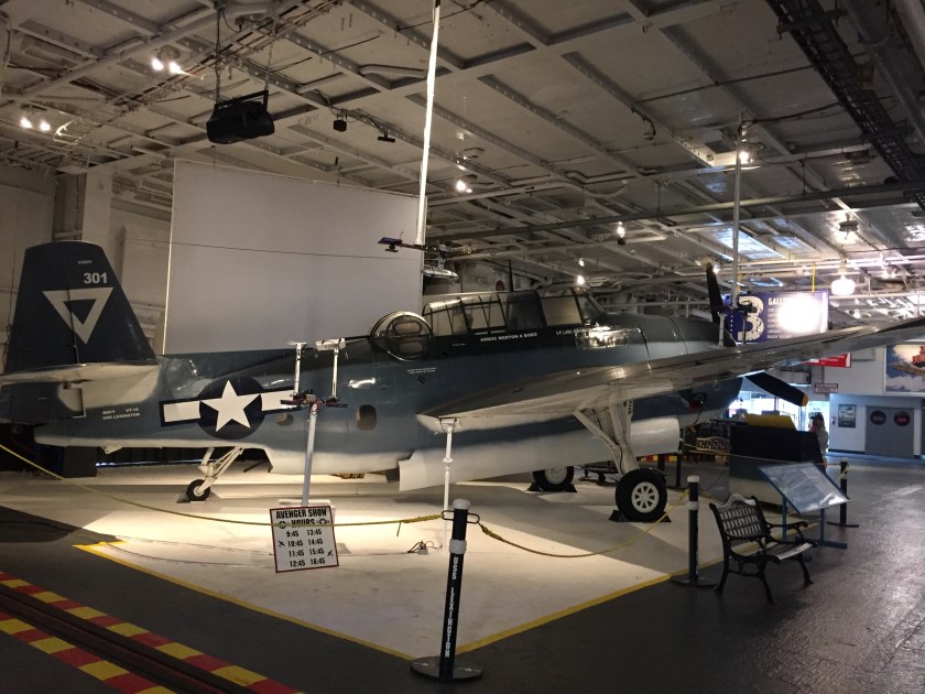
Here are some pictures in a slide show format of the hanger bay. This is where aircraft were stored, maintained and repaired. There were elevators to lower decks where bombs, torpedoes, missiles  and munitions were stored that came up to this deck and up to the flight deck.  There were a couple sets of giant sliding fire doors that could close off sections of the hanger bay.  In this space you could see much of the flight deck structure above, the sides of the ship and things like the sliding doors.  All of it is huge, heavy steel welded together.  It took only 13 months from the time the keel was laid down until it was launched making room for the next one. During WWII the US built more than 1200 major combat ships including 27 aircraft carriers and 8 battleships.

There are five self guided tours on the Lexington. They all branched off  the hanger bay.

The Lower Decks

This slideshow requires JavaScript.

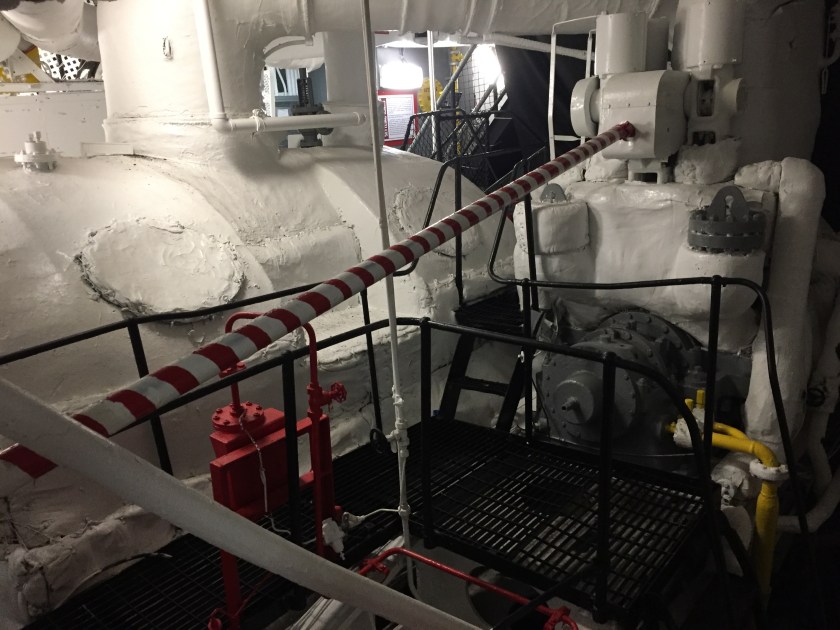
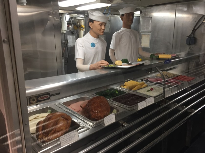
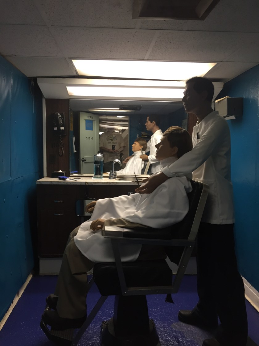
This tour led us through the crew galley (see the plastic food), the chapel, the dental clinic, the sick bay, the barber shop and the boilers and engine room.  It is hard to imagine the 2500 men on this ship fitting in all of these spaces.  The boiler and engine rooms must have been hot and noisy. Actually every space must have been noisy.


dscn8782

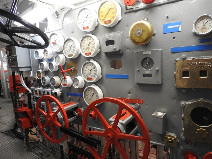
This reminded me of the locomotive Rudy and I checked out in Duluth, knobs and dials and wheels everywhere.

img_7508

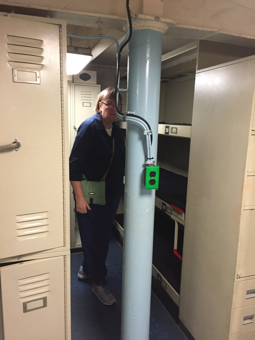
Susan was inspecting the crew berthing areas. This is a much later remodel.  In WWII sailors slept in canvas hammocks.

In the Foc’sle we saw the Junior Officer’s and Officer’s quarters.  you had to be pretty high up on the ladder to get a tiny closet sized room of your own. It looked like the only quarters that had their own bathroom and shower was the Captain’s Quarters. But since Fleet Carriers were often Flagships (the Admiral of the fleet was aboard) there had to be other quarters that we just didn’t get to see.

img_7506

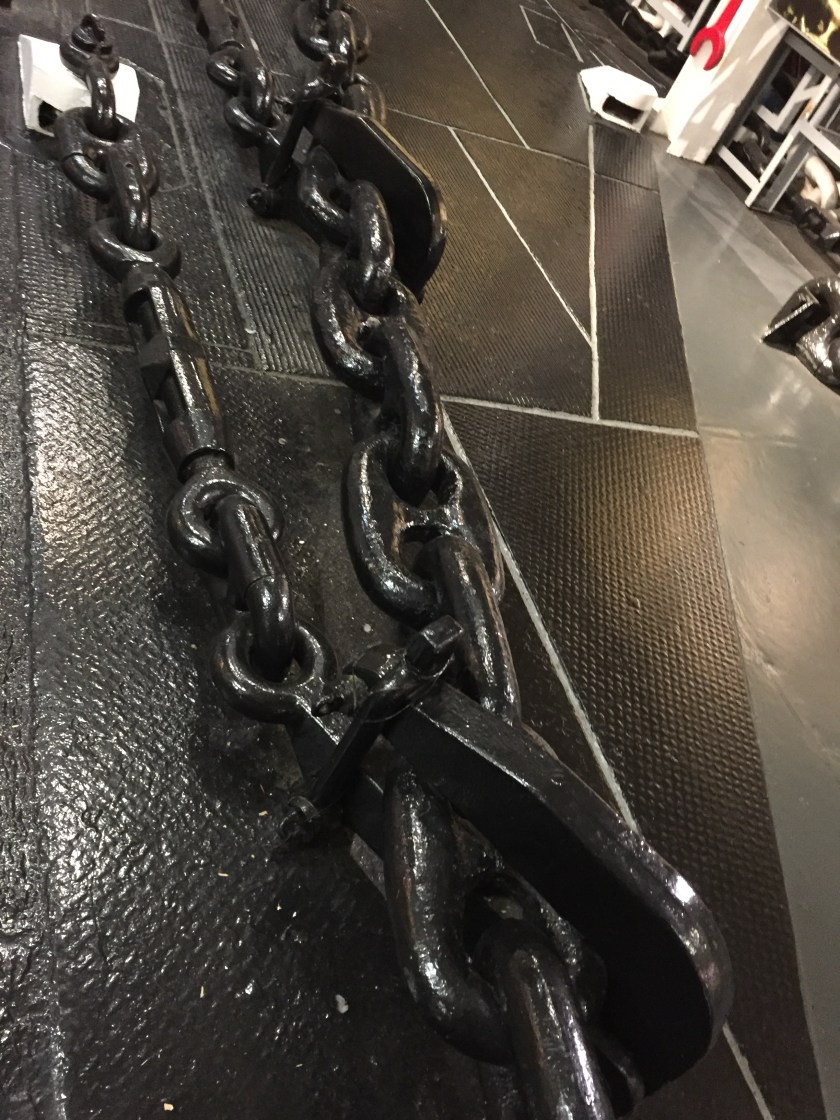
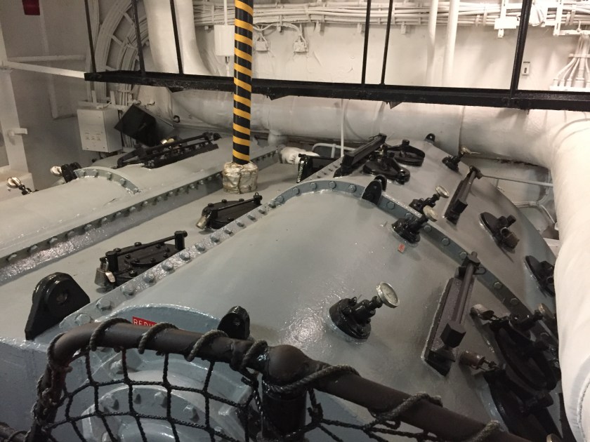
And in the front of the ship are the rope and chain lockers and the anchor controls. There are two huge chain locks to prevent the anchors from accidentally deploying.  There is one anchor on each side of the front of the ship and a center chain that would be used for towing the ship if required.  Each of these chain links weigh nearly 150 pounds and the anchors weighed more than 15 tons each.  The big red wrench hanging was about four feet long and was used for tightening the turnbuckles on the chain locks.

img_7507
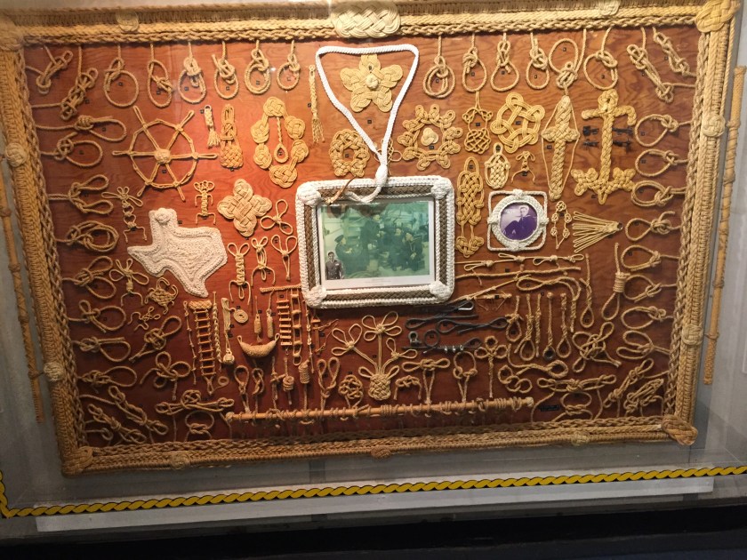
And every good sailor needed to know his knots.  This was a pretty neat display. I thought of my old friend Paul Schoberg who was Chief Many Moons at our Boy Scout Camp.  He was a master at knots and lanyard making and taught me a few of these including splicing ropes.

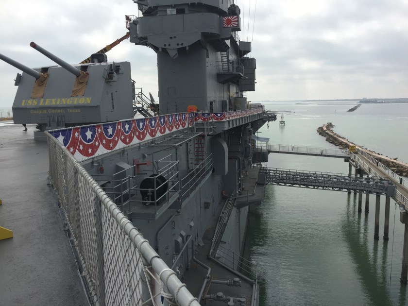
And then there was the Control Rooms and Bridge.  These included the chart room, the combat information center and the Captain’s quarters (which were just off the bridge).

img_7522

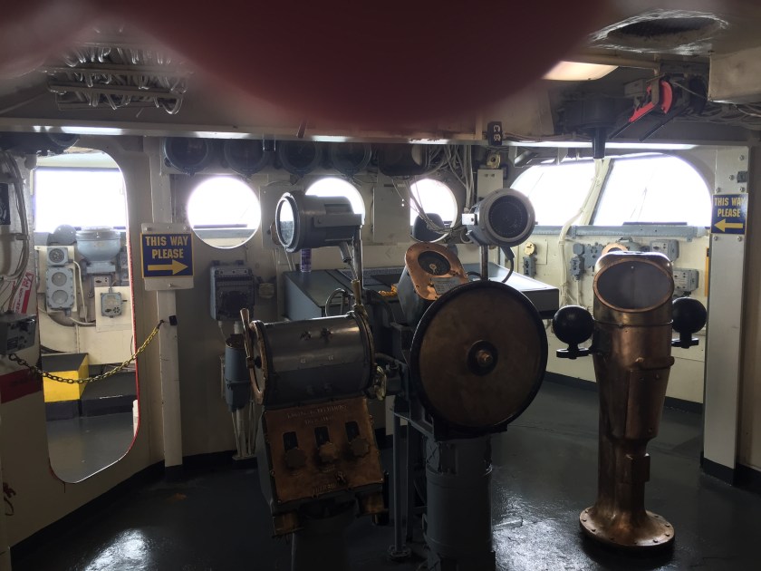
There was the forward facing Bridge where the ship was controlled and a rear facing bridge to manage aircraft operations. I was surprised at how small this area was compared to what you would think after seeing all of the WWII movies. There wasn’t much room especially for all of the people who must have been in there.And just in front were the Captain’s chair.

img_7523

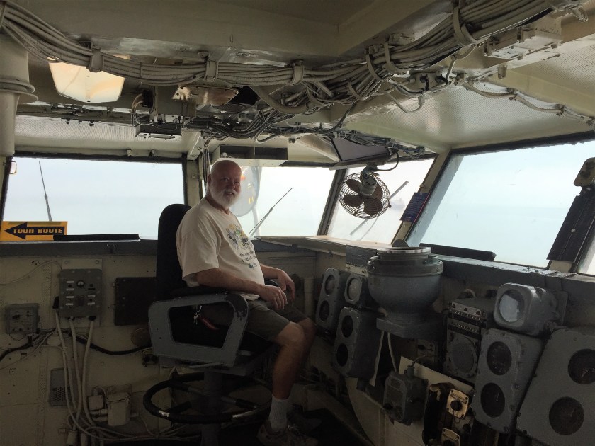
Not much room and old technology!

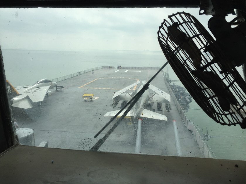
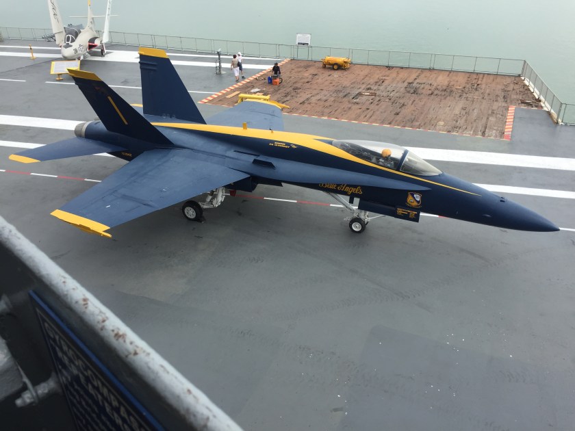
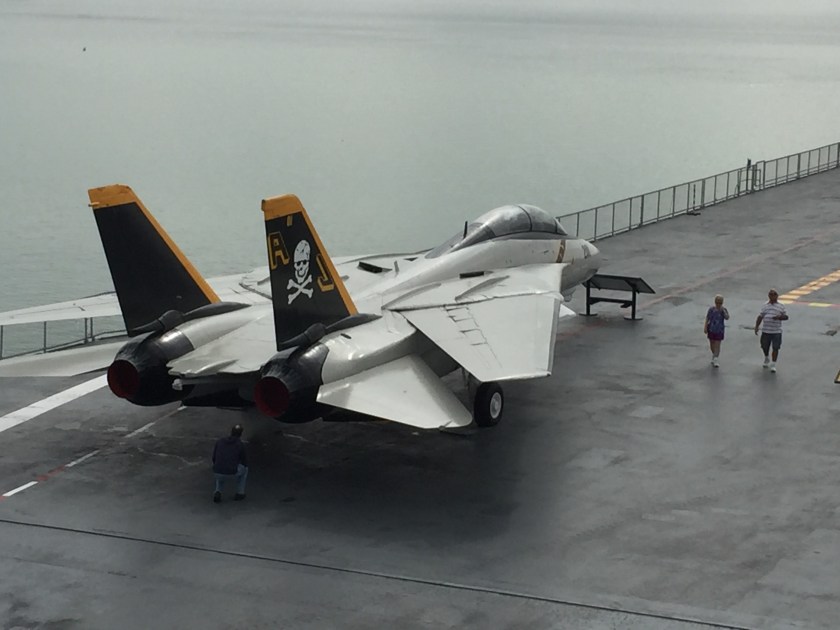
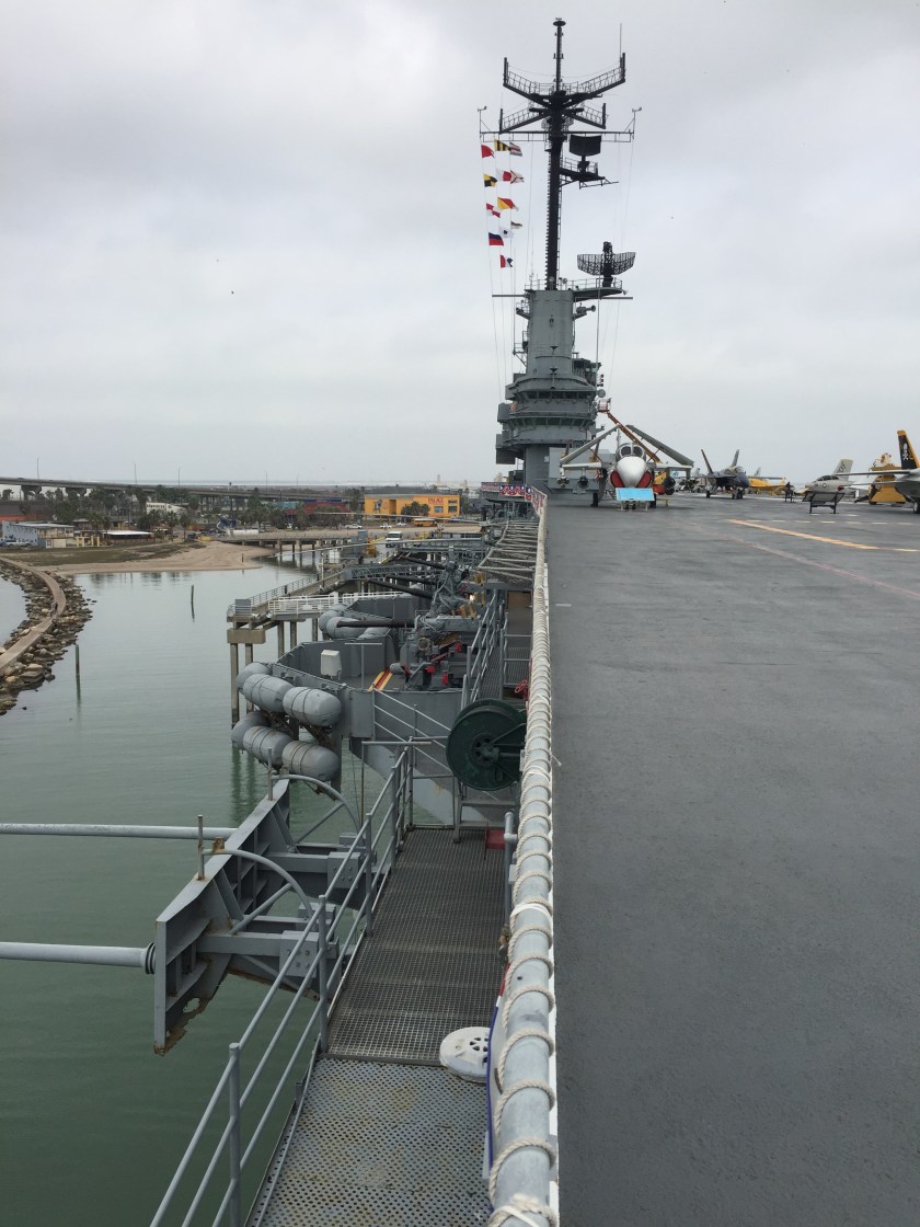
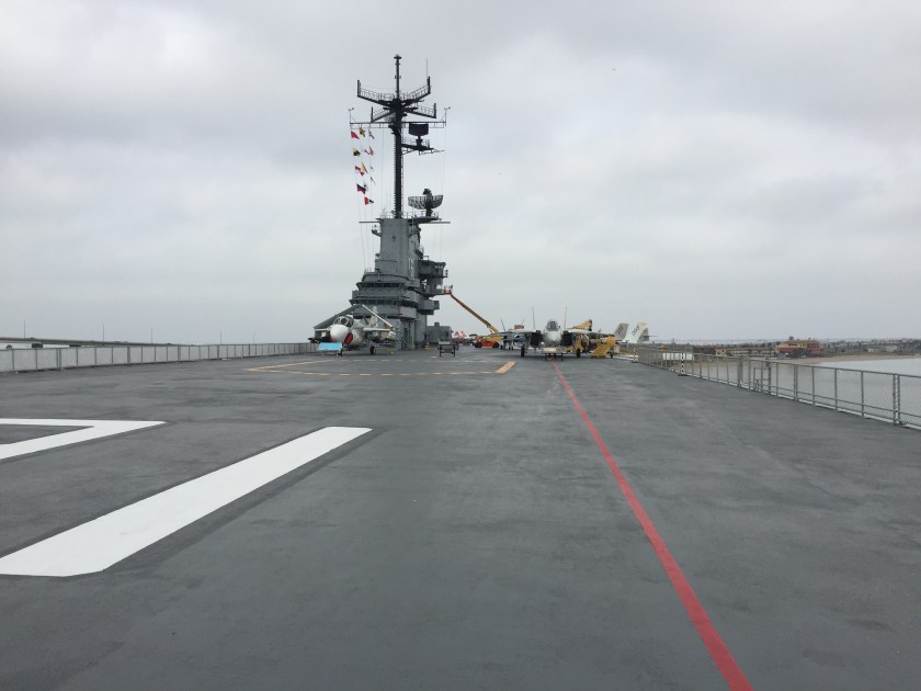
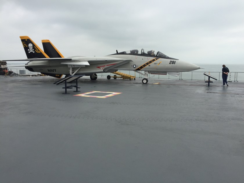
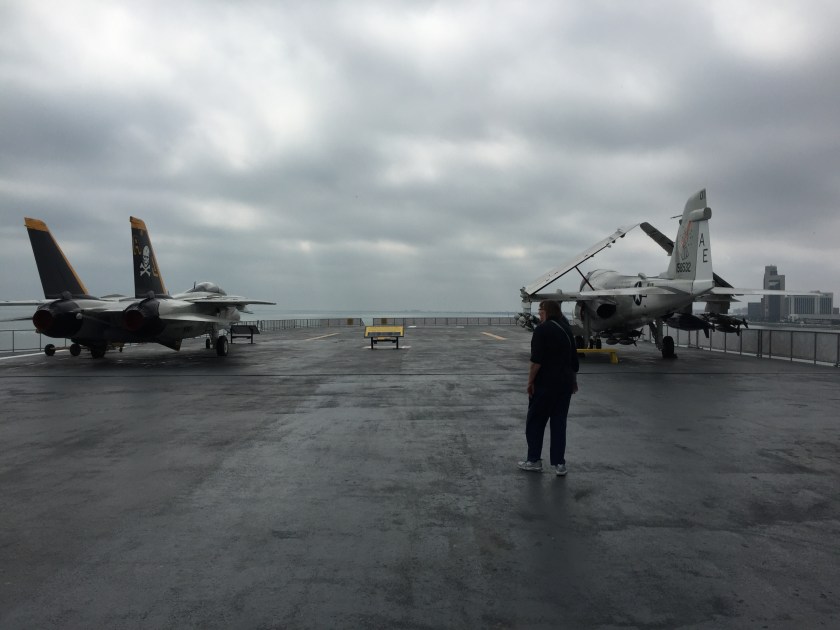
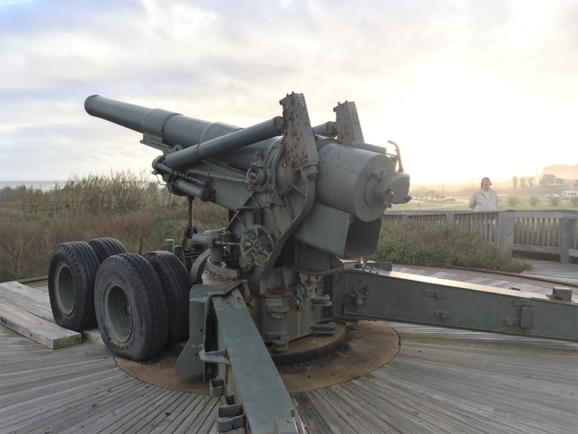
Out on the Flight Deck there were planes to see, catapults to look at and the arresting wires to catch landing planes.

This slideshow requires JavaScript.

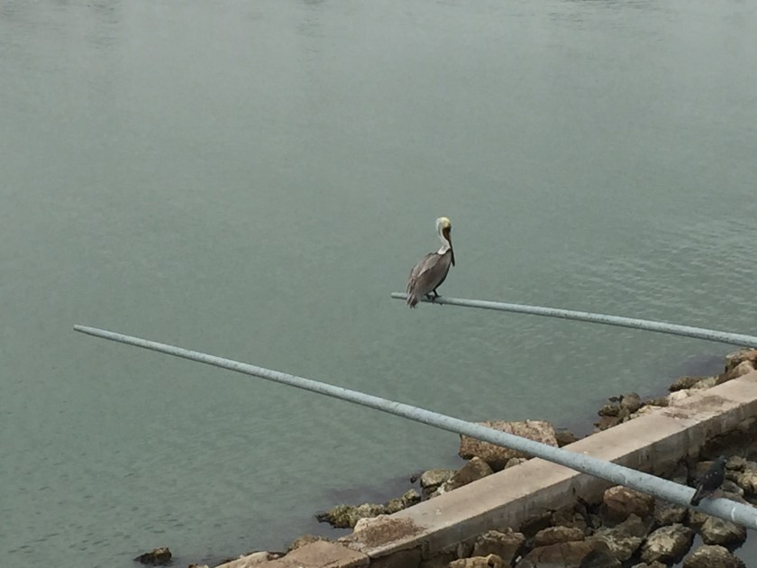
The pelican on the horizontal antenna was pretty cool.

img_7515

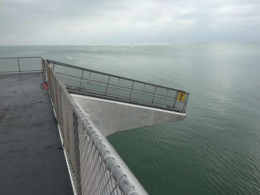
This is the gang-plank sticking off the front of the ship.  There are two of them.  At least that is what the signs all said.  They really were for catching the catapult launching gear if it got away from where it was supposed to be trapped.

img_7519

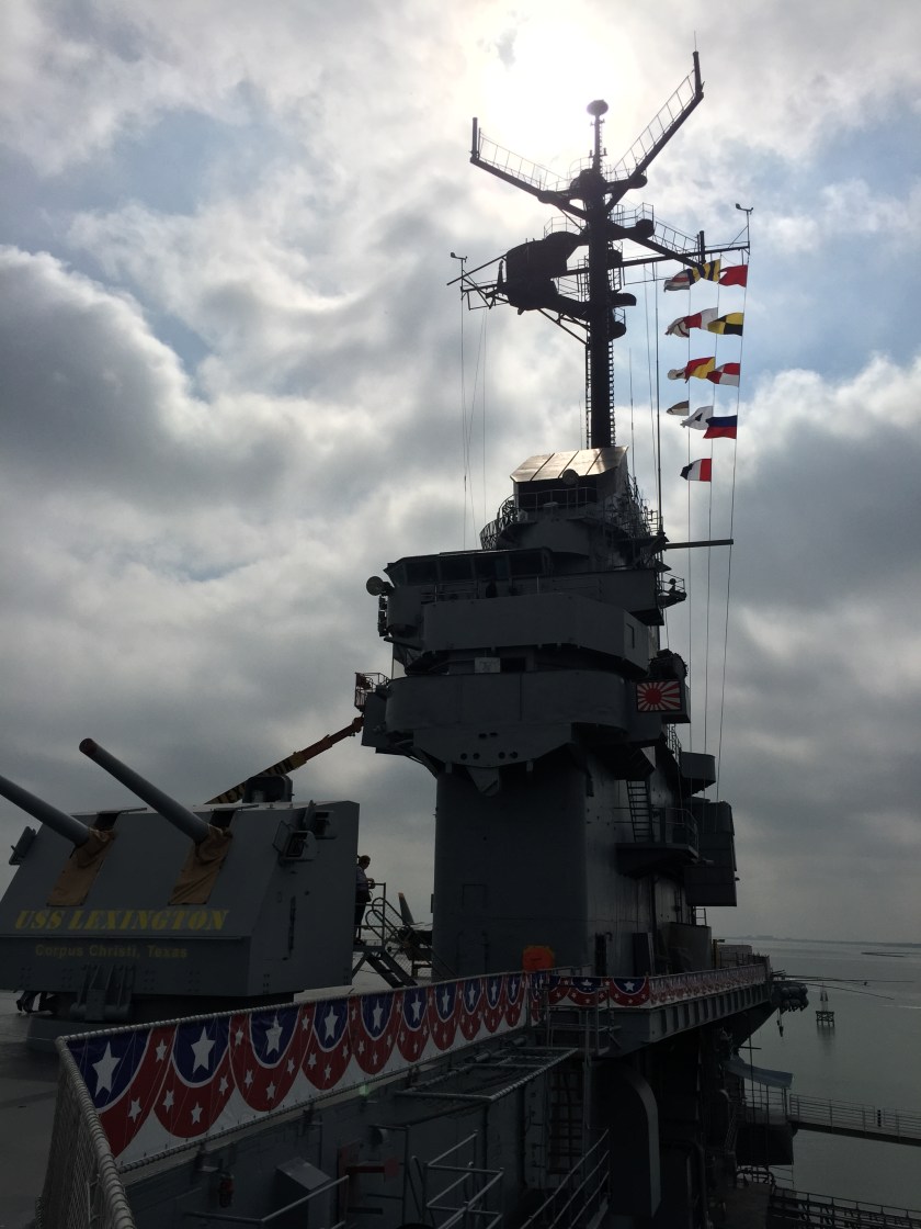
And I crawled inside of this gun mount just ahead of the bridge tower. It had two five-inch cannons and a crew of five.  Projectiles and powder bags were fed up from below and hand loaded into each cannon. The crew had no control over where the cannons were firing.That was done from a different location.Just load and shoot 15 rounds a minute!  The noise!  And these were mostly very young men, for a while anyways.

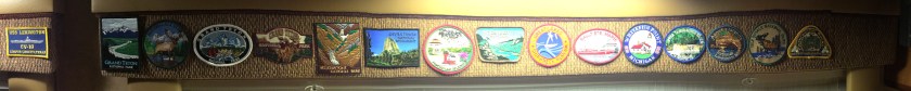
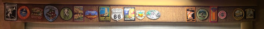
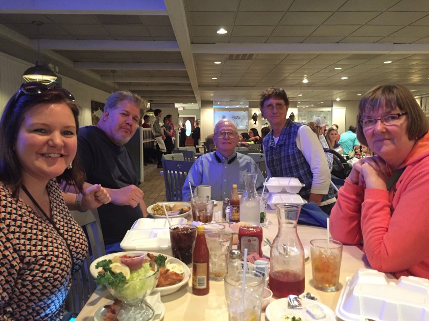
There was also a mess hall where we had lunch and of course a gift shop where we got another patch to add to our growing collection.

It was a very interesting visit, it stayed pretty cool inside but was roasting when we got out side.  We stopped for groceries on the way home, normal chores.

More later,

Roger and Susan

Mustang Island State Park, TX, February 2017

Mustang Island State Park is actually on Mustang Island which runs along the Gulf Coast from Corpus Christi at the south end to Port Aransas at the north end. Corpus Christi is on the main land. You have to go on a long causeway over the bay and then up and over the Inter-Coastal Waterway to the very north end of Padre Island. Going over these causeways is a bit nerve-wracking.  Susan doesn’t like to look to the right going over them.  The lanes narrow and it is up a huge hill and you can’t see anything but sky.  We just get in the lane and stay calm.

The north end of Padre Island has lots of condos and resort-like things, stores to buy beach stuff, food places, a hardware store, gas stations and a laundromat.  But we turned north and go over the channel between Padre and Mustang Islands.  Mustang Island stretches north for about 15 miles.  There is pretty much nothing until you get to Port Aransas at the far end of the island. The first six miles on the Gulf side are part of the State Park.

The campground is about five miles up.  It is a pretty basic campground with water and electric.  The sites are probably 25 ft wide and have a covered picnic table.  These are wider than most private parks and half the price too. The parks we looked at in Port Aransas made us glad we chose the State Park.

img_7416

It is a wide parking lot with 48 campsites but better than many.  There are four additional volunteer spots, the staff is friendly and it is clean.  There are showers and bathrooms at one end.

img_7414

The sites were nice, ours faces the Gulf sand dune.  The ocean is just a couple hundred yards away.

img_7415

And it is Texas and there are snakes. We haven’t seen any. Day time temperatures have been between low 60’s and mid 80’s and usually a pretty good breeze coming from the Gulf. The wind and the humidity make if feel cool.

img_7535

The Moon comes up before the sun goes down.  Almost Full

img_7556

Feb 10, a Full Snow Moon in the penumbra shadow of the Earth.  It is very humid here, early and late fog. It makes for fuzzy pictures.  The blue dot below is actually a greenish comet named Comet 45P. It is at its closest to the Earth tonight. Unlike many comets is has little sign of a tail.  It is hard to see with the naked eye so binoculars or some camera enhancement is needed.

img_7558

And every clear night for the past three weeks we have been able to see the International Space Station.  It is quite bright and pretty easy to see it move.

img_7488

img_7486

Every kind of camping rig you can imagine.  Our friend, Bob was asking about small trailers. Lots of them. There were three Airstreams here.  This stubby one was pretty old but functional.

The park as five miles of beach heading south.  The beach is a State Highway and you can drive on it and camp anywhere.

img_7554

If you can get there you can camp there.

More on the beach, Port Aransas, The Padre Island National Seashore, the aircraft carrier USS Lexington and more.  Later.

Roger and Susan


Quintana Beach County Park, January 2017

We have been to Texas three times since we bought our coach.  The first time we stopped in NAC and then headed to Big Bend National Park.  The second time we stopped in NAC, then in the Hill Country north of New Braunfels (think of German, Texans and accordions) and then on to Guadalupe Mountains National Park. We have friends who suggest we come to the “Valley”.  This is the very southern tip of Texas in the Mission area.  It is an hour or more from the Gulf.  It is tempting but we wanted to try some Gulf Coast locations first.

Quintana Beach County Park popped up on our look at list pretty quickly.  It had been recommended by others and when we did a search for County and City campgrounds on our AllStays Camp and RV app there it was.

Quintana is a small island community (population 56) right on the Gulf near Freeport TX about 100 miles down the coast from Houston. It has been here since the 1500’s and is named after a Mexican General. During the Civil War there were more than 2,000 people living here. After a series of hurricanes in the early 1900’s only three homes survived.  Two of them are now  located in the County Park.  Today there are a few beach homes, a 50 acre RV park and more than six miles of beach.  It is located next to the main ship channel leading into Freeport area.  There are automobile unloading docks, chemical docks, LNG docks, container docks and more.

img_7332

We had to go high over the Houston Ship Channel on a cable stayed style of bridge. This one was high, wide and long.  For ships to go underneath it needs to be about 200 feet above the water.  I thought this was interesting because this style of bridge was considered for the Hastings bridge during the design process.  It came in second.

img_7348

One thing in common all along the coast is endless construction.  down the road from the campground they are building huge LNG (Liquid Natural Gas) facilities where the natural gas is compressed into a liquid and then loaded on to ships.

img_7412

From out on the jetty in clearer weather you can see the LNG plant going up. Further down is another plant going in.  The cooling fans on the right are about 80 feet tall.

img_7338

We had a nice campsite, they are spread out and roomy.  Full hookups for $22/night.

img_7339

And the beach.  High 60’s and 70’s so nice for walking on the beach, not so much for swimming.  And there were alligators perhaps but we never saw any.

img_7374

img_7345

img_7343

Lots of beach and a fishing pier.

img_7356

And kite flying.

img_7347

And ships going by.

img_7350

And leftovers from WWII protecting us.

img_7401

While we were here we celebrated our 42nd anniversary with a nice dinner at a local fish place.

And came back to see the Moon and the International Space Station.

img_7404

img_7407

The moon was much more yellow and the Space Station was very bright. If you watched for a bit you could see it moving.

That’s about it from 10 days at Quintana. Nice to just stop for a while with nothing scheduled.  A very nice place, we would go back.  On to Mustang Island State Park on Padre Island, further south.

Thanks to Susan for editing.

More later,

Roger and Susan

Baytown, TX January 2017

Our friends Rudy and Carolyn live east of Baytown, TX which is east of Houston.  They are full-timers but have a  nice home base. It has a covered space to park their coach and cars and it looks out on a fairly good-sized lake which is where a sand pit used to be. There are quite a few lakes like this in the area.  There are fish and turtles and birds and ducks and even a beaver.  And once in a while an alligator will stop by for a visit.

img_6466

There is space for another coach to visit so that is where we parked.  Douglas and Amanda also came by to visit. There was space for them as well just down the road.

Rudy and Carolyn took us to a good burger joint, Tookies.  To them it was just down the road. To us it seemed like it was half way across town.  Not really but Texas folks seem willing to drive a long way.

img_7328img_7325

And we had to go to the Monument Inn, probably even further away but great food.  It is right on the Houston Ship Channel and at the end of the road.  There is a ferry-boat that takes cars across but we went by road.  The San Jacinto Battleground State Historic Site is right near the Monument Inn.  It commemorates the defeat of the Mexican Army in 1836 after the Texans were massacred at the Alamo.  For Texans this is where independence was won.

img_6540

And nearby is the dreadnought Battleship, the USS Texas.  It is the last remaining battleship to serve in both WWI and WWII.  Commissioned in 1914, she was one of the most powerful ships of the time. She was the first US battleship to have anti-aircraft guns and directors and range finders to control gun fire.  After WWI she was converted to oil burning boilers, added armor against torpedoes and was equipped with one of the first naval radars.img_6541

At the beginning of WWII She was the flagship of the Atlantic Fleet and participated in D-Day in 1944.  Her final battle now is against time and rust.

Back at the Monument Inn dinner was wonderful.  Everyone took home some leftovers. During dinner a pretty big thunderstorm blew through and every cell phone in the place sounded the severe weather alert.  Amazing. It rained heavily during dinner but by the time we were ready to leave it had stopped.

Off in the distance Exxon was burning off oil and gas. Rudy said that they only do that when there is some sort of problem.  All of the refineries and chemical plants are interconnected by pipelines. The output of one plant feeds several more down the pipe that do more processing.  If something breaks down further along there is no stopping production or storing anything, they just burn it off.  They were burning off a lot!

img_7330

Some of these fire plumes were a couple hundred feet high. On the way back we had to make some detours to avoid flooding.  And back at the lake we could see the flames burning and hear them too.  They sounded like jet engines at an airport and burned most of the night.

img_7369-2

Amanda made a handsomely decorated cookie bar in honor of the South Shore Expedition. Ralph took this picture and entertained us with Texas Humor. He should have been a standup comedian. We ate some cookie bars and then the youngsters played Quidler and Uno. A&D keep us up late enough until they win. What fun it is to have good friends.

And then it was time to leave.  We are heading for Quintana Beach and Amanda and Douglas were heading for Livingston, TX. But first we had to go to Buc ee’s for fuel. These are giant gas stations and everything else stores often with a hundred pumps.  Diesel was $2.14/gal and Rudy has a discount card that made it $2.04.  Between the two of us we bought more than 250 gallons!

untitled

img_7363

Some waiting was required.

img_7365

And then after what seemed like Minnesota Goodbyes and lots of hugs we were off.

More later,

Roger and Susan