Durango, Chaco Culture National Historic Park, 3/29 – 4/1/2015

Durango

Durango is about 40 miles east of Cortez so we took a day and drove over there. This is another place we have been to in the past. We thought we might take the narrow guage train up to Silverton but that run had not started for the season yet. There was a shorter trip but it left a 9 AM. So we just drove over, spent a few hours walking around, had lunch and drove home.
I am sure if we had stayed in the area that we would have found much more interesting stuff to do but Durango for a few hours was just like Prescott, a nice old town converted into a tourist oriented town. At least this helps to preserve the old buildings and to some degree the look of the old town.  We walked quite a ways up and down the main street of old Durango where the old business buildings, the old stores, the banks the train station and all of the other early buildings were.  Virtually every one is now a restaraunt, a store selling new age trinkets, sandals, an extraodinarily high priced mountaineering store, unusable antiques stores, crystals, beads and Sedona wanna-be stuff, probably a dozen shoe stores, some very high end clothing stores, t-shirt shops and every other thing you can imagine to milk every possible dollar out of the tourist who comes to Durango hoping for that old west experience.  
I don’t think that in 10 or 12 blocks on either side we saw a single store or restaurant that any ordinary resident of the the area would have shopped or eaten at.  I am sure some blocks away there is a real hardware store or places where people who live there shop.  It is too bad that what we remembered about Durango is gone at least what we saw way back when is gone.  We contrasted that to Cortez where the main street is where all of the commerce of everyday life seemed to go on.
But like so many towns Durango has adapted to changing times and survived. The Durango, Pagosa Springs, Chama area has always been a favorite place we remember.
The train depot was old with a silver mining past. Part of it is now a museum which was interesting.
This old Curtis airplane was the first airplane to fly into Durango, or so they claimed. There was a big model railroad sort of depicting Durango, old cars and trucks and lost of other old stuff.
The model of the drive-in movie theater had a modern day tablet for the screen. The museum was in the old roundhouse, a building where locomotives and rail cars could be maintained or repaired.  The tracks leading into the roundhouse were like spokes on a wheel fed by a big turntable in the center. Buildings like this have rarely survived. I would have put in a picture but none that I took would have helped you understand.

We left Cortez and drove south towards Shiprock, NM and then a bit east through Farmington, NM (the fourth largest city in NM) and just a few miles more to the San Juan County Fairgrounds where they have cheap RV camping with electric and water hookups.  The fairgrounds are immense.  They have barns for many hundreds of horses and cattle and sheep and what ever else they show at the fair, room for 560 RVs with electric and water hookups and a dump station, a casino/race track for gamblers/horses and room for thousands of cars. The County Fair must be a really big event.  They also have other events there as well.  While we were there the Passion Play was being presented each evening.  Several hundred cars showed up each evening and then left.  As far as we could tell there was only one other RV there and they were quite a ways from us.

This is what road graders used to look like.
We stayed there so we could drive down to Chaco Culture National Historic Park. It was about 30 miles south from Farmington and then more than 20 miles west on a rough dirt road. Chaco Canyon is another World Heritage Site. From about 800 AD to 1200 AD Chaco Canyon was a cultural, ceremonial, religous and learning center for the Ancestral Puebloans who lived in much of the Four Corners area, some several hundred miles away.  It was also a major trading center for other indigenous peoples from Mexico to the south, the great plains to the north east and from Nevada and California to the west.

Chaco Canyon is a shallow canyon among the mesas and buttes of this region. There is evidence of a small river that ran through the canyon although it would have been dry at most times of the year. When it rained (about 10″ per year) water would flow off the mesas that made up the sides of the canyon. This water was caught in catch basins where evidence of small dams has been found. At the head of the canyon is Fajada Butte. This along with some of the surounding peaks formed sacred alignments marking the canyon’s significance. The top of Fajada Butte has many monuments and structures that are used for marking solar, lunar and cardinal directions and events.

Unlike the great cliff houses of Mesa Verde, Chacoans built their great houses on the canyon floor mostly near the south facing canyon wall. There were dozens of Chacoan Great Houses built throughout the canyon.  There were massive stone structures with hundreds of rooms in mutliple stories.  The appear to have definite plans from the start but some took centuries to complete.  Each is shaped like a D with the straight side facing towards the mid-day sun and precisely aligned with the rising sun on the spring equinox.  Researchers have found markers on the canyon edges, sometimes several miles apart that mark the exact alignment of the spring and fall equinox of the sun as well as moon alignments.  All of these markings were used to align buildings and roadways s well as to signal planting times and other seasonal events.

All of these dozens of great houses were built so that they could see and communicate with each other.  Prehistoric roads led from Chaco in precise alignment to more than 150 other distant Great Houses in the region.  These roads were essentially straight lines from Chaco on which many other distant Great Houses were located.  Where cliffs or other obstructions blocked the way, stairways and ramps maintained the alignment.

The biggest of the Great Houses is Pueblo Bonito. Obviously, this is not what the Chacoans called it. Actually no one knows what the Ancestral Puebloans called themselves or this place. There are no written records of any type and only oral histories and legends give any clue as to what Chaco Canyon was called.

This is a painting of what Pueblo Bonito likely looked like around 1100. It had several hundred rooms and more than 20 Kivas of different sizes at different levels. They were built over hundreds of years, the designs evolved, the construction methods changed and they were likely for different clans visiting from distant pueblos. No way to really know.

When Chaco Canyon was discovered all of these Great Houses were buried under hundreds of years of blowing sand and dirt.  The early explorations excavated and exploited what they found.  It wasn’t until the early 1900’s that scientific efforts took over and preservation became a prime motivation.

An arial view (not my picture) shows what Pueblo Bonito looks like today. We have always wondered if any of the cliffs ever collapsed and here we saw where the entire cliff face collapsed around 1960 and crushed the upper section of the Great House.
Trails through these structures are pretty organized, you can only go where they go.  Here we climbed over the fallen cliff face along the back wall.

We have never seen Kivas this big.  These were three or four times bigger than any we had seen before.  

These Kivas had high walls and were covered by a complex roof system. The inside walls would have been plastered and decorated.  Each Kiva had four foundations for the vertical wooden columns holding up the roof. The fire pits and Sipapu (the portal from which their ancestors emerge to the present world) were very similar in all Kivas no matter when they were built. Present day Navajo believe they are now in the fifth world. Kivas were used for ceremonial, ritual and religous purposes by both men and women.

The Chacoans used stone and a clay based mortar to build with.  They had no metal tools to shape stones just stone tools.  And yet their stone work is precise.
This is an older building style with bigger stones, still cut precisely.
Later styles used smaller stones tightly fit together as bigger stones were getting harder to find.  These walls were all covered with a smooth plaster.

There were few windows, doors were of different styles which evolved over time.  Floors were made with wooden poles embedded in the walls and covered with layers of bark and plaster. The ends of the original wooden poles are still in the walls.

There was room in Chaco Canyon for many thousands of people and yet archeologists think that less than  2000 lived there as permanent residents.  People came from long distances to be there at special times.  Many people came and stayed for a summer or a whole year to learn and to build.  They would take the latest building techniques back to thei home pueblos for use there.  There was clear Mayan influences from Mexico that are unique to Chaco which indicated a very wide influence.
There wasn’t enough agricultural areas to grow enough food for all of these people so it is assumed that visitors brought their own food, goods to trade and their own tools.  Groups from different clans would build a Kiva for their own use perhaps, maybe the reason for so many.  They would return with new trade items, new skills and building techniques, maybe new tools or ideas about ways to make tools.  It must have been almost like a college town with a transient population and a fixed population.
We visited about a half dozen sites.  There were many others to see as well and hiking trails to more. They quit digging up sites long ago now that thay have ground penetrating radar to see what is underground and map out what is there.  Leaving them buried is the best way to preserve them.  Even in Pueblo Bonito most of it that was excavated has been reburied after damage to the walls was repaired.  The exposed walls are carefully cataloged and there are teams there continually repairing and  restoring the walls.  They use hand cut stones to fit as exactly as they can and mortar made in the original way but with additives to make it last longer.  
This entire canyon remains a sacred place to Native Americans who still come here every year.  This place is in their history, ritual, culture and myths and beliefs.  All of this long before any Europeans arrived.  I am not so sure about alien visitors though.  
While we were there the sun was bright, hats were good.

When we were in this area in 1980 we visited Canyon de Chelly, another Puebloan site about 50 miles west.  It was in a deeper canyon with a river, a very nice site with cliff houses and much easier to get to.  On our way back from Chaco Canyon there were big black clouds on the horizon. It looked like rain.  Lots of wind but it never rained and by the time we got back to the fairgrounds the sun was out again.
Next up, Cochiti Lake on the Rio Grande River near the Cochiti Pueblo, about 40 miles south of Santa Fe.
More later.
Roger and Susan

Cortez, CO, Mesa Verde National Park 3/26-3/29/2014

We were hoping that the weather would be OK so that we could get up to Mesa Verde National Park.  It is another place we visited in 1980 and haven’t been back to since. The long time weather averages suggested it would be OK, cold at night but warmer during the day. The campground in the Park was not open yet nor were the two campgrounds near the entrance to the Park so we chose the Sundance RV Park in Cortez, CO about 10 miles to the west. It was a very nice RV park with a huge city park across the street. The park was almost full with a lot of trailers and RVs that looked as if they were set up for the long haul. I talked to the owner and he told me that a very big natural gas deposit was found just to the north and that a company from New Mexico was doing the development work and had rented about 2/3 of the park for nine years. He thought that was good and had spent money on the laundry, showers and bathrooms, They were very nice. He said the best thing was that almost everyone who was working at the new gas site were local people as well as most of the subcontractors  It was a big deal for Cortez which is regional center for the Four Corners area.

Nice trees, starting to leaf out. We would go back there.
We packed snacks, hiking shoes and a bunch of water and set off for Mesa Verde. The weather was warm in the morning and upper 70’s forecast for the afternoon.
The Mesa Verde area covers 520 sq miles of high mesa areas cut with deep canyons. Mesa Verde was named by Spanish explorers and means green table. The Park today includes 81 square miles of land and canyon with more than 600 cliff houses, many mesa top archeological sites and many more undiscovered sites. It has been designated a World Heritage Site.
There is a new Visitor’s Center at the entrance to the park. It explained how the Ancestral Puebloans lived here on top of the mesa and in the cliff houses in the canyons. They lived there from about 550AD until about 1300. The early dwellers lived mostly on top of the mesa in an evolving building style of pit houses. These gradually got deeper and larger. Their influence lasted to the Kiva designs of the later inhabitants of the cliff houses. At Mesa Verde’s peak there were 35,000 Puebloan people living on the Mesa and in the valley just to the north. Today the population in the same area is only about 20,000.
This was not here in 1980, just opened a couple of years ago. The original Visitor’s Center was 25+ miles into the park.
This sculpture near the entrance to the Visitor’s Center depicts the way the Puebloan people got to their cliff houses. They climbed up and down the steep cliff sides carrying bundles using just small hand and foot holes pecked into the stone face. They had no metal tools, only stone to make hammers, chisels and axes. Life was hard and short.

From the Visitor’s Center at 6,500 ft elevation a steep winding road leads about 6 miles to the campground and then 8 miles of more winding roads, a tunnel and some steep sections to Park Point Overlook where at about 8,600 ft elevation there is one of three fire lookouts in the park. These are important places for the park. Since 2000 there has been three major fires which have burned well over half of the mesa.

Technically it is not a mesa since it is not flat. It is called a cuesta since it has a consistant slope of about 3 degrees towards the south. The south facing slope gives the land more sun and increases the growing season on the mesa top by as much as 21 days compared to the lower elevation valley.

Another 8 miles out on the Mesa and you come to the Far View Sites. These are a collection of more than 50 farming villages from 900 to 1300 AD. These villages evolved from pit houses to pueblo style building sites with extensive dry land farming areas. There were reservoirs for water but the fields were generally not irrigated. They were more likely used to supply household water needs. Preservation experts have added a compatable cap of mortar onto the top of the remaining walls to keep them stable.

The road goes on and splits. One way heads down the Wetherhill Mesa which was not open at this time of the year. There are many cliff dwellings out at the end of this mesa and when it is open the only way to see them is by tram. Car traffic was stopped long ago to reduce the impact on the area. We rode the trams in 1980.

The other road heads down the Chapin Mesa. There is the original Visitor’s Center and an interesting archeology museum, gift shops and a small restaurant. The museum did a great job of depicting everyday life over time. It showed the development of tools, building materials, plant materials used for making clothes and sandals, the use of pottery, the beginning of the use of cotton and other materials for weaving and quite a bit of archeologists best guesses at family and cultural structure. Culture, the seasons, daily work, traditions and rituals and their spritual life were closely linked. Most of this is not really known since there were no written records but it is inferred from the oral histories of many Puebloan communities that exist today.

Lunch was a shared Frito Pie.

Chili on Fritos with cheese.  Tasty.


Spruce Tree House is a cliff dwelling that has been excavated and stabilized. There are trails down to see it today. There were no trails when several hundred people lived here. Rangers were there to answer questions and to suggest appropriate behavior as needed.

There were several Kivas, places for ritual, ceremonial and religous events and three to four story buildings going back many rooms into the cliff openings. This particular cliff house had been opened up by looters before archeologists and historians got to it but even still their restoration and stabilization work is only about 5% of what is there today. The Puebloans closed most of the openings into these structures when they left. Much of what was left was buried under windblown sand and dirt. So careful excavation reveals what survived and what was left behind.


The Square Tower House had some modern day supports while stabilization work was being done.  The square tower was unusual.  While structures were more or less square cornered, towers and kiva were round. There is no explanation for this other than it was an adaptation of earlier buliding techniques or something learned from visiting other Puebloan sites in the Four Corners area.


Openings in the cliffs were formed by parts of the face collapsing and then more of the ceiling collapsing because there was no support underneath. Some of the openings in the cliff face were huge. We saw no place where the cliff had collapsed on a cliff house but it has to have happened. We saw a huge section of cliff that collapsed on a community built next to the cliff face in Chaco Canyon.

This is the Cliff Palace as they call it today. Likely something else back then.

This is Navajo Canyon, several miles long and a few thousand feet deep. There was no easy way to go from one side to the other. From these communities to the communities in the valley to the north of Mesa Verda it was a 30 mile or more trip. And yet they did travel far and wide.  

There is evidence of trade for things like sea shells, turquoise, bird feathers, even pipestone from MN.  The Puebloan people had a very wide spread cultural reach into New Mexico, Arizona, parts of Nevada and Utah and traded with other cultures from thousands of miles away. But it was more than goods they traded, they learned from each other about everything including building techniques, pottery making, weaving, medicines and more.
No one knows why but the Puebloan people of Mesa Verde moved south around 1300. They brought everything they knew and believed with them.  Many settled along the Rio Grande in central New Mexico. Today those Puebloan cultures are still there surviving the early Spanish explorers and all of the diseases they brought, the Mexicans, the Catholic missionaries, the western movement of America and the American government.
Their past and present, their history and culture and the people thenselves deserve our respect and understanding. They are the original people of this land and part of our heritage.
Well, lots of rocks and stuff, I know.  One more stop on this part of the journey at Chaco Canyon, another World Heritage Site. This was the center of the widely spread and diversified Puebloan Culture.
More later.
Roger and Susan.

Monument Valley, 3/24-3/25/2015

Monument Valley

We left the Grand Canyon on 3/23 heading for Monument Valley which is just across the border into southern Utah. The big group of folks from Quebec were a couple days ahead of us so we couldn’t get a spot at Goulding’s Trading Post (and campground and lodge and restaurant and car wash and gas station and grocery store and pizza place and post office and airport). So we stopped at Cameron’s Trading Post (and campground and lodge and gift  shop and restaurant and gas station and post office) at the Little Colorado River heading that way.  Neither location had much of anything else nearby.
Cameron’s had a really nice looking lodge and a interesting restaurant decorated with hand woven Navajo rugs and Navajo art work.  We ate in the dining room and stayed in their minimalist campground.

The stone work,  woodwork and art work was impressive.

This is the original 1911 suspension bridge across the Little Colorado.  There is a newer bridge on the other side.  The Mormon Trail crosses near here as well.  This bridge swayed and was creaky from day one.  It is a single lane bridge. It has long since been used for a gas pipeline crossing.  A National Historic Site now.
The next day we drove about 50 miles to Goulding’s Campground. The campground was in a narrow canyon whose opening looked out towards Monument Valley.
It was mostly dirt, electric OK, water hard, small,short sites and probably the most expensive campground we have ever sayed in, $48/night!  We are averaging about $20/night.

Monument Valley is a Navajo Tribal Park.  It is located in the Navajo Nation as is Goulding’s.  It cost $20 for a four day entrance permit and then you can drive on the one way, rough and dusty road through Monument Valley.  People live in the valley, there is no water anywhere.  They all have water trucks that they fill up at Goulding’s.  Oh, it is a water fill station too.  If you don’t want to drive you can pay $56 or much more to ride around the park in the back of a pickup truck outfitted with seats and have someone tell you what you ware looking at rather than reading the brochure that tells you.  We drove the Jeep.  The main erosive force in the valley is wind.  It was windy there.  And wind erosion uses fine particles to do its work which creates more fine particles.  Monument Valley is covered with a reddish very fine sand.

The Tribal Park has a Visitor’s Center and a Museum.  The museum was mostly about the Tribal system of govenment, the geology and life in the valley. The Visitor’s Center was more about the recent history of the valley in movies.  The Goulding’s arrived in the 1920s and started a small trading post.  They were fair and honest folk and got along well with the Navajo people.  The Great Depression hit the Navajo particularly hard and the Goulding’s as well. They set out for Hollywood with their last $60 to try to convince movie producers that Monument Valley would be a good location for the increasingly popular Western movies. They were persistant and finally met John Ford who looked at their pictures and decided on the spot to shoot his next picture, “Stagecoach”, starring John Wayne in Monument Valley. The Goulding’s got an advance payment for helping to make all of the arrangements, hire extras and to provide services to the movie crews. Goulding’s Lodge soon followed. Dozens of movies have been filmed there.  More recently just scenes. The last movie was the third Transformers film. Lots of adds have been made there too. While this provides revenue to the Navajo Nation and they are able to control use and exploitation of the Valley it does not provide jobs. Production companies today and for a long time bring everything they need with them, all of the equipment and all of the people, even food and cooks and very tight schedules and budgets.  Not much local spending.
Most of the features in Monument Valley are volcanic in origin, lava pushing up into cracks and holes in the ancient sea bed.  All of this was easily eroded leaving just the columns.  Many looked like Devil’s Tower in Wyoming, same geology, even a close encounter with a movie there.  

You can just about see the swaggering John Wayne kicking up dust, Pilgrim. These are called The East and West Mittens.

And Elephant Butte, with some imagination.  The other side looked like nothing.  

The Sisters.  It is supposed to be a nun and her two students.  We looked but couldn’t see the ruler.

Some of these spires are vary narrow.  There be cowgirls, too.

Very few trees.

A homestead in the shadow of the cliff.

There is a string of horses riding across the dune.  Everything is very big.

And out towards the north, nothing but dust.

Monument Valley is another one of those places that is almost too big to show in photos.  But being there was very impressive.  Glad we went.
Next Cortez, CO and Mesa Verde.
Until next time,
Roger and Susan

Grand Canyon National Park, 3/13-3/23/2015, Part 4

North Kaibab Trailhead

We set aside a day for a bike ride out to the North Kaibab Trailhead.  It was about 3-1/2 miles out on the Greenway Trail.  This is a walking/biking trail that follows along the rim.  Most of the biking allowed trails are back from the rim and lead through the woods.  There are about 20-30 miles of Greenway trails.  You can ride your bike on any of the paved roads as well.  About the only place you can not ride a bike is where there is no trail or on unpaved trails.  
We were able to leave directly from the campgound on a connector trail that went by the water strorage tanks for the main South Rim area.  There were five huge steel tanks, 80 – 100 ft in diameter and 25 ft tall.  There is a lot of infrastructure that is hidden from view to support the vast number of people who come to visit the National Park (about 5 million each year).  This trail went to the Visitor’s Center and connected to the trail following the rim to the east.  Like so many ways we went in the park there was something amazing at every turn.

It is a treat to be able to take the time to go slow and see these things. Riding bikes is a good way to do this. So is walking. We ran into a couple of significant hills both up and down on the way out to the South Kaibab Trailhead. The upsides were challenging, the downsides were fast but we perservered.

The helmets are very stylish.  On the way out we ran across some elk, wapiti, no horns so they were cows. They were right on the side of the trail, maybe 30 ft away.
At the trailhead there was a large mule corral and barns.  This is the main departure and return point for mule supply trains to the Phantom Ranch at the bottom of the canyon.  It is also where one and two night overnight mule trips to Phantom Ranch start and end.  These are pretty pricey.  There are similar opportunities from the North Rim.
The main thing to do here is to hike down into the canyon. There is some water and a few rest rooms on the way.  The trailhead is at 7,260 ft. There is a 3 mile round trip that goes down about 1200′.  The estimated time was 3-5 hours.  This is probably the most frequent hike. There are other trips further down that take longer.  Down to the bottom of the canyon at 2,480 ft elevation was over 7 miles, an all day hike one way.
The South Kaibab Trail was built by the NPS in the 1920’s after many years trying to get control of the Bright Angel Trail without success.  The Park Service wanted a public access trail into the canyon.  So the South Kaibab Trail went into the canyon from the south.  The North Kaibab Trail descends from Bright Angel Point on the North Rim where the North Rim Lodge, campground and Visitor’s Center are located.
The two trails meet at a suspension bridge over the Colorado River near the Phantom Ranch.

(Another internet picture, thanks to someone) I didn’t actually walk down here.

We could see the trail heading down with people going both ways.

And then up came a mule train.

People stand aside.  Mules rule. And they looked like they knew they were near the end of the trail where their loads would be removed and there was water and food .  They were not going to be denied.
I followed the mules back towards the barns where they were being unloaded and there were more elk, about 10 of them, just wandering around.  They seem almost tame but they are not. They are much bigger than deer.
There was a big muddy puddle left over from the snow a few weeks earlier.  One of the elk just flopped over in the puddle for a bit of a “bath”.
More great views on the way back.  And all of those hills on the trail seemed less challenging and the route much shorter.  Funny how that works. When we got back to the campground there were seven more elk.  We didn’t see any until just the last few days we were there.
And then I ran across this motorhome in the campground.
Pretty neat to see one of these from Hawaii.  We saw one several years ago at the EAA convention in Oshkosh, WI.  We have seen many from Alaska, most every province in Canada, states from Maine to Florida, Washington to California, Minnesota to Texas.  It is clear to us that people are traveling and in every imaginable way.  
We have had an RV of one sort or another since 1974 so our days in a tent are long past but after more than 40 years of traveling this way we are hooked.  It is a lifestyle choice, not everyone’s, but ours. Time seems to slow down when you focus on the present and let all of the distractions slide away.  
Our days at the Grand Canyon are coming to an end.  We are heading east and north to Monument Valley for a few days.  In all of the times we have been in this area it is a place we have never been to.  
We are going to miss the giant Meteor Crater near Winslow, AZ.  Also the site of a great movie, “Starman” with his “Dudeness” Jeff Bridges. One of my favorites.  We saw a public TV show about Route 66 with Billy Connelly.  He visited this site on his cross country motorcycle trip and was very excited to see what every American man wants to see, a really big hole in the ground.
More later.
Roger and Susan

Grand Canyon National Park, 3/13-3/23/2015, Part 3

Grandview Point, Navajo Point, Tusayan Ruins, Desert View Watchtower

 
The buses run east to Yaki Point.  But if you want to go out to the far eastern part of the Grand Canyon NP you have to drive about 25 miles.  Along the way you drive by many overlooks.  

We stopped at Grandview Point. Across the canyon you can see the high Walhalla Plateau ending at Cape Royal on the North Rim. Susan and I were there in 2004 when we visited the North Rim. A Park Ranger at the North Rim told us that less than 10% of all visitors to the Grand Canyon make it to the North Rim.  Less than 10% of those few North Rim visitors ever leave the road ways and follow the trails along the North Rim. We hiked about 12 miles on these trails.
Cape Royal is at the end of the flat plateau on the left side of the horizon.  While we were at Grandview Point we saw two California Condors. They have a wingspan of about 7ft. They were almost extinct thirty years ago but with a captive breeding program there are now more than two hundred Condors living in the canyon. Even still, they are rarely seen and seeing two was pretty amazing.
They are very large and easily identified by numbers and colored tags on their wings. I’d like to take credit for this picture but it came from the internet. The distance across the Grand Canyon from Grand View Point to Cape Royal is one of the shortest crossings so this is a great place to watch migrating birds.
Navajo Point was not too much further along toward Desert View. There was still snow on the canyon walls.

Navajo Point looks out over the site of the worst airline disaster in US history at that time.  On June 30, 1956 a United Airlines DC7 and a TWA Super Constellation collided at 21,000 ft and crashed into the canyon near Temple and Chuar Buttes. All 128 passengers and crew died.  Within a few years Congress established the FAA to improve airline safety.  This area of the Grand Canyon has special protections and restrictions. Remnants are still being discovered.  29 unidentified remains were buried at the Grand Canyon Pioneer Cemetary. 70 passengers from the TWA flight were  buried in a common grave in Flagstaff. The other 29 remains were returned to their homes for burial.
These two Buttes are in the canyon to the left of the river.
Further along we came to the Tusayan Ruins.  These are the remnants of an agricultural pueblo built about 1185AD and occupied for about 20 years. It was a small U shaped pueblo with the open end facing south and the sun.  There were living and storage rooms and a Kiva.  This site was listed on the National Register of Historic sites in 1974.  There are more than a thousand known archeological sites in the Grand Canyon.  Only 5% of canyon has been explored.
There was an interesting interpretive museum (not an original building) and of course a gift shop.

This building style with stones fit together and mortared with clay and mud is typical of the puebloan building style of this period. How the stones are shaped and fitted together as well at the mortar mix helps date these sites.

There was a path through a wooded area and on to an open area in a small valley where farming would have taken place.  A small stream probably flowed at times through the valley to help with crops. There was evidence of a small dam to hold water. Signs along the trail identified the different plants of today that were likely the same then and how different parts of the plants were used for tools, food, medicine, fibers and building materials.  Weather and plant life was likely similar to what it is today. It is interesting to begin to know and understand life and cultures that were here long before any Europeans  came.
And then on to the Desert View and the Watchtower. The Watchtower is another Mary Colter designed building. While it looks very old it is another early 20th century structure built to look what the designers thought a much older building would have looked like.  The Watchtower has a steel inner framework hidden in the very carefully selected stone work.  The tower has five levels and a stairway to the top.
Beyond this area to the east the land flattens out, the desert view.

It really isn’t that old but built to look like it.  The inside has extraordinary decoration.

Looking up is even more amazing.
It was really quite stunning.
Hanging on, Susan got near a railing.
Looking back to the west, the canyon seems to go on forever.

There are many more opportunities to see the river at this end.

In the Watchtower there were several “ReflectoScopes”.  These are highly polished black mirrors.  When viewing the canyon in these mirrors the colors are said to be much more vivid.

They did have a great look.

This was a great ride, lots to see and learn.  There is a campground at Desert View that is open in the summer.  There was a nice picnic area as well where we ate our lunch. 
Another experience at the Grand Canyon that seems special.  Seeing two Condors, learning about a plane crash over the Grand Canyon that was a subject of a Tony Hillerman mystery feturing Jim Chee and Joe Leaphorn and seeing the artistry at the Watchtower.
A couple more days ahead.  We have been riding our bikes on short rides getting used to the 7,000 ft altitude getting ready for a longer ride out to the North Kaibab Trailhead.
More later.
Roger and Susan
 

Grand Canyon National Park, 3/13-3/23/2015, Part 2

Hermit’s Rest

Hermit’s Rest is another Mary Colter designed Grand Canyon building which also include the Lookout, the Watchtower and the Hopi House. It was built in 1914 at the west end of the Rim Trail for the Fred Harvey Company and is meant to look old and natural. The original hermit, Louis Boucher, staked claims in the canyon in 1891 below this point and carved the Hermit Trail down to where he lived alone at Dripping Springs and eventually further down to the bottom of the canyon. The Hermit’s Rest was a way station and rest stop for horse drawn stage coaches on their way to a Fred Harvey camp called Hermit’s Camp. The camp has vanished with time but Hermit’s Rest remains and is a National Historic Landmark. 
This was a bus ride that took about an hour round trip.  It was much longer if you got off to see the canyon from all of the stops it made.  And every stop was worth getting off and just being there for a while. This ended up being an all day event for us.

The views are amazing. Different times of the day make everything look different. One day was overcast and I thought it made the deep canyon more vivid.  

Susan started out not wanting to get anywhere near the edge. As the days went on she got a bit better and with some hand holding, she got pretty close.

Hermit’s Rest is announced with an archway with a bell.

Fitting to the influence of the railroad the bell is hung from a piece of railroad rail. It was rung to call the resting stagecoach passengers back to finish their ride to the Hermit’s Camp.

Down the path towards the canyon rim to the Hermit’s Rest itself.

There was a large welcoming fireplace of an interesting design.  Sort of a 1/4 sphere. No marshmallows today.

Can you guess what else is here today?  Why gifts and souveniers and a snack shop.  Susan got some hot chocolate, I had a great cup of coffee.  There were some very nice matted photos that we thought were nice. The matting was especially unique. We thought they would be at another shop so we didn’t buy anything.  We never saw them again so we made a return trip to the Hermit’s Rest to reconsider. They are very nice.

Some of the best canyon views were on this part of the Rim Trail. Deep side canyons everywhere, many with remnants of the 2 feet of snow they got here about two weeks before we arrived.
Almost every area not facing the sun all day had some snow left.
It is hard to describe or even show in pictures the scale of the Grand Canyon. This is one place I just barely wish I had a more capable camera (beyond my iPhone).  The range of light levels is huge and one part of the picture will be ok and another underexposed or overexposed.  In this grandeuer it is hard sometimes to get it right.
It is 277 miles long, a mile deep and just huge.

We went to a Ranger program one day where she talked about Grand Canyon Geology. We like to go to these because there is so much to learn if you are interested.

The bottom layer of rock is called the Basement Rocks and consists of several layers of very hard basalt and granite. These were formed 2-1/2 billion years ago as tectonic plates collided and pushed over and under each other.  (By the way, the exposed rock on much of the North Shore of Lake Superior in Minnesota is 4-1/2 billion years old, some of the oldest know rock on the planet!) All of this slowly cooled and sank.  Over the next billion and a half years, give or take a week or two, this area was covered by oceans, layers thousands of feet thick were deposited and rock formed. Oceans retreated and returned over and over this entire area laying down all of the different layers one sees today.  The layers can be carbon dated so scientists know the age of each layer.  There is one discontinuity between layers where a million years or so is missing.  That entire layer was deposited and then eroded before the next layer was formed.
After all of this deposition came uplift.  The entire Colorado Plateau was lifted up by forces deep in the earth.  And rather than being folded and broken the entire plateau was lifted evenly.  That is why the horizontal lines of the canyon are so uniform.  All the while this uplift was occuring over millions of years the Colorado River flowed through this area.  Water and sand and rocks began carving down into the layers.  Water flowed in from the sides making side canyons bigger and deeper.  More and more silt, gravel, rocks and boulders added to the force of the water to grind away at the canyon.  There were no dams so this was an enormous erosion event.  All of this happened long before the glaciers. 
But there were dams.  Scientists think that between 40,000 and 1.5 million years ago at least 13 lava dams have blocked the flow of the river.  These took from just a few days to form to thousands of years to finally block the river.  There is evidence that some of these dams backed the river up as far as Moab, UT.  The river and erosion always win out and over tens of thousands of years all of these dams were breached and the canyon got deeper and wider.
The Ranger described the river flow in this way. Even with the dams on the river today and the flow managed the river is about 300 ft wide at the bottom of the canyon. A basket ball is about one cubic foot in size. Normal water flow at any point in the canyon is about 13,000 cubic feet per second. That is a lot of basketballs going by every second. Since the dams have been built the flow has been as high as 30,000 cubic feet per second. Before the dams were built the spring melt brought measured flows of more than 300,000 cubic feet per second.  
She also told us that where we sat on the canyon rim was 2-3,000 feet below the surface of the Colorado Plateau when the big uplift began.  All of that rock, everywhere for hundreds of miles in every direction has been eroded by wind and water over millions of years.  So even though the Grand Canyon is a mile deep today it has actually been carved through a mile and a half of rock to get where it is now.
So the geology story is interesting, the people story is interesting, the story of the ancient puebloan cultures and their predecessors that have lived in this area since about 14,000 AD is interesting, the plants, trees and animals are interesting as well as the visitors who come to see it today, they are interesting too.
Our blog readers are interesting too, your comments and feedback is always welcome.
So that was Hermit’s Rest and a bit of geology jibber jabber.  
Next up is The Watchtower at the far end of the organised part of the Grand Canyon.
Roger and Susan


Grand Canyon National Park, 3/13-3/23/2015

Camping, Grand Canyon Village, Visitor’s Center

 
This is the first of what I expect will be four posts on the Grand Canyon. This is the fourth attempt at the first. Google Blogger, well you probably know what I think of this app.
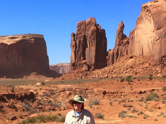
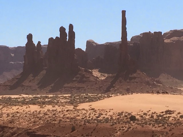
We took over 400 pictures while we were there. Internet access was not good. After we left if has been almost nonexistant for about four days while we were at Monument Valley.
_______________________
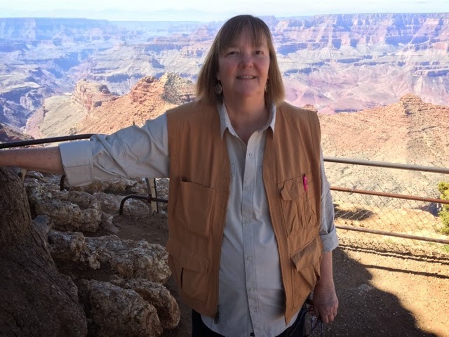
Susan and I were here on the South Rim of the Grand Canyon in November, 1980.  We were traveling in our camper van and were there for Susan’s Birthday.  I made her a two layer marble cake on the stove top, one layer at a time in the frying pan of our cook set.  Frosted it too.  She made me a carrot cake on this trip with frosting.  Very good.
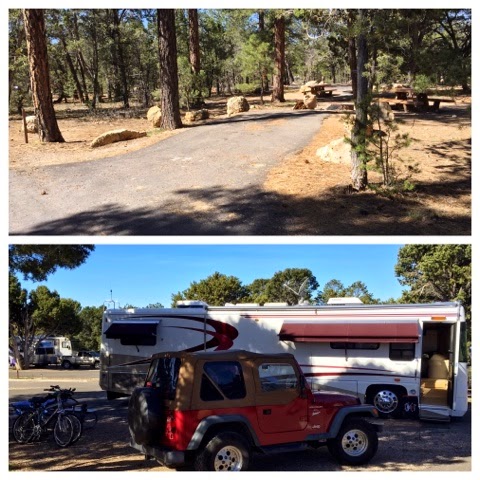
Back then we stayed in Mather Campground. It looked like this now and the same back then. Our camper then was only 22′ long and would fit in Mather’s 30′ length limit. Mather has over 300 campsites in several loops. They all have a parking space, a fire ring, a table and a grill. Water and restrooms are nearby. Showers and a laundry are at the entrance to the campground.  It is basic but really pretty nice. We did notice that well over half of the camp sites have been changed from pull-in or back-in parking spots to a short drive-through off the main loop road. I’m not sure of the idea behind this but it probably has to do with changes in the way people and families travel and camp in the park.  About 1/3 of the Mather Campground visits are in one form of RV or another.  We were very surprised to see as many rental RVs as we did.
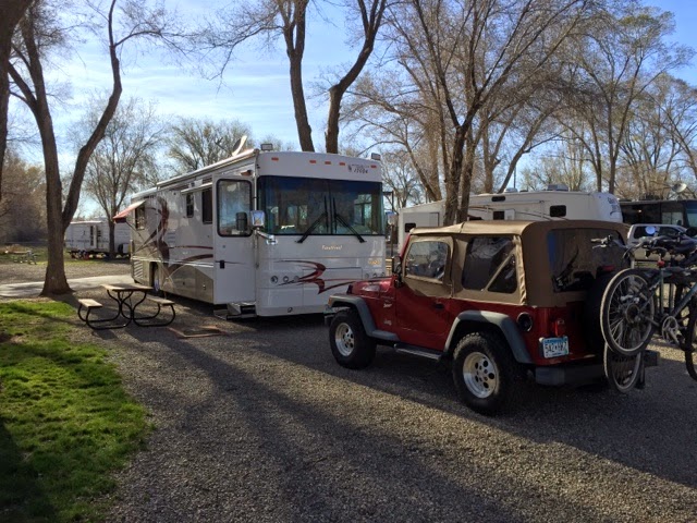
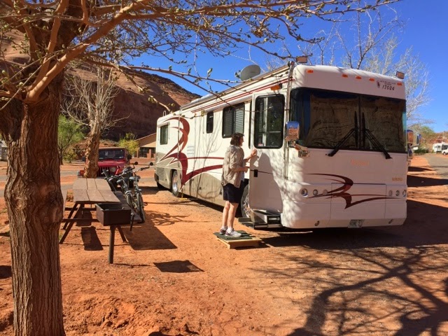
Since our coach is 36 ft long the only option in the park was the Trailer Village RV campground.  It has 84 full hookup sites.  Our site was quite spacious and had trees.  Very nice for our 10 day stay.
We noticed that everyday a significant population in the campground left and was replaced by new folks. I had a chance to talk to a campground person one day and she told me that the average stay at the Grand Canyon campgrounds was less than three nights. The average visit is even less with many people not even staying overnight. It seems like it is hardly enough time to see anything in any detail. 
There was a group of 22 RVs there from Quebec. They were there for about five days traveling together as part of an organized tour that lasted three months. As soon as they left they were replaced by the other half of the group, another 20 RVs following behind. The RV campground is 100% full almost all year round. Mather at this time was about 75% full but it too is 100% full most of the year.  Reservations are required especially since it is 60 miles to Williams going south and 75 miles to Cameron to the east.
There is a Market Place area near the campgrounds. It has a bus transfer point, a full grocery store with a large section of camping supplies and a gift shop, a cafe, a US Post Office and a bank.  The Yavapai Lodge is also located there. There are about 3,000 full time residents in the park. They are the National Park Service people and all of the contractors who make the park function.
We met a young family from British Columbia in the campground. Their kids had a week off for spring break so 9 days to travel. They drove from BC to the Grand Canyon, stayed for two nights, then went to Monument Valley for one night and then were driving home.
Grand Canyon NP has a shuttle bus system, three routes, that are free.  They run from Hermit’s Rest on the west end to Yaki Point on the east end. At least 30 miles from one end to the other. You can get off and on at any stop and transfer from one line to another at transfer stations. They run every 10-15 minutes from 4:30 AM until one hour after sunset. There are bus stops at both campgrounds.
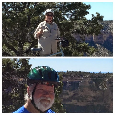
We used the buses to go to Hermit’s Rest since it was a 16 mile walk or ride. A bus ride seemed appropriate. We rode our bikes east to the South Kaibab Trail Head about 4 miles along a nice paved bike trail along the canyon rim.

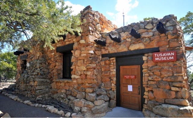
The Visitor’s Center was only a 15-20 minute walk through the woods on a nice trail.  Most days we walked well over 10,000 steps. The Visitor’s Center had lots about the Grand Canyon history, geology, animal and plant life.  There was a theater with a short introduction film. Rangers were on hand to answer any question. Maps, of course were readily available. In the Visitor’s Center Complex there was a bike rental shop, a cafe, a book shop and a big gift shop run by the Grand Canyon Association. There is a gift shop every where you go. It appears that going shopping in the gift/souvenir/book shops was as or more important for many visitors as actually seeing the canyon or anything else in the park.

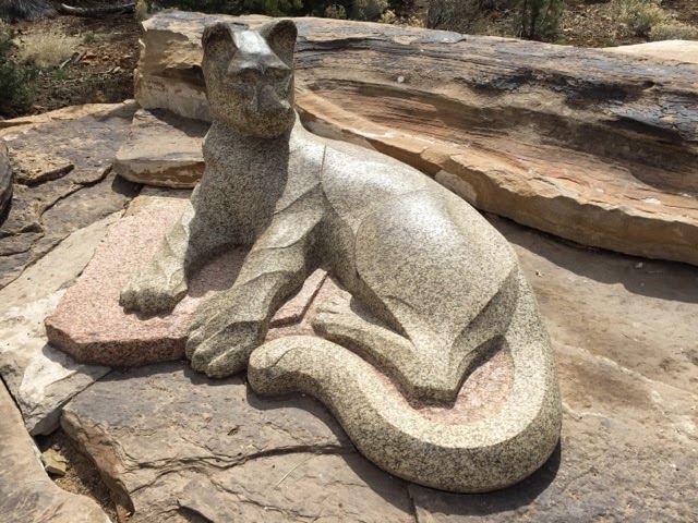
There are mountain lions in the Grand Canyon.  This is likely the only one anyone will see. They are very  elusive and avoid people.
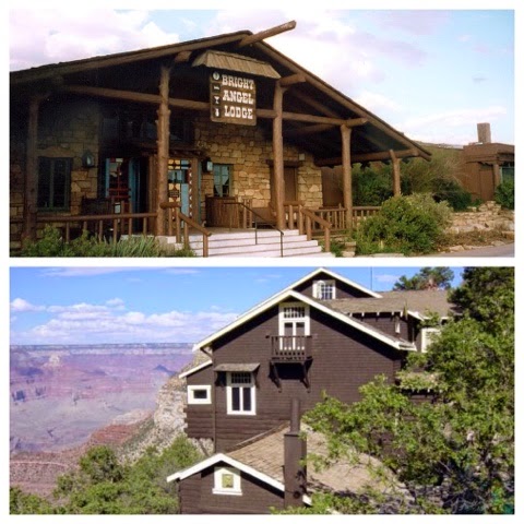
Another short walk was down to the Grand Canyon Village where all of the lodges and other early Grand Canyon buildings are located.  Quite a bit of the South Rim of the Grand Canyon was privately owned and those owners weren’t eager to give up their land and businesses as the Grand Canyon was being established.  The railroads were there early on.  They built the Bright Angel Lodge which is a lodge, dining rooms and lots of now old looking cabins.  The Bright Angel Trail was originally a for profit private adventure for those who could afford it.  The Kolb Brothers established their photography studio hanging over the edge of the Grand Canyon on privately controlled land.
Really, the Kolb Brothers Studio hangs over the edge, way over the edge.  
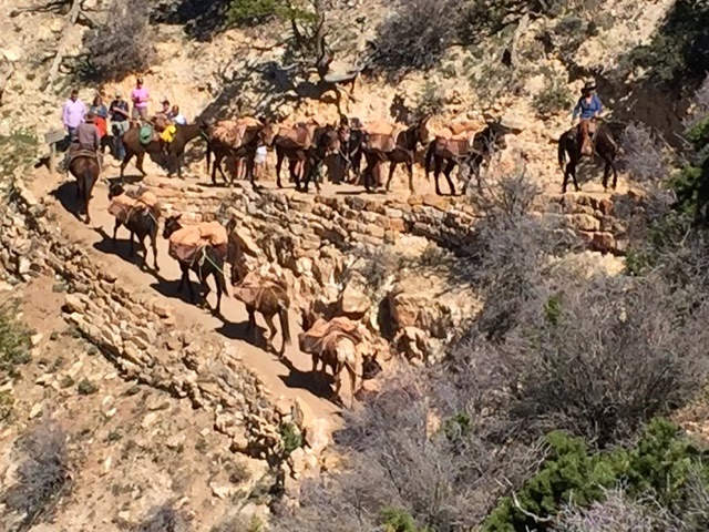
Transportation options back then were mules (horse+donkey=mule), the train or a long stage coach ride from Flagstaff or Williams.
The mules are still in use for a mule ride along the rim from the mule barn near the Bright Angel Lodge. You can also get a mule ride into the Canyon from the South Kaibab trail head for a one or two night stay at the Phantom Ranch near the Colorado River at the bottom of the canyon. A one night stay is almost $600/person. Add another $200 for the extra night.
The train comes up everyday from Williams full of people who get about 5-1/2 hours to experience the Grand Canyon, get some lunch, go shopping in the five or six shopping experiences in the Village and get back on the train headed for Williams in the afternoon. The cheap seats started about $190 the best seats were several hundred.
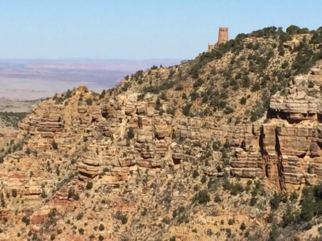
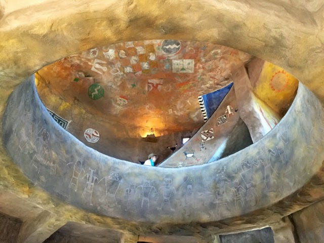
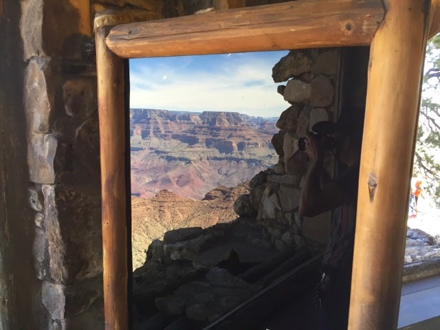
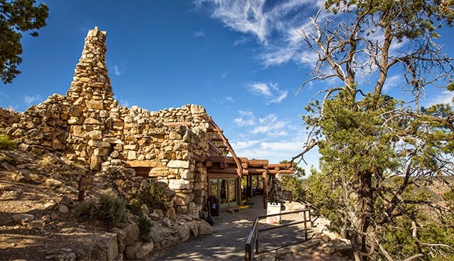
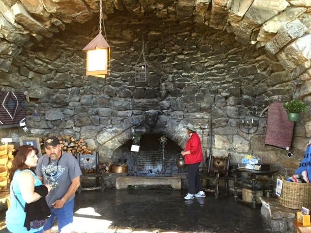
The Bright Angel Lodge was originally operated by the Fred Harvey Company.  Remember the Demming, NM post? The Harvey Company operated dozens of hotels across the west. Harvey hired Mary Colter, a school teacher from St Paul MN to design buildings and hotels in many National Parks.  She also designed  furniture and dishes for Harvey and for the Santa Fe Rail Road.  In the Grand Canyon she designed the Hermit’s Rest and the Watchtower.
 
In the old days you had to get dressed up and behave yourself.
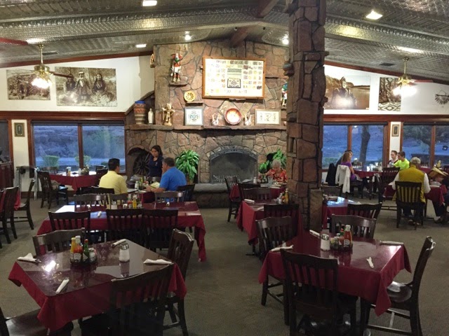
Susan and I behaved ourselves so we had lunch at the Bright Angel Lodge.  It was very good so we went back for a second time.  We don’t eat out often but a nice lunch means a nice soup supper.
After lunch we wandered through the gift shop, of course.  They have a nice history room too and a big fireplace.
Towards the East along the rim are two more lodges, the Thunderbird and the Katchina.  These have that 60’s look.  But get a room on the rim side and you would have a pretty good view.  A bit further away from the rim is the Mazwick Lodge.  There is a central building with several different cafe, cafeteria and dining room options.  The 250 rooms are in 18 two story buildings.  This is more oriented towards families.  The rooms can be for two or many more. Many are big enough for a whole family.  Rooms for two ran $120-$200 per night.  That made out $36/night in the RV park seem cheap.
And then there is the Grand Canyon grand daddy of lodges, the El Tovar Lodge, built in 1905, originally a railroad hotel owned and operated by the Fred Harvey Company. They were busy putting on a new roof. A lot of maintenance goes on at this time of the year in preparation for the nearly five million visitors each year, most come in the summer. Of course there is a gift shop.
And the the Hopi House, another vintage building which is now operated by a Native American concession selling Native American art and of course all of the same stuff as all the other gift stores. It had very low doors and a very appealing mix of art work, some T-shirts that were only available there and people who seemed to actually know something about what they had to offer.
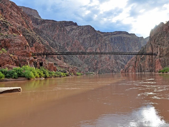
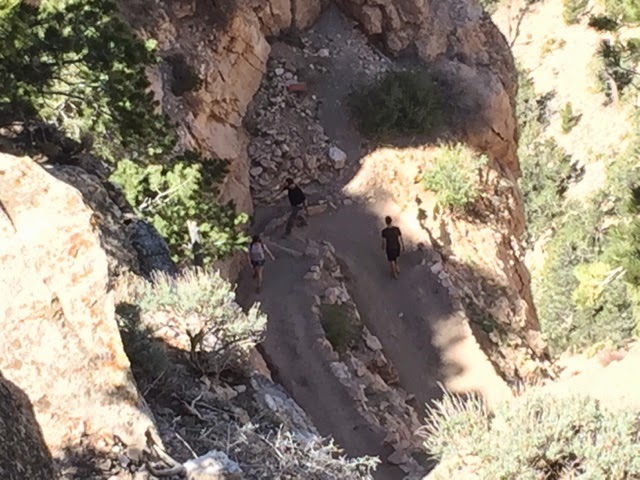
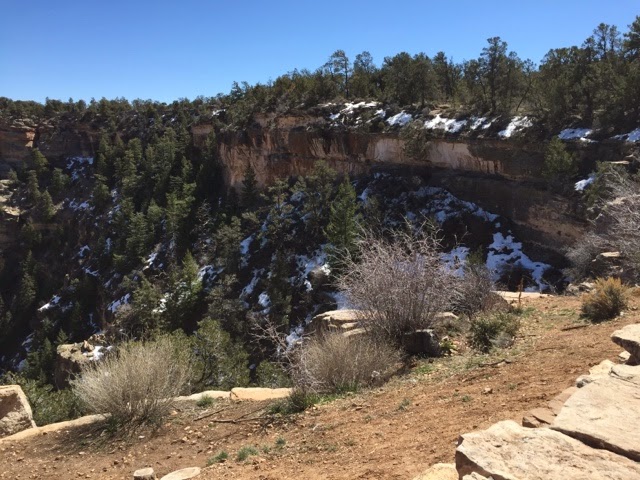
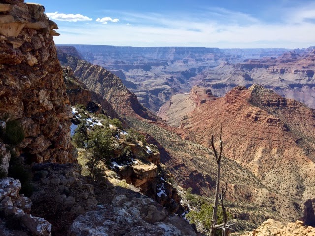
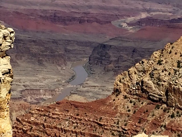
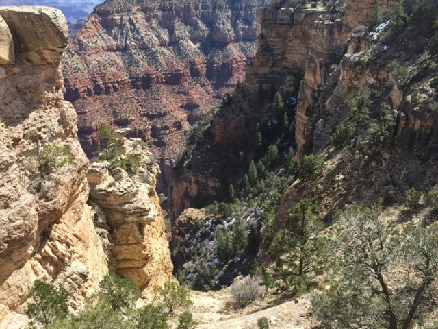
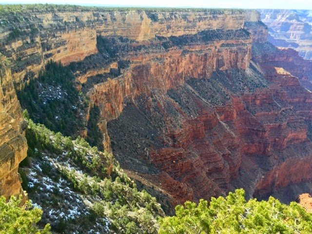
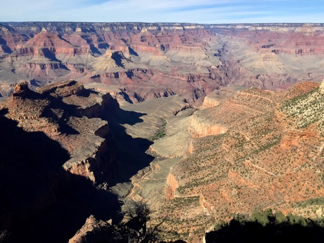
Looking over the rim you could see the Bright Angel Trail heading down into the canyon.  A side trail heads out on a plateau to an overlook. The Bright Angel Trail meets up at the very bottom of the canyon with the South Kiabab trail, a bridge that crosses the Colorado, and then the North Kiabab trail that leads up the canyon in the distance to the North Rim.  The Lodge on the North Rim can be seen on the other side (with binoculars).  It is about 12 miles as the crow flies, 22 miles by the trail, one vertical mile down and one vertical mile up.  It is a two day hike even for experienced hikers.
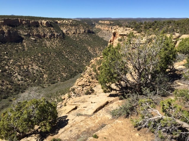
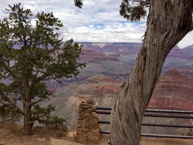
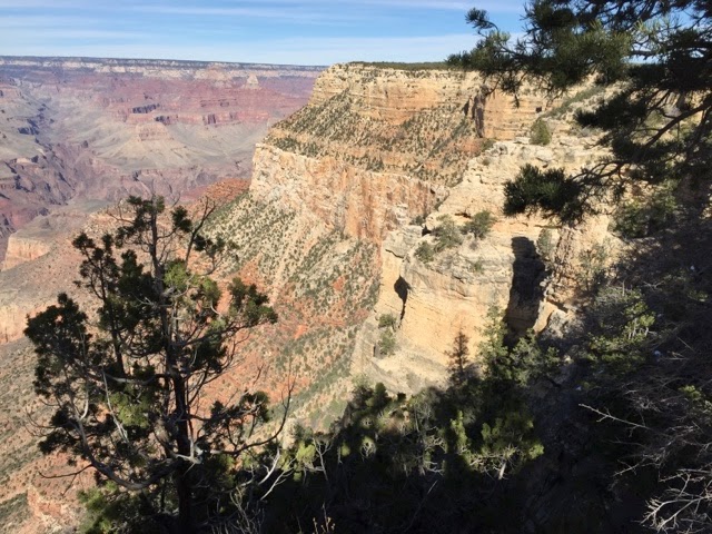
Every turn is another view.  Every moment is the same thing only different.  Light, color, shadow and clouds make it an ever changing experience.
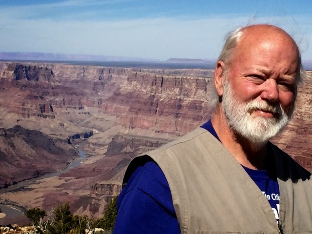
We had the opportunity to be here for 10 days, to walk, ride the bus, ride our bikes, just sit and watch and to see for ourselves those amazing views that perhaps only we saw from where we were at that instant in time.  I often thought of those folks who were only there for a day or two.  They would jump out of the bus, look for five minutes and get back on the bus. It reminds Susan and I of why we like traveling this way. Together, at our pace savoring the time we are blessed with.
More later.  Wow, I think I am going to get this post done without another visit from the Google Gremlins.
Well, no I didn’t.  I went back for one last editorial pass this morning and the entire post was gone again. This cloud thing and being dependent on internet access is not as wonderful as people think it is.
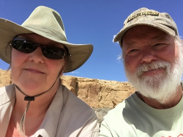
Roger and Susan.

The Hole in the Mountain

One last ride with Brad and Phyllis.  Susan elected to stay home.  There was steep, narrow roads ahead. I think her insides had been jiggled enough for one week.  So it was Brad and Phyllis and Barney in the Green Bomber and me in the Chili Pepper Red Jeep.

We drove up the Colorado River past the Parker Dam to a BLM (Bureau of Land Management) access parking area. (Why do they call it a Bureau? Wonder if it is because it started out working out of a chest of drawers.)  The access area had been carved out of a mountain of mining tailings into a terraced parking/camping area.  There was maybe a dozen campers in there from motorhomes to an Airstream trailer.  It was pretty much uphill every way you could go.
Brad had been here before so he led the way focusing on the road ahead. When we had our first Jeeps, a 1947 Willys and a 1973 CJ5, they had no power steering so you learned to keep your thumbs on the front side of the steering wheel towards you.  This protected them when you ran into a rock or a big hole and the steering wheel jerked one way or another.  Power steering makes this less likely now.

I think Barney took a liking to me but then Brad says he likes everyone and everything, even a fence post.
Brad’s marker flags are easy to see when he is down in a ravine.
This was our goal, the mountain with a hole in it.  Look closely and you can see a small dot of light showing through.  We drove up some very narrow ridge roads, steep sides off both sides. In a couple places we had to make a right hand turn off the ridge and down the steep slope of loose rock. You couldn’t really see the turn or the road down as you got closer so you just had to pick some markers and turn when you thought you were in the right place.  Pretty hair raising, even for someone without much hair.
We drove up towards the mountain to a stopping point near the base on the left side. The hole is probably up about five times as high as the height of the Jeep.
Barney and I climbed up one side and then around to the other side where the hole was easier to see. I tried to get Barney to sit still for a picture.  He is just like a two year old and never quits moving.

The hole is about four feet high. The rock in the back looks like a grumpy bear to me.  Use your imagination. The rock is mostly granite, an igneous rock, full of gas pockets formed when it was still hot.  It really looks quite amazing close up. 

Along the trail home we came across a blooming prickley pear cactus. They all bloom, it is just hard to be there when it happens.
And more flowers. Fleeting blooms, a wonder to see in the desert.

So there is a bit of our off-road adventures and our time in Parker.  An interesting place to visit.
Next, we are off to the Grand Canyon.
More later.
Roger and Susan.

Up to an Old Mine

Brad and I took the Jeep out in the desert one day in a different direction.  One that Brad hadn’t been in but there was signs of mining operations so off we went.  While Brad has a lot of time in his four seater (and his two seater) off-road machines he has never been off-road in a Jeep.

Ready to go.  Our 1998 Jeep looks pretty good even with 145,000 miles on it. Barney got to go as well.  His first time in a Jeep too.
There are old mine sites all over the place. If you look for disturbed areas or tailings piles you are likely to find an old mine. This looked like some sort of processing setup. Long abandoned. There were a lot of copper deposits in this area. Maybe that is what they were mining and this was some sort of crusher. No signs of a smelter or big heat producing equipment.
We met two nice folks from British Columbia, Neil and Pat, with a two seater Can-Am Commander at the campground.  Similar to Brad’s four seater but more of a utility machine with a cargo box on the back. Brad has one of these at home.  They had been down in Arizona for two months exploring all over.  Brad spotted their Commander and asked them to come along.  
There were mine holes everywhere.  All of them had iron grates over the opening to keep people out.
Even though it is desert, rocks, cactus, more rocks, dirt and it looks pretty desolate there is plenty out here that is quite lovely.  Everything blooms in the spring.
We got back to the campground and there were lots of Jeeps there. A big sign announced some sort of Jeep Jamboree the next morning.  The next morning was Saturday and there was also a big flea market at one end of the park.  We were going there in search of a folding rake and some sand paper. We found those and some nice sunglasses and a flexible grabber tool. It was a really big flea market, well,over a hundred vendors.
Even more Jeeps had shown up. The Jeeps all got organized probably by destination and played follow the leader out of the campground.  Four strings of 25-30 Jeeps filed out just like it was some sort of parade.  I had no idea where they went but it is hard to imagine that trying to do anything with 30 Jeeps could have qualified as fun.  

We used to go up around the Boy Scout Camp near Grantsburg, WI. and drive through the woods and the swamps and the river bottoms.  There would be three or four machines and as many people as we could fit.  We had great times.  Several others wanted to go with us once and we said OK.  What was fun became no fun.  One and only time we did that.


Brad had to admit that my Jeep,was fully capable of doing what needed to be done.  He did comment about the stiffness of the ride compared to his Maverick.  Barney didn’t complain. He is all about having fun, all the time. And nuzzling ears from behind.

One more ride to report on, later.

We are more than two months into being elsewhere, living in our coach, finding new places, new friends. We are working on stretching our stays, we want to try for two weeks or more at any one place. That gives us time to do what we want to do without hurrying, time to discover new things, time to take a day off, time to make adjustments as needed. So far this is working quite well.  All of our next stops will be 10 days to two weeks.  We are looking forward to them.

Roger and Susan

Off-Road to the Top of the Parker Mountain

Rides with Brad and Phyllis

Our first and third ride in the desert was to the top of a big rock mountain with a giant “P” on the side and a forest of antennas on top. It is Black Peak.  We saw no roads or trails to where the “P” is. They had to use hundreds and hundreds of gallons of white paint. It was probably sponsered by the local Sherwin Williams paint store and done by agile high school kids.
Black Peak is east of Parker about 10 miles. It is just a big rock out in the middle of the desert. North of the rock are sand dunes about 150 ft high, a mile or so wide and several miles long. We left the campground, headed a bit south to where we went into the desert, followed a set of power lines through some really deep washes and came out to the sand dunes. Up over the dunes, further south, around the bottom of Black Peak and up the road to the summit.  It is about two miles to the top and about 1,500 ft up. That means an average grade of 15%. That is pretty steep.
Brad is a farmer from Virginia. His wife Phyllis was a school teacher. He really likes to drive off road especially in the sand dunes. He has a four seat Can-Am Maverick X. It is like a giant ATV.
On the first trip to the top we all went with Brad. The second time I drove the Jeep and brought along the dash cam. It takes great live action video from which I was able to get some snap shots. Too bad I can’t plug in video in the blog. 
Barney is Brad’s standard poodle. When there is room Barney loves to go for a ride.
He is always putting that wet nose on your ear. He is a great dog. At about a year and a half old, there is still a lot of puppy there.
Most of the road up Black Peak was very steep and very narrow with pretty much nothing but straight down on one side. Susan does not like these situations very much.

It is amazing what you can find on the internet. Here is Black Peak from overhead. You can see the “P” and the road going up to the top.

Off we go. The red at the bottom is the hood of the Jeep. Black Peak in the distance.
Brad likes to lead. He has an orange triangle flag and another with a red ladies unmentionable.  I needed a flag so I found one that suits me.
The power line trail had some very steep ups and downs. Fun. Black Peak beyond. It felt like it was straight down.
And then came the sand dunes. They were challenging. Brad’s machine just went right up them no problem. It was tougher with the Jeep in the soft sand.
And then through the sand dunes towards Black Peak.
 And up we went, slowly, about 1-3 mph to the top.
You get a better idea of the grade going down.  Same speed down.  Slow and bumpy.
Some parts of this road had a thin layer of concrete over the rocks. It was put down when the first antennas went up there more than 30 years ago. The story goes that they used prison labor to haul buckets of concrete up the hill one at a time. It just got dumped on the rocks and spread around with shovels and rakes. Most of it is broken up now with big holes, broken edges and sections washed out.  It wasn’t much easier to drive up or down on these sections than on the sections that were just rocks.
We went out for three to four hours at a time. Lots of fun. After one ride we went to the bar and grill just down from the campground for a late lunch.
A nice way to end a day in the desert.  
Brad and Phyllis are nice folks.  We knew of them through the Foretravel forum, an online community of more than 3,000 Foretravel owners and people interested in Fortravels.  We almost met them last winter near the Great Smokies.  Timing just didn’t work out but we did see them heading east on the freeway just north of the Somkies as we were heading west.  Phyllis likes to bake bread so we compared notes. Neither of us had tried making bread in the coach so we gave it a go. It works!  The convection ovens work well.  We have done cakes, corn bread, cookies, cupcakes and now bread. 
More later.
Roger and Susan